 |
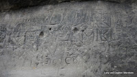
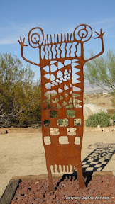
| Coso rock art figure |
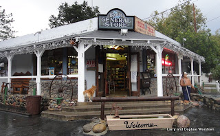
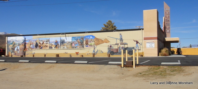
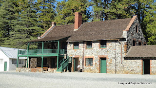
We stopped for a quick one-night stop at the Elk's Lodge in Ridgecrest. This stop gave us an opportunity to check out the Maturango Museum. This organization was the original publisher of my aunt Roberta's book,
Gold Gamble. They have the new edition on the shelf too, and we talked with the director about how the book came about, how long the family had lived in Garlock, and other details she was unaware of.
It's a nice little museum, and it is small, but they are well underway in doubling their space so we look forward to visiting again on our next trip through the area. We didn't have time for much touring, and there's a lot to look over. It's been over 30 years since we were here and saying it "has grown" would be a serious understatement.
We're on our way to visit a school chum from way back in middle school. We see her only seldom, so it's a real treat to be able to get together. We're staying at the Adelanto RV park, which is only a few miles from her house.
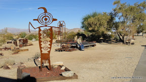 |
| Coso rock art figure |
Now, my memories of Adelanto, as a kid driving back and forth from our home in Long Beach to our place in Garlock, was that it was a dark intersection with a gas station and a place to buy blocks of ice for our cooler. There wasn't much else here. Again, saying it has grown doesn't quite capture it...... I wondered why the town was here in the first place, assuming mining as that was the purpose for most of these other little desert burgs.... but actually this was a different scenario.
From the city's website:
Adelanto was founded in 1915 by E. H. Richardson, the inventor of what became the Hotpoint Electric Iron. He sold his patent and purchased land for $75,000. He had planned to develop one of the first master planned communities in Southern California. Richardson subdivided his land into one-acre plots, which he hoped to sell to veterans with respiratory ailments suffered during World War I. He also hoped to build a respiratory hospital. While Richardson never fully realized his dream, it was his planning that laid the foundation for what is currently the City of Adelanto.
Acre after acre of deciduous fruit trees once grew in the city. Famous throughout the state for fresh fruit and cider, the orchards thrived until the depression, when they were replaced by poultry ranches. As the wartime emergency developed early in 1941, the Victorville Army Air Field was established land within the Adelanto sphere of influence. In September 1950, It was named George Air Force Base in honor of the late Brigadier General Harold H. George. Adelanto continued as a "community services district" until 1970, when the city incorporated, and Adelanto became San Bernardino County's smallest city. The city became a charter city in November 1992.
Of interest in the area include nearby Lake Mirage, where several movies have been filmed, including one of the well known scenes in the Lethal Weapon episode where the good guys met the bad guys on a dry lake.
One of the most surprising features of the Adelanto area is the Thien Vien Chan Nguyen Buddhist Meditation Center.The 24-foot-tall, 60-ton white marble statue of Quan yin, an "Enlightened One," is quite startling as it's only a short distance off the highway. It is a part of a Buddhist meditation center in the Mojave Desert. The planned $15 million temple is the vision of a senior citizen monk, Thich Dang "Tom" Phap,[67] who lives next to the statue in a trailer. The Quan yin statue attracts many Buddhist visitors, who believe that it possesses healing powers and radiates a white light. The center's walkway features statues of 18 other Enlightened Ones. [RoadsideAmerica.com Team, 12/01/2008] Here's a
slide show from the Press-Enterprise
Though most don't realize it, the Mojave Desert is where the business end of Southern California happens. The
aqueduct, that brings the water, the solar plant at Cramer Junction, and other electric resources like the static inverter plant, that provide the electricity,
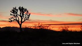
correctional facilities, military bases, and other essential services too "uncomfortable" to have based in more densely occupied areas are routinely relegated to the desert where "nobody" lives. These mundane and sometimes threatening services seem a stark contrast to the beauty of a Joshua tree silhouetted against the sunset, or the sparkle of a few distant lights in the distance in the inky night. The people who do live here, though relatively few in number, are hardy, self reliant individuals, though there is a great deal of economic suffering here as in many other smaller communities. The few jobs there were are rapidly drying up. Sad to see.
 We fought wind again all day today, including a rather dramatic dust devil in AZ that included flying tumbleweeds, and finally settled in around 3 in the afternoon at Rockhound State Park, near Deming, New Mexico.
 This is the only state park I know of that actually invites visitors to collect mineral samples. They even have a nice sample display on a stone pillar in the campground, so you can identify what you are collecting if you are a newbie rockhound.
 The campground has sites with and without utilities, and is snuggled up against the Little Florida Mountains, with a nice view of the valley below. There are several trails, leading to collecting sites..... all to be explored in a much more temperate climate!