Thursday, August 29, 2013

North Davis Creek, 2013

North Davis Creek campground

What a difference a year can make. Looking back at our notes (see that post here), we stayed here at North Davis Creek on exactly the same dates in 2012. There is a noticeable difference in the water level in the lake portion, though the creek is still as boisterous as ever. I've put comparison photos in the album, to illustrate the difference.

North Davis Creek campground is northeast of Davis lake, on the east side of highway 46, and actually feeds into a small arm on the west edge of Wickiup Reservoir. A bit of history here: The name Davis is taken from "Button" Davis, a nineteenth century stockman from the Prineville area who ran cattle in the vicinity of the lake. Davis Mountain, rising above the lake on the east side, was presumably named for the same man. In 1878 the name was already in use when Lt. T.W. Symons visited the area. His survey report included the first known description of the area, so this area has been well known for a long time, but it seems to have a lot less traffic that other lakes and other campgrounds in the general area, so we enjoy it for its quiet and natural beauty, and lack of traffic and crowds.

What a beautiful campground! Several of the sites back up to the creeks, but site 7, the beach view site we stayed in last year, was available when we arrive, so who could resist? Arriving on Thursday we had the campground to ourselves until Saturday, when several sites were occupied. The place emptied out again on Sunday, so Monday and Tuesday morning were quiet, leaving only the occasional drive-through visitor to chat with.
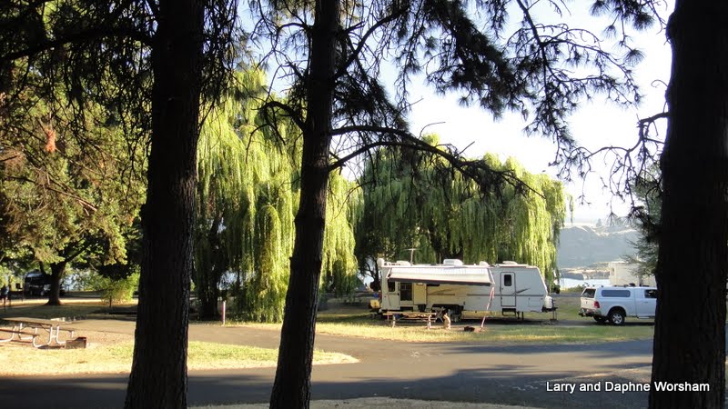
Our campsite from the opposite bank

I think it's safe to say that Shiner LOVES this campground. We forded the creek toward the east on Friday and explored the shore opposite our site. The shore, exposed now due to the low water, is soft silt, muddy in places, and the forest higher up on the shore is almost too dense to walk through...unless you are a deer at any rate. The only trails are made by the wildlife, so it's tricky to explore, but fun to see a view of things from across the water.

Investigating the source of the creek
On Monday we went up to the headwaters of North Davis Creek. Just above site #12 there is a sign identifying the location, though the trees crowd in so closely now that the sign is hard to find. The headwaters is a rough pile of basalt with crystal clear water gushing from its base. Oozing between piles of moss and fallen logs the water builds speed as it is joined by multiple little streams along the way.

We walked across the basalt flow to get to the other side of the creek, and then tried out several of the many little log bridge routes.
Flying across the bridge

There are at least 3 log bridges (depending on how generous your definition is); one between sites 10 and 11, a  zigzag of three logs across the mouth of the little lagoon to the north shore, and the one connecting the campground to the shore near the lagoon at site 9. Shiner tried wading as well as actually walking on the logs, and is pretty good at both methods. Anything that leads to an adventure appeals to her!   

Some ambitious exploration will reveal several outcrops of basalt, all sheltering water flows. Layers of moss, who knows how many generations deep, surround the quiet lagoon that has formed off to the north of the creek.
Sky and clouds reflected in the water underneath the moss
You can walk on the moss and hear water running, but only see it in the occasional holes in the mossy forest floor that reveal you are actually walking on water!

If landscape can be "photogenic" this location definitely is. I know I took way too many photos of the creek, and of Shiner playing in it. She was having so much fun exploring it was tempting to try to capture all of her adventures, but she moves way too fast!!   

The most abundant wildlife here is, no surprise, the golden mantle squirrel (chipmunk to most of us).  These are Shiner's primary irritant as they know when she's on a leash and sit just out of reach, chattering at her. I guess you could consider it dog TV as it does keep her entertained.

Farther afield, across the creek, we spotted several deer and some very healthy looking coyotes (full of chipmunks no doubt). They never show up when the camera or binoculars are handy of course, so we just enjoyed watching them.

The days here were fairly warm and comfortable, but a couple of thunderstorms did their best to make it feel as though fall is already here, rather than just approaching. The second storm was complete with some fairly substantial hail. We didn't see any smoke on the horizon following either storm, a good thing, as there are already way too many fires burning in the state. Each night was a bit colder than the previous, with our last night here dipping down to 36 degrees. Yes, fall is definitely on the way.
More photos of our adventure here.

We're packing up on Tuesday morning and heading for Armitage Park in Eugene, to get things "civilized" and attend the first Duck football game of the season.... GOOOOOOO Ducks!!

Thursday, August 22, 2013

Tailgate Trainging Camp 2013

We've held training camp at  Ochoco Forest Campground for several years now, and it's quite a distance from the Willamette Valley, so we stopped one night on the way, at Cold Springs campground. This is a nice place to work back into the boondocks mode.


The area is fairly open, with pines and a few shrubs, and a little creek running through the campground. It was very quiet as there were only a few other sites occupied. Shiner did her best to rid the area of chipmunks and other varmints, but I don't think she was very successful.


Friday morning we left Cold Springs and moved on to Training Camp.

This was a bittersweet year for us, as our long-time friend Bill wasn't with us, and he was the one that found this location where we've been meeting for several years. There were several toasts (with Coors, his beverage of choice), and lots of stories told around the campfire as we remembered past camp-outs. We missed Bill's wife, Grayce, too. Hopefully she'll be with us for Training camp next year.

We had several new attendees this year.
The humans new to the event were Ron and Evie Finch, our friends from Nevada. They showed up with fresh oysters for hors d'oeuvres on the first day. . . a dish that met with enthusiastic approval by everyone! The new canine attendees were Maggie May, a mini-Australian Shepherd, and Lucy, a West Highland Terrier.

Maggie and Lucy were already acquainted, but both readily accepted Shiner. She is so much bigger than the two younger dogs that we had to closely monitor the rough-housing, and as Shiner had strained a front leg a few days before she was on restricted activity anyway. The chipmunks all knew that, I'm sure, and teased her unmercifully.

There was a heavy sports schedule this year at camp.
Dave and Evie tried out her new bow, there were a few games of horseshoes and bolo toss, and some of us went for the annual walk around Walton Lake. It's small, but very pretty. The meadow that's usually covered with wildflowers and butterflies was drier this year, so though there were a few butterflies enjoying the wild asters, most of the wildflowers were in short supply.


We came home with a special treat this year. John made several bird houses and feeders for those who came to camp, and we were lucky enough to have this one, complete with a little piggy.

The detail John puts into these creations is amazing, right down to the little handmade ax stuck in the little stump on the porch.


It was a great four days - good food and good friends is a combination hard to beat! For a few more shots of the camp and all the fun we had, check the album.

Saturday, August 17, 2013

Barton Park and Champoeg State Park, Oregon

We have to work ourselves into the urban environment slowly, so as to not cause too much of a shock to the system, so when approaching the Portland area we took even smaller steps than usual.

First, a couple of nights at Barton Park, east of Oregon City, on hwy. 224. This is a Clackamas County park. The park has 102 sites in addition to day use facilities and lots of parking for river access. Everything is very nicely maintained, though they've left quite a bit of unmowed area around the little ponds. That works out well for the wildlife.

The ponds are a bit swampy  covered with algae and duckweed they look greener than the grassy areas, but they do attract the wildlife. Our first evening in the campground a big fat beaver waddled up out of the creek, across the grass and down into the pond. Shiner stared in amazement as she didn't quite know what to think of the critter.

This park was a unique experience, as we don't often stay in such an urban environment. Most of the campers live within an hour's drive from the park. They just wanted to "get away for the weekend", and often come in two and three family groups.

The evening had a happy sound, as children rode their bikes and skateboards, played volleyball and other games, and the adults visited and played horseshoes.

Beautiful weather added to the enjoyment, as did the colorful sunset. The second evening we had a bit of rain, and a full rainbow....at 8:15 in the evening! That doesn't happen often!

Moving west, to the middle of the Willamette Valley, we stayed at Champoeg State Park, convenient for our friend Grayce to drive down from Portland for a visit, and for us to drive up there for a great BBQ.

We've used Champoeg before as a base for the Portland area. We stayed here in 2010, right after I retired. Here's the album from that trip.

It's a great place for us, as there are plenty of places to walk Shiner, and the park has a fascinating history. We even found a Nez Perce connection here, with the trail-side grave marker of Kitty Newell, the Native American wife of one of the pioneers who settled here.

Trails wander among markers indicating the location of various buildings before they were all lost to flooding, and the volunteers do a marvelous job of maintaining the historic kitchen gardens around the visitor center, as well as sharing their knowledge of the history of the time. The gift shop is stocked with a variety of hand made and history related items, especially books. They had some great northwest related children's books, and the gardeners have made available packaged seed from heirloom varieties grown in the garden here.

We had a great time visiting with Grayce and the family, first, a back yard bbq at Grayce's house, and then an afternoon out at the campground.

Now we head back to eastern Oregon, to  Ochoco Forest Camp, for Tailgate Training Camp. We'll be out of touch, electronically speaking, for awhile as it's a fairly remote area.

Wednesday, August 14, 2013

Around Mt. Hood, Oregon

Heading back to Hood River, then south on the Hood River Scenic Highway (hwy. 35),  as we traveled around a corner Mt. Hood suddenly came into view. Wow! what a site.....

This is a beautiful part of the state. The road is lined with prosperous looking farms, fruit orchards and fruit packing plants. This time of year the trees are heavy with ripe pears, and a few wildflowers here and there for color.

It was only a short drive down the highway to a gem of a county park that Steve discovered using one of his favorite resources USCampgroundsInfo.com

Tollbridge Park is operated by Hood River County, and it's definitely going on our "A" list! (We didn't have one, but I think we'll start one now!) If we had known this park was here we never would have stopped at Memaloose.

The park has basically four loops. One for tents, one for full hookups (no tents allowed), two for partial hookups where tents are allowed - 85 sites in all, not counting the group sites. As the park takes reservations we could see that many sites were already spoken for, but we'd only planned two nights so we were able to snag one of the five river-side sites. All the river side sites are named for Oregon rivers, rather than having the usual numbers, and ours was "Crooked".

The sites are all carved out of the dense, mixed forest so, at least in the loop we stayed in, they are fairly private. The campground map indicates a trail along the river, and though there are trails back to the river in several places, the trail along the river is rather sketchy and overgrown in areas. In some sections even Shiner had trouble deciding which rabbit trail was the one to follow!

Our river access was a bit steep, but we found several nice, sandy locations out at the edge of the park where Shiner could play in the water and she had a ball! She'll rescue drowning logs as long as someone will toss them into the water for her.

She does prefer the larger ones though, if a stick is too small to suit her she'll rescue it, then park it on a little island in the middle of the river and wait for us to throw something larger and more worthy of her attention.

We really enjoyed our hikes down to the river. The forest here is an interesting mix of fir, pine, big leaf and vine maple, ferns, wild roses and a myriad of other shrubs, all sprouting from between volcanic boulders and lovely beach sand.

Most of the underbrush is ferns and typical forest shrubs, but one sunny, sandy patch along the trail was filled with heat-loving manzanita bushes, a surprising contrast to the brilliant blue Oregon grapes glowing in the shade only a few yards away.

We took a short drive on our second day over to the little town of Parkdale and stopped in McIsaacs's market. They have anything you'd need, including some nice looking local produce and a full line of craft beers.

We had a wonderful, relaxing time here, watching the river slide by, admiring the forest and listening to the rushing water. 'A vast improvement over the trains and traffic noise we've had in many campgrounds. For families with small children, the picnic area at the entrance to the park has a nice playground, so there's something here for everyone! You can find the park on Facebook too.

Sunday, August 11, 2013

Traveling the Columbia Gorge

Making French fries, in the SAGE center
While staying at Plymouth Park we stopped at the visitors' center in Umatilla and picked up a brochure for a new museum in Boardman, which was on the way down the gorge on the Oregon side, so we planned a stop there. What a unique experience! The SAGE Center (Sustainable Agriculture and Energy) is an interactive experience, and would be an especially good experience for school age children. We enjoyed it too, and so it's not just for kids.
The displays in the center are educational as well as entertaining. Visitors can experience a simulated hot air balloon ride over the county, with a tour guide explaining the scenes below. One of the centerpiece displays demonstrates the handling of potatoes from field to french fry, and a large tractor simulator puts the visitor in the driver's seat. Hands-on exhibits demonstrate the importance of dams and ports to irrigation, food production and distribution. There's also regional history and photos woven throughout. The center is colorful and well organized, and definitely worth a stop.

Our stop for two nights - Memaloose State Park, Oregon
Entry into this park is a little unusual, as you pull off the freeway, travel through the day use/rest area, then make a right down into the campground.

Compared to our previous stop, this campground is looking a bit parched, which seems funny as it's right on the Colombia river. It's a much larger campground (well over 100 sites) and according to the park website they're having problems with the irrigation pump.

Some of the sites are a little on the crowded side, but as the water-only sites didn't all fill up we had a bit of breathing room. The sites with services are pretty much all reserved every night, so if hook-ups are desired, a reservation is definately recommended. There's no official hiking trail, but leading from the grassy slope down by the railroad tracks is a trail that leads east, parallel to the river and the tracks. The trains haven't bothered us at night, though we do hear them during the day. It's fascinating to watch the numbers of cars as they go by on both sides of the river and meditate on how many goods are moved by rail.

Though our site wasn't a "river view" site, we did have a pretty good view of it, and nestled under a couple of big old weeping willows we had plenty of shade. From our vantage point under the willows we had a nice view of two little islands out in the middle river.

Steve noticed what appeared to be some kind of monument on one of them. We finally found a signboard explaining the significance of the monument, and the island itself. The Chinook Indian tribes of the Columbia Gorge used to lay the bones of their dead on open pyres on Memaloose Island, the largest of the two. The granite monument marks the resting place where a local pioneer named Victor Trevitt wished to be buried. There are apparently several islands in the area known as Memaloose because of this tradition. More about them here.
Memaloose Island

There are large blackberry patches around the edges of the campsites but due to the dry spring weather most of the berries are small, hard, and not very sweet. We did find a nice patch over by the over-flow camping area, where I filled three small bags while Steve and Shiner played ball. On the way back to our campsite we discovered an overgrown orchard of plums - three kinds! I think this must have been a farm at one time, as these trees look like seedlings and very overgrown old trees all tangled together. A woman we talked to said she believed this area had been some kind of traveler's stop in the old days - an inn or something of the sort perhaps.

One disadvantage of this park location is that it sits in between two widely spaced freeway access ramps. In other words, you have to go clear down to Hood River to get turned around to go back up-river to The Dalles. So we did. And, in the meantime, did a bit of shopping in Hood River, which has all the grocery stores, etc. one could want. Then, heading back east to The Dalles, we fueled up, then turned around and headed back west to hit a museum we'd seen coming in.

Pioneer days, at the Discovery Center
The Columbia Gorge Discovery Center and Wasco County Historical Museum sits above the Columbia, surrounded by pioneer wagons and buildings. The paths around the center offer beautiful views of the river and great opportunities for photos. Inside, it's a whole different experience.

Beginning with the Ice Age exhibits tell the of the hstory and ecology of this area as well as the people who have lived here.

Ice Age, in the Discovery Center
The Discovery Center and the Historical Museum are two separate collections, but presented in a rather seamless manner so it's not distracting. The Historical Museum collections focus more on the people of the area. A large area built to resemble a town presents collections of everyday items as they would have been used, and several mini-theater areas offer video experiences.

Visitors learn about frontier life, the role of the missionaries and Native Americans, the railway, and more. Along one side of the building is the "Kids Room" with hands-on activities. There are also kid-friendly opportunities throughout the exhibits, with items to handle or try on. The center is huge, and a family could easily spend most of the day here. It's a good thing there's a cafe too. They've thought of everything!

From Memaloose we'll be leaving the Gorge and heading toward Mt. Hood.

Whitman Mission and Plymouth, Washington

Heading west, toward the great Columbia River, we stopped at the historic Whitman Mission, which also figures into the Nez Perce history we've been following.

The Whitmans were among the very first white settlers in the Oregon Territory, settling between Mill Creek and the Walla Walla river, in Washington. Their mission was established in 1836-7, and soon was seen by the local Cayuse, Nez Perce and other tribes as a positive and helpful resource.
Historic painting of the mission

The local Native Americans were so impressed by the tools, conveniences, and skills the pioneers possessed they wanted these same things for themselves. Thinking the "power" they were witnessing came as a result of the settlers' religious beliefs, they asked to learn about Christianity. This new power would be something they could add to what they already knew and believed spiritually.

Things went well for a time, but the missionaries could not understand or adapt their teachings to the seasonal life-style the Cayuse had followed for generations - hunting here, gathering there, then moving somewhere else to fish. It was the only way people could survive in this climate, but the missionaries wanted them in church on Sunday. They wanted the people to quickly adopt white habits, clothing, and mannerisms.

The missionaries began insisting they change their ways and become farmers. When the people realized this new "religion" was going to require not only changing how they lived, but giving up their prior beliefs they became somewhat disenchanted - to say the least - and they began drifting away from the mission.

In 1847 a measles epidemic hit the area. Though many white settlers, especially children, were effected, Whitman (a doctor) was able to save most of them. Lacking the natural resistance the people of European ancestry had, almost all of the Cayuse who were infected died. The tribe blamed the missionaries for the disease, and soon rose up and killed the Whitmans and several other settlers at the mission.

Now all that remains of the mission are a few artifacts and stone outlines of the original building foundations. The walking trail through the original mission site has signboards to assist the visitor in visualizing how the mission was built, where the gardens were, etc. So much history here! And, what a lesson in how two cultures can think they understand each other, but are actually working at cross-purposes, and each looking for different outcomes.

Home for the next few days (July 31-Aug 4) is Plymouth Park, in the tiny town of Plymouth, Oregon. The town was named for a huge boulder that reminded the original residents of the original "Plymouth Rock", so they say anyway. It's not visible now - 'probably was covered with water when they created the dam.

This is the most park-like campground we've ever stayed in! Plymouth Park is a Corp of Engineers park on the Columbia River, and there's apparently no shortage of water for irrigation. Truly an emerald oasis, the park is surrounded by giant sagebrush and tawny grasses, all leading down to the steep banks of the Columbia.

The 32 campsites are all distributed along one road, spaced fairly generously, and each has a deep "lawn", leading to the river edge, as well as a large graveled area. Though there are no shrubs between sites, and therefore less privacy than some, we still don't feel crowded. There are a lot of mature trees scattered through out the park, so it's cool and shady most of the day. Many sites are full service, others have only water and electric. Most sites can be reserved, but two are held for first-come-first-served occupancy.

There's also a boat ramp just a short distance away from the campground. Shiner enjoyed swimming there during the week, when there weren't any boaters putting in and out. She also made a lot of new friends here. One of the hosts practically adopted her, and we met a couple who live locally who made here very welcome in their camp (he's a fellow Texan!) In spite of being right on the water the "bugs" weren't a problem at all. It helps that the sites are set back from the edge of the river. The best part, with a senior pass the price is only $11 a night!

We took an afternoon to go into Umatilla for groceries and were met by a giant John Wayne greeting us at the entrance to the parking lot. I'm not sure what his connection to the area is, but he is eye-catching! Hermiston, famous for it's melons and other produce, is nearby, and the market stocks a lot of local produce so we stocked up. Yummm, best melons and peaches we've had in a long time!

Just across the river from the campground is McNary Dam, in Umatilla, Oregon. The dam visitor center was another afternoon's entertainment. The center has some very nicely done educational displays, and there are a lot of opportunities to see the various stages of managing the salmon runs.

The fish ladder, the sorting tanks, are all included in a self-guided tour, and we finally got an explanation for the occasional "fireworks" sounding booms we'd been hearing from the campground. It's a method used to keep birds away from the young fish!

Another shopping day, which of course included a couple of quilt shops,and after the fabric shopping we stopped for lunch at Nookies Bistro & Spirits which is now the home of the Hermiston Brewing Company. 
It's a comfortable place to relax, plenty of tables and bar seats, and enough neon signs and artfully arranged collectables to provide the visual entertainment. The restaurant has been there for eight years, but the brewing component just started up in early July. 13 beers on tap - hard to beat, and they make a darn good burger too!

Saturday, August 3, 2013

Pink House campground and Nez Perce battlefields

Leaving the  Missoula area and moving west into Idaho we made a  one-night stopover in the Wilderness Gateway campground, located on the Lochsa River (pronounced "Lock-saw").

The campground was practically empty, so we had a nice, quiet afternoon enjoying the dense forest around us. My goodness but this is good bear country! There were ripe salmon berries, service berries,
and other delectable items all through the campground.

This area is rich in history. The Nez Perce roamed this area for generations, and the Lewis and Clark Expedition traveled the Lolo Trail, which flows through the Lochsa Gorge.

There are historic signboards at pull-outs all along the highway, and when we stopped at the Lolo Pass Visitor's Center we were given a set of CD's with historic information to listen to along the road. Per instructions, we turned them in to another visitor center when we reached the next area. I took a little time to admire a quilt they center had hanging in a little room off to the side. It was a cooperative effort, constructed by several quilt guilds in the state.

One of the first historic stops along the highway featured this replica emplacement, used (unsuccessfully) by Army soldiers to protect themselves from Nez Perce bullets. It might have been a useful idea in different terrain. Here, the Indians simply climbed the hills on the opposite side of the canyon and fired down on the soldiers. The Nez Perce leader, Looking  Glass, thought the whole idea was rather amusing and dubbed them "soldier corrals". The whole endeavor was so ineffective that residents began calling the area "Fort Fizzle". It's still known by that name on maps today.


The Pink House campground, Orfino, Idaho, was our next stop, and home for five days. It was an accidental discovery, as we were actually headed to a place a few miles further on down the road. Steve spied the sign "Pink House Recreation Area" and pulled in to check it out, and we decided to stay!What a funny name for a  boating, fishing and camping area!

Though there's no pink house in site now, there once was. Charles and June McCollister lived here and she, being an artist decided the area needed some color, so they painted the house PINK. 

View of the Clearwater river from our site
Fishermen floating the river saw the pink house (and the shed painted to match) and began calling the nearby fishing hole "the Pink House Hole." It was so well known in the area that when the BLM established the recreation site, and the campground, the name Pink House was used.

The house was burned by vandals many years ago so there's no sign of it now, but the campground is wonderful. Jim, the host, keeps everything in tip-top shape shape, and knows the area well so he can offer tips on any services needed. We were lucky enough to arrive early so most spaces were empty and we grabbed #12, right on the river. We enjoyed the view, and the peace and quiet, so much that we stayed five days. That hasn't happened in awhile!

The dogs-on-leash rule is enforced, but there's a vacant lot adjacent to the campground, and river access out of the park boundaries, and Jim (the host) taught Shiner how to battle the rain-birds, so she had plenty of fun too!

It's a good location for exploring more of the Nez Pierce history. We took a day to drive the historic loop, east on hwy. 12 to the first stop on the loop, Canoe Camp, then dipping south to Grangeville, then back north on hwy 95 and then east, back to camp. This route includes not only Lewis and Clark related historic sites, but many of the locations so important in the Nez Perce War.

Another stop along the highway provides a dramatic overlook of the valley where the  Battle of White Bird took place.

White Bird battlefield
A little further on the loop drive, located on the banks of the Clearwater River south of Kamiah, you can see the Heart of the Monster. This formation is the legendary birthplace of the Nez Perce Tribe, where Coyote defeated a monster and, in turn, created the Nez Perce people.

Nearing the end of the loop is the  Nez Perce Historical Park Visitor's Center . The center has an amazing collection of artifacts - beaded clothing, weapons, jewelry, and other items. Displays and a short movie enhance a visitor's understanding of the tribe's history and struggles. We have actually been following the Nez Perce Historic Trail in reverse, as we started from the east, near the middle of the trail. The tribe lived here, in Idaho and Oregon, and when the conflict began, it was here the battles began, so the visitor's center marks the actual beginning of the events that led to the tribe's eventual banishment from their homelands. The remaining part of the Nez Perce Trail runs up through Yellowstone and Montana, s we'll visit those areas on another trip.

There are many layers of history here. Additional historic signboards along the way have information on more recent events in the area, including railroad development. The hillside are peppered with huge trestles and tunnels, all necessary to lay tracks in this hilly country.

Logging was also a major industry in the area. Many of the older pieces of equipment can still be seen, parked in empty fields, and some still in use. One afternoon we heard what we thought was an old steam driven locomotive in the afternoons, and it turned out it was a steam powered tractor! Charles McCollister's daughter helped him publish memories and photographs of the area's logging history before his death in 2011. A brief article about their project ran in a local paper.

Pink House Campground is a good location for regrouping before moving on either east or west. There are services close at hand in Orofino, including groceries, hardware and anything else one might need. We spent the last day doing just that - shopping for groceries, bits of hardware, hitting a couple of quilt shops (of course!) and catching up on household chores.

There are a few more photos in the album. 

We'll be continuing to creep west. No telling where we'll light next!

Friday, August 2, 2013

Black Range Tales, a book review

These are the stories of James A. McKenna, or "Uncle Jimmy", as the community came to know him in his later years. Uncle Jimmy's stories of his life and adventures are unique little windows into a time long past. There is no bragging here, no attempt to write a wild, shoot-em-up adventure story. These are true tales of Indian wars, mining adventures, the miners and gamblers, theives as and good and honest folks. Real life, as the pioneers lived it, in the natural, colorful language of the time.

Set in the Black Hills of New Mexico, those familiar with the state will recognize the names of many of the mines and settlements still on the map. Silver City is at the center of the area where most of the stories take place. Mines, both lost and well known figure largely in his tales, as well as many mining towns no longer in existence. The geographic and geologic details of mining camp locations make the book a great resource for ghost town hunters.

Born in Pennsylvania in 1951 Uncle Jimmie began working his way west at an early age. He did it the way most folks did at the time... a little trapping, a little herding, a little working on the riverboats. He landed in the southwest and settled in  prospecting for silver and gold, as the area was heavy with mining opportunities. When he wasn't prospecting he serving as a justice of the peace, or any one of his many other roles. Along the way he met some pretty fascinating folks. In delicious detail Uncle Jimmy tells of surviving battles with Indians, near misses in mining accidents, hunting bear and dealing with the shysters attracted to the easy money of a mining community. Many of these fascinating characters, like the fellow members of the Spit and Whittle Club, helped him tell the stories. All together, it's a captivating read, especially so if you happen to be familiar with the area and can envision the rugged landscape he describes.

This edition (1969) has some improvements over the first edition, published in 1936. Updates include a map in the front that covers most of the locations mentioned in the stories, and the addition of an index. The index is fairly complete, and would certainly be useful for referring back to stories for details on specific mines or individuals mentioned. Even better, the text has been scanned and is available as a completely searchable document on Ancestry.com, for those with a membership to that service. Search Black Range Tales.

Black Range Tales, chronicling sixty years of life and adventure in the Southwest.
James A. McKenna. The Rio Grande Press, 3rd edition, 1969
The book is available from several retailers, and as it has been reprinted several times, check closely to see that your edition includes the index and map. The book is not available in electronic format, other that the source mentioned above.

A big Thank You! to David and Stephanie Nishikida for giving me a copy of Black Rock Tales!