Tuesday, June 23, 2015

Fleece in the morning, shorts before noon

Sunday, June 21

We enjoyed a really cool evening at Duck Creek (down into the 40's) and awoke to sunny skies. We planned an early start, as the day was predicted to hit 90 or more. This kind of temperature range is typical of the high desert, so one has to be prepared for all kinds of temperatures, and weather. Another concern for us is scheduling the day's drive through the Carson Valley (Nevada). The "Washoe Zephyrs" as Mark Twain called them (referred to in other areas as gale-force winds!) kick up every day around 1 or 2 o'clock, so we like to be off the road by then.We have to travel south through the Carson Valley  to get to our destination, and the wind there and it other parts of Nevada can be a challenge to deal with when towing a trailer.

We're following a familiar trail, Hwy. 50, also known as The Loneliest Highway. It does seem lonely in a way, as the traffic isn't heavy, but there's lots to do on the way if you are interested in history, photography, mining, or hiking. There's even an opportunity to search for garnets! We've traveled this road many times, so you can read about some of those adventures in the posts here and here. Those posts touch on the history, the Pony Express era, the charcoal kilns, and more.

Our home for Sunday is the Elk Flat campground, Cave Lake State Park, near Ely, in Nevada. This campground is not the one at the lake, it's the first one you come to after turning off the highway. It's quiet, and not nearly as busy as the one that caters to the fishing crowd. The sites are nice, and fairly far apart, but there are only a few that will accommodate our length, and Steve managed to shoe-horn us into the last one that would work.

True to prediction, it was 90 degrees when we unloaded, but it again cooled down into the 40's during the night. The chilly evenings make the hot days a lot more tolerable than they might be otherwise.

In the morning we were surprised to see a smokey haze in the distance. That thin lavender layer at the horizon in this photo is supposed to be a crisp band of purple mountains, as they are very close, but that's where the smoke settled.

We learned from our friends in Gardnerville that the smoke was coming from a fire in Markleeville, California. (That's south of Lake Tahoe, just inside the CA border with NV.)  As the crow flies, our campsite is about 275 from the location of the fire.
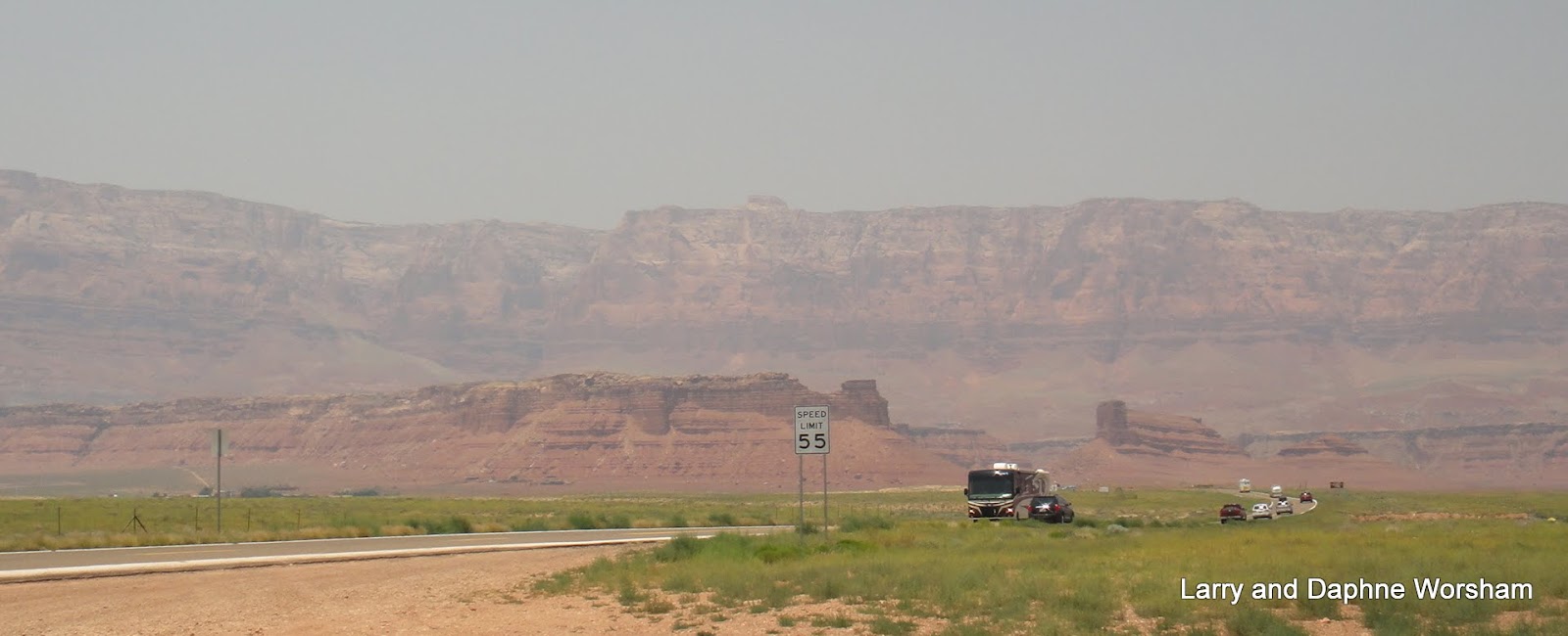
The smoke filled up side canyons in the smaller mountain ranges we passed as we drove, and we were amazed at the limited visibility in some areas. As of 6/23 the fire, dubbed the Washington fire, has burned almost 14,942. Updates on the fire here.

Monday, June 22


Something a little different tonight, we're camped at the Churchill County Fairgrounds in Fallon, NV. $15 a night for hookups, trees and a bit of grass.

It's not fancy and manicured, but we have lots of space, and Shiner has some interesting things to explore. We're surrounded by huge cottonwood trees, and the shade is welcome as the day warmed up to about 90.

The alternatives for RV parks in Fallon are limited, and this is definitely preferable to a paved parking lot next to a downtown casino.

This is the home of Fallon Naval Air Station, and TOPGUN training center, so there are jets overhead quite often during the day, but they fly high enough so as not to be a problem and actually provide a bit of entertainment. 

Tomorrow morning we head for Gardnerville and the annual Happy Birthday America gathering!

Saturday, June 20, 2015

Evading the heat

Thursday, June 18
The route we originally planned has been hit by a real heat wave, so we're heading north toward cooler climes.

Our first stop of the day is a sight-seeing tour of El Moro National Monument.

The park is named for the imposing sandstone structure, behind Steve in this photo, that rises above the floor of the desert (a "cuesta", geologically speaking).

The area is historically important as travelers on the ancient trade route that passed by here relied on the pool of water at thFe base of El Morro - a pool of runoff and snow-melt that has never been known to completely dry up.

Another reason this area is of such historic interest is the markings those visitors have left behind. There are so many signatures on the sides of El Morrow that it has come to be known as Inscription Rock.

Ancestors of the Zuni Indians called it Atsinna - "place of writing on the rock." The early Native Americans recorded their passage in pictographs, the Spaniards who explored here in the late 1500's recorded their names, the dates, and the accomplishments of their expeditions. Then, as European immigrants moved west to California, the Mexican-American War (1846-48) and western railroad expansion brought more people to the area, they too left names and dates on the sandstone walls.

The volunteer at the visitors center gave us a loan copy of the guide book and suggested we hit the trail immediately as it was getting warmer by the minute so we took her advice. The trail is paved, .5 miles, and dogs are welcome (on leash), a good thing as we couldn't have left Shiner in the car for that long. The trail is an easy walk, with a few bits of steep grade. The trail is well worth the effort.

We really enjoyed seeing the little pool of water - the primary reason this particular place was so important! There are several
Cat tails and reeds in the desert?
cliff swallow nests along the looming wall above the pool. We were watching the swallows sail above us when the most hellacious noise I have ever heard came echoing out of the huge vertical crack in the sandstone, just behind the pool. After listening to the racket for a few minutes we decided it was crows, defending their nest (or disciplining their children!). Whatever it was, it sounded quite frightening!!

As we walked on we began to see the variety of inscriptions. Some of the engravings are truly amazing, for the age and the messages as well as for the quality and style of engraving.
 
Copper plate style engraving
Copperplate and flowery script mingle with rough block letters and ancient running goats.

Some inscriptions are accompanied by the initials  UP, indicating they were connected to a survey the Union Pacific Railway conducted through the area. Others, reading "Beale" and "Breckinridge"  are connected to the Army's 1850's experiment using camels as pack animals in the desert areas.
The dry climate has helped to preserve the quality of the carvings, and some look as crisp and sharp as if they were done just yesterday. The El Morro photo album is here.

The rest of the day was driving, our stop for the night, Homolovi State Park. Our site had a bit of shade, and the temperatures were tolerable by the time we arrived (100 degrees at 3 P.M.- by 6 it had cooled of to 95.) Thank heavens for electrical hook-ups!

Friday, June 19
We wended our way through the very picturesque Navajo country - colorful formations all around, and the Vermillion Cliffs, amazing scenery (follow the link as they have photos on days with no smoke!. . .  what we could see of it. A fire up in the forest near Grand Canyon has sent smoke wafting all the way to Homolovi where we camped last night - near Winslow.

We'd been wondering what was making the sky so hazy, and it got worse as we traveled closer to the canyon. Steve checked news reports and now we know the cause. It's not threatening people or structures, so they are letting it burn. Probably a wise decision as fires are a part of nature. It certainly does make for difficult photography though! The haze was so dense we could hardly see the cliffs in front of us!

A 30 minute delay for construction just north of Cameron put a dent in our progress, but we didn't have that far to go. For each mile we climbed toward our destination, Jacob Lake /campground (Kaibab National Foreset), the temperature dropped. It was 99 degrees at the Vermillion Cliffs and 82 up at the campground. Overnight it dropped to the mid 50's. Ah, we're enjoying the cool while we can, as we have a lot of desert to get through before we get to our first real destination, Gardnerville, Nevada

Saturday, June 20
Duck Creek Campground, Utah
We left Jacob Lake fairly early, giving ourselves time to stop briefly in Kanab, just over the line into Utah.
We picked up a couple of things at Honey's grocery store, where we met Rusty. I'm quite sure Rusty is the cousin of Mater (of Cars movie fame).

Kanab is a beautiful little town, and this is the second time we've been here. We vowed this time to come back and spend a few days. The town has so many interesting little shops, historic areas, and the striking contrast between all the green trees and the bright red rim rock and formations that surround the town is a treat for the eyes.

Through Kanab, up hwy. 89 and then west on 14 we finally arrived at Duck Creek Campground.

We were worried that on a Saturday it would be hard to find a site, but there were several available.

We slid into #12, perfectly flat and level, and what would appear to be a whole meadow all to ourselves. We even managed an internet connection (ATT this time).
The campground map shows the trails that lead our of the group site parking area (at the top of the map). The trails are nice, not difficult, and add to the dog-friendly atmosphere.

As we watched the aspen leaves shimmer in the 80 degree breeze we contemplated on the fact that, if we had followed our original plan we'd be in Boulder City (NV), at 111 degrees right now. I'd say we made a good decision in swinging north!

Wednesday, June 17, 2015

Sky City, Acoma Pueblo, New Mexico

Wednesday, June 17

(You may notice, we're getting caught up all at once. We anticipate not having much connection for the next few days, and we haven't had much in the past, so we're taking advantage of the wi-fi we have at the moment. It may be a few days before you hear from us again.)

Today we visited Sky City - Acoma Pueblo is more than just a tourist destination, it's considered the oldest continuously occupied settlement in the United States.This is a rare opportunity to witness a culture that is little known, and has been in danger of disappearing.

The name “Acoma” translates in local dialects to a “place that always was” and legend tells that the Acoma people have lived on the mesa forever. The pueblo is an important part of New Mexico's cultural heritage and Acoma is recognized as the oldest continuously inhabited settlement in North America. It was the 28th Historic Site designated by the National Trust for Historic Preservation.

Cultural Center courtyard
We started our day at the Sky City Cultural Center.  On our way to the Cultural Center we passed a view point along the highway and it was packed with cars and tour buses. Aware that the day was already getting warm (at 9:00 A.M.) and seeing all those people heading the same way we were encouraged us to go directly to the center.

The Cultural Center contains a museum, vendor displays, a cafe, and gift shop. You obtain your tour pass here, as well as a permit for your camera. There are strict limitations on what can be photographed, so it's important to pay attention to their protocols. It's also where the tours of the pueblo begin.

A tour group was leaving soon, so we gathered in the courtyard at the back of the center and boarded a small bus. Our tour guide narrated the short drive up to the mesa top, and then directed us to unload.

On Acoma Pueblo mesa
For about an hour and a half we wandered the short "streets" between rows of homes, listening to her explain the significance of various buildings and symbols and browsed the wares offered by a variety of vendors. Unless one obtains specific permission from the vendor, photographing them or their beautiful pottery offerings is against etiquette. There were 6 areas in the pueblo, with 2-6 vendors in each area, so our shopping opportunities were quite extensive. The traditional Acoma Pueblo designs as well as modern adaptation were available, as well as some jewelery and a few other hand crafted items.

As we walked our guide explained the historical as well as the practical significance of features of the housing and village life that have become tradition, and how necessity often impacted design.

For instance, if one looks closely at the structures (small mounds)  around the cemetery walls you see that they have noses and ears. They appear at a distance as people, constantly on guard and intimidating the aggressors below. This was very important in the old days when other tribes were trying to take food and slaves from the pueblo.  (You can get a larger version of any of these photos by clicking on the photo.)

Cemetery guardians in the distance
The mission church is at the heart of the pueblo's cultural activities. Though it was constructed at the direction of the Catholic church it is now completely managed by the Acoma elders. It is used for a variety of traditional tribal celebrations and events.
San Estevan del Rey

Construction of the Acoma Pueblo mission church, San Estevan del Rey, was a 12-year project, begun shortly after the Spanish founded the mission in 1629 and completed in 1642. The church was placed on the National Registry of Historic Places in 1970.  Photographing the inside of the church and the cemetery is not allowed, but there are photos available on the web that were taken with tribal approval.

Acoma Pueblo is built atop a sheer-walled, 367-foot sandstone bluff in a valley studded with sacred, towering monoliths. In ancient times messengers traveled the area testing locations for settlement. When they heard the appropriate echo from the mesa here they knew this was the place to settle. High atop the mesa they were safe from marauding Navajo and other tribes, and later, the Spanish invaders. At its peak the pueblo had a population of several hundred, now the permanent residents number 20 - 30, with others using their family homes on weekends and feast days. As their is no running water or electricity on the mesa, the smaller numbers of permanent residents balance the little naturally available water. Lights and other amenities are kerosene or gas powered.

The were traditionally entered through the roof, with access via very long ladders.
Kiva ladders
The ladders traditionally extended far above the roof tops, so if an attack happened while the men were away working in the fields the women could raise the ladders by leaning on the very tall ends (good use of leverage!) Nowadays that is not needed for security so the ladders pretty much stop at the roof level. The ladders leading to the kivas are special - more ornate, and painted white.

Unlike the round Hopi kivas which are below ground level, the Acoma kivas are square, with no windows, and at street level. This is the biproduct of persecution by Spanish priests and soldiers who destroyed  kivas as meetings were in progress. By building them to resemble a standard house along the street they avoided detection.

The Pueblo's  web site is full of information and great photographs. The photo album on Acoma Pueblo's site includes a few vintage shots too, which lends a bit of recent historical perspective.  There is more info at the NPS siteOur photo album also has a few additional shots.

El Malpais National Monument, New Mexico

Tuesday, June 16

It's only a 150 miles or so to our next stop, so there's plenty of time to explore on the way. We had a leisurely morning in Datil Well, and then headed for El Malpais National Monument.

El Malpais translates as "The Badlands", which is a fairly accurate description of the terrain. Beautifully rugged, it is especially so today as the backdrop is a mixture of billowy white and threatening black storm clouds. As usual we come in through the back door, and start at the opposite end of the scenic drive from the visitors center.
We enjoyed the scenery anyway. As we passed a massive sandstone arch and beautiful colored layers, eroded into fantastic shapes, raindrops began spattering the windshield. We weren't too worried. A few bolts of lightening livened things up a bit, but not much rain was produced.

The monument includes huge lava flows, lava tube caves, ice caves, and cinder cones. There are miles of trails and area to explore, but we aren't up to that today. We stopped for lunch at the Lava Falls area and enjoyed a short jaunt over the lava flow. Blooming cactus and shrubs have established themselves in this very hospitable environment, softening the effect, but lava is still very unforgiving.
There is a deep, nearly bottomless crevice that one has to step across and cool air drifts up from it. Much of the lava is a frothy, glass-like structure, hard on shoes and even harder on a dog's feet, so we had to be careful where we went for our walks.  It was too hot by then anyway, to spend much time exploring black lava under the blazing sun but there was plenty to admire as we drove the winding road through the park.
There are a few more shots of the Lava Falls area of the park in the album. 

Stop for the night is the RV park at the Sky City Casino, owned by Pueblo Acoma.

The Salinas Pueblo Missions National Monument, N.M.

Monday, June 15

After picking up a park brochure at the visitor's center in Mountainaire yesterday, and a good night's rest, we were ready to tour the two missions out of the three in the monument that we had selected for this trip. (Park map his here)

 As far back as 7,000 years ago agricultural based Pueblo societies flourished here. Then, in the late 1500's Spanish explorers established a permanent colony for the primary purpose of mining salt and other valuable minerals they expected to find. Though not much in the way of valuable minerals was ever discovered, the Spanish king decided to finance the colony for the purpose of Christianizing the natives.   The Salinas Pueblo Missions  are the result of those efforts, which spanned about 70 years.

Admittedly, there has been much restoration and preservation work done to keep enough of the original structures intact to enable visitors to visualize the original complex. You can see a comparison of two different repair/preservation operations in this photo. A ranger we talked with said they make the rounds and try to work on each mission every five years or so, so this demarcation is due to differing ages and possibly different materials used in the mortar. He explained that while the fallen wall tops are topped with colored stucco to prevent further erosion, the mortar between stones is a combination of adobe soil and stucco. It does erode with the weather, but not as quickly as plain adobe.

These missions were complexes, or small cities, not just churches. A model in the museum, as well as the maps in the brochure clearly indicate huge settlements. These were all at their peak during the late 1500's through the middle of the 1600's.  Then, around the 1660's or '70's, drought and famine, disease, and the inability of the Spanish government and the Catholic church to maintain the desired level of control over this area led to the Spanish retreating. The people from this area joined other pueblo cultures further to the south, and these villages were never occupied again.

Archeological excavation has revealed some of the structures, but others remain buried under hundreds
of years of melted adobe, sand, and rubble.

A walk around the area however reveals the remaining stones peaking through mounds of adobe, and with a good imagination one can envision a thriving community. The area behind this main ruin at the Abo site is covered with mounds, most with bits of wall protruding.

In Pueblo tradition, the men do the weaving and the women build the houses (perhaps because they own and control the property!). . . lending a new meaning to the term "house work"! 
This church was built by Tia Pueblo women over a span of five years. The complexity of the church is amazing, and there was considerable help from men as the heavy timbers used for the roof and windows had to be lifted up and installed as the walls were built.

There are a few more photos of the mission ruins in the album here if you'd like to see some of those details.


After touring the ruins of the missions at Quarai and Abo we moved on to Datil Well Campground,http://www.blm.gov/nm/st/en/prog/recreation/socorro/datil_well_campground.html just outside the town of Datil. We've stayed here before and have always enjoyed the quiet.

The campground is never very full, and it's well maintained. The signs displaying the historic information for the area, and the little visitors center, are nice touches that one doesn't usually find in a BLM campground. The best part is, the camping fee is only $5, which is cut in half with a Golden Age Pass. Now, you can't beat that! From the BLM website: "Datil Well Recreation Area Campground includes one of 15 water wells along the old Magdalena Livestock Driveway. The old cattle trail was established in the 1800s and stretched 120 miles from Springerville, Arizona, to Magdalena, New Mexico. The area includes 3 miles of hiking trails in piƱon-juniper and ponderosa pine woodlands, with scenic views of the San Augustin Plains."

I had never noticed the sign leading to the trail before, but when we saw it on our loop around the campground this time I decided to give it a try. In the morning Steve was occupied with trying to resolve some electronic gremlins  (I think your gremlins hitched a ride with us Grayce!) so Shiner and I explored part of the trail.

It's beautifully maintained, and probably not heavily used. There wasn't a spec of litter anywhere!

The trail starts at space 6, then crosses a gravel road where you hit the trail head sign and a log book box. A few yards from the trail head there is a nice little gazebo with benches. This time we took the loop to the Crosby Canyon overlook. At the overlook there is another shelter with a bench, clearly marked so you know you've arrived at your destination. Next time we visit we'll try out some of the other branches of the trail. Here is a great map of the campground and the hiking trail.

As the day was ending Steve brought my attion to the view just behind me. . . what a perfect way to end the day!

Manzanos Mountains State Park, New Mexico

Sunday, June 14
On the way to our camping location we stopped in the town of Mountainair at the visitors center for the Salinas Pueblo Missions. The town has several galleries and art related shops, and murals on several of the buildings.

We were quite impressed by the mural where we parked. Please excuse my fat finger across the corner. That's the problem with digital cameras in bright sun..... you can't see what you are doing!

This mural has a lot of detail that was especially nice up close. There are subtle rock art symbols on the boulders, and snakes hiding in the rocks.

They have a nice little bookstore/gift shop at the park information center, and as usual I picked up a couple of children's books, but we were most impressed by the fantastic adobe "L" shaped bench in the parking lot.

Mosaic and hand crafted tiles were used to create a snake curling around the back of the bench, and there are little reptiles tucked in all over the structure. Strong sunlight and the lattice covering combined to make a very harsh shadow, so it's difficult to get the whole structure. Guess you'll have to use your imagination!

We're camping at Manzano State Park this evening, for one night only. It's a nice park, with plenty of pine trees and and between spaces. We headed for the big space, #33, way at the back and though it looked spacious, by the time we dodged branches we still had a bit of a challenge to get our rig shoe-horned in. We finally got it settled and enjoyed a cool evening as we're up a little over 7,000 ft,in the juniper and pine forested mountains.

This campground reminds me of  "the old days" of camping. There are few services, no water and electric at the sites. There are trees between and in all the spaces, so they are more private than we often see, and the surrounding area is fairly wide open, so you can walk anywhere.

It's also a very friendly campground, tonight anyway! We tried to go for an evening walk to get Shiner a bit of exercise and could barely move to the next space before we struck up another conversation. Shiner seemed to enjoy the walk, even if it was at a snail's pace.

Tomorrow we tour the ruins of the Salinas Pueblo Missions. 

Sunday, June 14, 2015

Bottomless Lakes State Park, New Mexico

This state park is a very scenic area, and one of our favorite stops as there is a place where Shiner can swim, but this time we aren’t doing much “touring”, it’s a stop to catch up on a few things that didn’t get done before we left, run errands, and just relax.

We arrived Friday after a short drive from Brantley Lake. Hot weather, brilliant blue skies with huge clouds, and a bit of an afternoon breeze made things very comfortable, if a bit on the warm side. We puttered at a few chores, getting technology set up, working out the bugs in several systems and making up a short shopping list.

Saturday was shopping day. We haven’t spent much time in the city of Roswell before, so this trip into town gave us an opportunity to venture down a few side streets.

First of course comes a quilt shop. I found some great fabric at the Calico Cow, which has a nice selection of Southwestern fabrics, and I really enjoyed my visit there.
Perfect souvenirs
Steve relaxed with an iced coffee at the shop next door, and then we proceeded with the rest of the shopping.

We haven’t tried the locally produced Alien beer yet but it’s on ice… we’ll report on it later. On the way out of town we passed the New Mexico Military Institute. We’d seen signs on the highway pointing to the facility, but we were amazed when we actually saw it. The campus is huge, with a multitude of brick buildings, all with the “castle parapet” look of the Corp of Engineers logo, if you’ve seen that. Their website says “Located in Roswell, New Mexico, the New Mexico Military Institute  offers a rich history and tradition of educating tomorrow’s leaders through a program of strong, challenging academics, leadership
preparation, and character development. Known as “The West Point of the West,” NMMI remains the only state-supported co-educational college preparatory high school and junior college in the United States. “ And I might add, that campus is a very impressive facility.

Roswell is famous for aliens, but that image is getting a bit worn out now – they need another visit to refresh the image I think! It’s pretty much just a typical southwestern town. We finished the shopping for groceries, the post office, pet store, etc. – boring stuff but gotta do it, then back to camp to stow everything away.

And then the afternoon zephyr hit.

We frequently hit extreme weather here, and this visit is no exception. In 2013 we were here for a monsoon, which was pretty amazing. This time, about 3 o’clock in the afternoon the wind picked up, and up, and up, and soon everyone’s tents were laid flat, sun-shade tarps bowed like giant sails, lawn chairs tumbled… you get the picture. Some folks were a little more prepared than others and had things battened down early, so they scurried around and assisted the Johnny-come-latelies with gathering up their wind battered belongings. Little rain accompanied the dark clouds this time, but the wind certainly sent us all scurrying. Shiner thought it was very strange that we had all the awnings pulled in and all our chairs and tables were wrapped up on the picnic table, as this is not our usual procedure. I will say, thanks to gathering everything up to save it from the wind we are pretty much packed up and ready to go tomorrow morning!

Friday, June 12, 2015

We’re back in the saddle again…..

. . . “ Out where a friend is a friend”. . .to quote Gene Autry.

Wednesday, June 10

After a year’s hiatus we’re back to our usual summer travels.

For the past few weeks friends have been calling and asking “Are you packed yet?” and when we say “No, not really”. They probably think we are just twiddling our thumbs. You see, “packing” for us in preparation for 4 or 5 months on the road involves a lot of things, some of them very last-minute. Like, chasing out the bird who just decided to build a nest in the electric box of our parking space, and then moved to building in the slide-out. And then, there's wiping down the ENTIRE interior, because the heavy oak tree pollen this year came in the windows and coated everything. Getting hitched up and ready to pull out the then discovering little things like electrical problems also slowed things down. Then, aside from RV prep, there is the watering system for the landscaping (what little we have) to get in place and adjusted. Finally, all is done! Food and clothes packed, chores done, and we’re on the road! We aimed for a 10 A.M. departure but made it by 11 – the usual discrepancy, but no big deal. We headed for San Angelo, about a five hour drive.

It was a beautiful day, with a bright blue sky filled with puffy clouds, and the rolling limestone hills covered with oak and cedar still lush from our recent rains. The weather was pushing 90 even this early in the day, but we were comfy in the truck. A perfect first day out . . . then . . . BOOM! . . .

A blow-out on a front trailer tire, on an uphill grade of course, demanded 2 hours of our time. I say “our” as we were both there, but poor Steve was the one on his back in the sun while I kept Shiner company in the shade.

He got the flat changed, and then we headed to Fredericksburg to buy a replacement.


It sounds simple, but between the heat and the time delay, San Angelo was out of the question so we landed at South Llano River State Park (near Junction), where we’ve stayed many times before. ( 2010 visit ) Shiner is so happy to be back on the road and out in the woods sniffing new smells and meeting new people that I could hardly hold her back on our evening walk. Steve spent the evening recuperating in the evening cool, as we watched the fireflies dance in the shrubs around the camp sites. We’ll be back on the road tomorrow. Let’s hope our first day wasn’t a sign of things to come! (Yes, next time we may call the road service, but that probably would have meant at least an hour longer sitting out there in the sun, so it’s a toss-up.)


Thursday, June 11

A leisurely 9 A.M. departure saw us rested and ready to hit the road again. It had been a couple of years since we had traveled hwy. 285 between Junction and Carlsbad and we were amazed at the increase in oil and gas production facilities. Wells, tanks, and temporary worker housing have sprung up like mushrooms. The increased truck traffic has also taken a heavy toll on the road surface. There are several stretches that are downright miserable. We probably won’t follow this route again if we can help it.

Other than feeling like we were riding in a buckboard, the day was fairly uneventful. We arrived at Brantley Lake State Park, New Mexico (near Carlsbad) at about 5:30 local time. It was still over 100 degrees, so we stayed in the shade, let the air conditioner cool things off a bit, and sipped a cool one.

Our site (#40) had a nice view of the lake, which now has water in it!

When we were here a couple of years ago it was pretty much a mud puddle. All the additional rainfall has not only filled up the lake, and taken out one of the campgrounds due to flooding!

The spring rains also brought out all kinds of wildflowers and fruiting desert plants. It makes for delightful walking along the trails. Our site had a lovely pink desert will blooming, perfuming the air and offering snacks for local bumblebees. Shiner enjoyed a walk down to the boat ramp to dip her toes in the water, and very much wanted to chase all the little cotton tails we scared up, but that’s a no-no in a state park! 


After such a long break from blogging it's going to take me a while to get back into the swing of things. Technology has changed the way a lot of things work on the back end, so hang in, I'll get caught up!