Wednesday, June 23, 2010

More travel on the Loneliest Highway

We've been traveling with ghosts these last two days - the ghosts of stage coach drivers, pony express riders, gold and silver miners, pioneers and outlaws, freight and ore wagon drivers, and Native Americans who were here long before any of them.

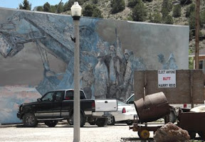
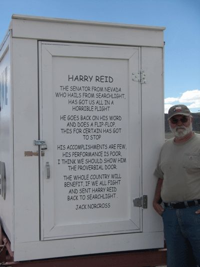
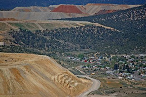
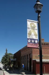
Yesterday we stopped briefly in Eureka - named for the outburst so common when a rich vein is struck. . . and in. . Eureka, I've found it! The first thing we noticed is that the town has posted a banner with the name of each of their residents who is serving in the military. A very nice tribute we thought.

Eureka's claim to fame was lead, silver and gold mining. The town is still fairly busy, and the opera house hosts performances on a regular basis.
There were none while we were there unfortunately. The docent at the museum gave us a nice CD with information about each point of interest along the highway. It's a nice addition to the other reference materials and maps we already had. We've listened to the various tracks as we travel and it's been quite entertaining and informative.
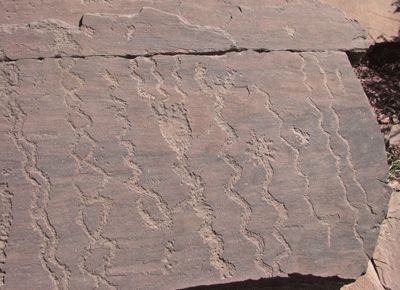
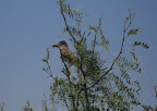
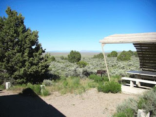
We spent the night at Hickison Summit. The area is of geologic interest. The cliffs are formed of volcanic ash, the result of an eruption that caused hundreds of times the amount of ash the St.Helens eruption produced. The ash is compacted, but not really firm rock, so it provided the early Native Americans with an easy medium in which to record petroglyphs. We hiked the short trail to the petroglyphs in the afternoon and took photos, but mostly just enjoyed the view down the valley.

The campground is a "dry camp" - no water or services of any kind (no problem for us) and the sites are all tucked up in between juniper trees. Very picturesque and cozy, but a bit tight when it came to navigating the road.

We did have entertainment, provided by Fallon Naval Air Base we assume (Fallon is the Top Gun training site) - a flyover of 2 F-16's - close enough to wave to the pilots if you move fast enough! There were more mosquitoes than we would have expected this time of year, so we only stayed the one night.

Our next stop along the route was Austin. Named for Austin, Texas no less! It's almost the exact center of the state. The town was smaller than we expected based on advertising in the western magazines. They have preserved some of the original buildings, but things could do with a lot of TLC. We visited the cemetary and were impressed not only with the age of some of the graves, but the flowers and other obvious care that is taken to maintain some of the family sites.

West of Austin we stopped briefly at Sand Springs, to see the huge sand dune and the remains of a pony express station. According to our sources this station never had a real roof, but as Molly and I hiked it at 1 PM under a rather sunny sky I have to think they had a canvas roof or something. No one would put up with this heat without at least a little shade.

We're planning to spend the next two nights at Fort Churchill. More updates to follow!

More photos in the slide show below. Click (or double click)on the photo to go to a larger version.

Tuesday, June 22, 2010

Cave Lake State Park, Nevada

We spent two nights here in Elk Flat campground, just east of Ely, one of the prettiest places we've stayed as far as the actual campsite. We'd planned on only one night, but had a nice chat with the ranger and he encouraged us to stay another night so we'd have time for a little exploring. The campground is very nicely designed, with the sites not only level and well groomed, but far enough apart with shrubby junipers in between so each is quite private. We're up fairly high, so the nights are cool, and there are still wildflowers everywhere.

The closest town is Ely, where we went exploring. The town looks fairly prosperous compared to many small towns we've passed through. They've done a nice job of emphasizing their history too. There are large murals on several of the buildings, and they've preserved many of the old downtown shop fronts.

The connections to hard rock mining and ranching are evident in the murals as well as inside the restaurant where we ate lunch, the Hotel Nevada.
Inside, the decor consists of a proliferation of western memorabilia, including a huge boa constrictor snakeskin, the primary view in the corner where we sat, in addition to motorcycle themed items and a classic 1948 Indian bike. As we passed by this morning there was a row of bikers parked outside, so they obviously cater to them.

One of our favorite street scenes was this mural with mining theme and a small sign included up front with the mining equipment. Can you tell what the local folks think of Mr. Reid? (Click on the photos to enlarge them) The largest version of the sign (and there were several around town) was at the east end of town. It also offers some poetic advice.


We spent a couple of hours yesterday wandering around on Garnet Hill, just west of Ely. This was a site the ranger recommended once he learned we were interested in rock collecting. It's covered in my central Nevada geology book too, so we had good directions. We did find a few samples to add to the mineral case. We also had a great view of the Robinson Mining District - the two pits in view in the photo are Liberty, on the lift, and the Ruth, farther back on the right.
There are several other mines in the district, clearly the primary employer in the area.


Ely is on the eastern section of highway 50, also known as the Loneliest Highway. Towns are not only small but few and far between, and so is the traffic. We've seen only a few other travelers as we head west. It's a very historic part of the state however. Ghost towns and old stone and wooden cabins are spotted all along the highway.As I write this, we passed a cattle drive just to the south of the highway. Cowboys on horseback pushing the cattle on to a different area of the range. There's also the modern touch, as we share the highway with a bicycle race!
There are a few additional photos in the slide show. Click on it for a larger view


Sunday, June 20, 2010

Great Basin National Park, Nevada

As I write I am sitting by a rushing creek, surrounded by invisible songbirds, rustling cottonwood trees, and snowcapped mountains. Yes, this is Nevada. Even though the state flower is sagebrush, there’s much more here to explore than most people expect.

We are staying in Lower Lehman Creek Campground, Great Basin National Park. The “Great Basin” is a geologically defined area that actually takes up most of Nevada, and some of the adjoining lands of Utah, California, Oregon and Idaho, but the park is only a small area in eastern Nevada, very near the border with Utah. What a strange and fascinating range of plant and animal life this park offers, in addition to interesting geology and beautiful scenery. With elevations ranging from about 7,000 to 10,000, harsh winters and hot summers, there are several microclimates.

This morning we toured Leahman Cave, one of about 40 caves in the park and the only one open for tours. The cave is amazing and we thoroughly enjoyed the tour as our guide Alex, a biology major from Arizona State, explained all the strange formations and the challenges the park service has in maintaining the integrity of the cave with so much human traffic. Tours fill up fast, so there are a lot of feet traversing the fragile environment.

In the afternoon we took a drive up to Wheeler Peak, passing the 10,000 elevation mark as we did so. At such an extreme elevation spring is only now arriving and trees are just beginning to leaf out. Tortured tree trunks are testament to the harsh winter and dry summers, but wildflowers still manage to survive. The view is amazing, but not something that can be captured by the camera. It’s too big, too wide, too distant. We break camp tomorrow for new adventures!

Cathedral Gorge State Park, Nevada

Steve gave me two choices of places to stop and I chose Cathedral Gorge, as it seemed to have more interesting geology and a more extensive visitors center. Good choice! The campground is very nice - they even rake the gravel pads every day! The staff at the visitor center are very friendly and helpful, and they gave us a really nice guide book to all the petroglyph sites in Lincoln county. We won't have time to check them all out this time, but we'll be back again.

Cathedral Gorge is a very picturesque canyon full of deeply eroded slopes and "hoodoos" - eroded pillars. They are composed of soil that is primarily volcanic ash, loosely compacted. Because the soil is soft it erodes so fast plant life can't really get a start, so the eroded areas are very much exposed, thus the interesting textures and shadows.

The picnic area, stone restroom building and water tower were all built by the CCC (Civilian Conservation Corp) in the late 1930's. The restrooms and water tower are no longer in use, but stand as testament to the beautiful stone masonry done by the corp. The picnic shelter is built in typical southwestern ramada style, with an adobe roof. The large beams are called "vigas", and the smaller "latillas." Mud is layered over the sticks to form a solid roof. Great in this very dry climate, but it doesn't wear so well anywhere there's much rain. This one is in very good shape so it must get regular attention. Click on the slide show below for larger pictures.

Wednesday, June 16, 2010

Boulder City, Nevada - part II

Last night we drove around the historic district a while. They've done a nice job with the older buildings and historic businesses. We also noticed a number of bronze statues around town. Many of them were installed last May as part of a public arts project.

High winds (gusts up to 32 miles an hour) kept us here at the Elks Club in Boulder City a day longer than we had planned. No worries. We went grocery shopping, bought a few parts and pieces for the rig, and visited the Boulder City/Hoover Dam Museum, housed in the old Boulder Dam Hotel. What an amazing engineering feat it was! and as the museum points out, the challenges the workers and their families faced just in daily living are noteworthy too. There was no school planned, no houses, no services, as all the families moved in. High temperatures were another challenge - no air conditioning in those days! Quite a bit of history is available on the museum web link, above. 

After touring we had another couple of cold one's in the Elks lounge - nice folks to visit with. Weather predictions are for much less wind tomorrow, so we'll be heading north.

Tuesday, June 15, 2010

Boulder City, Nevada

Boulder City, Nevada. This town, about 20 miles from Las Vegas, came into being as Hoover dam was being built, to support the workers and provide the support services that were needed. My dad helped build this dam, so I feel a sort of connection to it.

We pulled in to the Boulder City Elks Club right around lunch time today. We got the rig set up, then went in to have a cold one and pay our rent.  And, the beer was REALLY cold. The compressor went out on their beer cooler so they had to ice down the keg. Word got out to the members that the beer was even colder than usual.... they all mentioned it as they drifted in. 'Friendly folks. We got to chatting with the RV park host and hostess.... she's pulling bartender duty today too. Deb and Colin are from Oregon too, right up the valley from where we lived, just south of Lebanon. They moved away from Oregon several years ago and have been out here in the desert ever since. Small world!

As we talked with our hosts we learned some of the history of the place. The club is housed in a building that was once the Boulder City airport. One site on Boulder City history states "the terminal was dedicated May 20, 1938. It was a beautiful building: the waiting room had open beams in the ceiling and a large wood-burning fireplace; there was a radio room, ticket office, and office for airport manager..." Here's an historic photo of the airport building  The Elks bought the building in 1958 when it was retired from airport duty. The parking lot and RV lot are where the airplanes are in the photo.   Photos of the club room and bar show the original interior architecture. Heavy ceiling beams seen in the photo of the interior of the "lounge in the clubroom" at the above link are also seen in a photo they have on the back wall of the lounge showing the airport when it was in use. The back side of the bar was originally the ticket window, and those small windows are still in place. They really have done a nice job of maintainingthe facility and they also have quite a few activities scheduled. We won't be around long enough this time to participate, but this is definitely a lodge we'll visit again.

Last night we stayed at "Blake Ranch RV Park and Horse Motel". The Ranch is a really nice park. Very clean and well maintained overall. The staff are friendly and helpful, and the little convenience store offers pretty much anything you'd need. Landscaping includes some nice cactus beds, many were blooming and the effect was very pretty. Molly had a bit of a problem with this stop, however. Doggies here are expected to visit the very tidy little fenced areas to do what dogs do.... and she just doesn't quite know how to behave in a 20 x 30 fenced in spot with nothing to sniff. We each took her to the "dog park" and sat on the available bench to wait for her to perform..... she looked around and then came over and sat down next to the bench. Give that dog a bush to sniff and she's happy, but this just didn't make any sense to her.

Monday, June 14, 2010

Lyman Lake, Arizona

Wow, what a contrast. We had a low of 44 last night. I don't think it's been that cold since we left Oregon. It warmed up nicely today though, and we thoroughly enjoyed the scenery and the hiking. This is a really nice park, with a range of options from full hook-ups to cabins and yurts, along with basic no frills sites. There's fishing and boating, and plenty of trails to hike. Lyman Lake State Park is located in northeastern Arizona along the Little Colorado River in Apache County between St. Johns and Springerville just off of US 191.
The River was first dammed in 1915, dedicated as a park in 1961. We can't find evidence of who did all the stone work, but the trails are beautifully built, with nice stone steps leading the hiker right to the best spots for photos and observation of the lake. This lake is supposedly the smoothest water in the state for water skiing, but those afternoon zephyrs are something else. As evidence, all the trash can lids are weighted so they don't blow away..... and they way about 20 pounds each!

THE PETROGLYPHS
The Peninsula Petroglyph trail winds around a sandstone and limestone cliff. The trail also offered some fantastic views of the lake.

The petroglyphs are all incised or pecked into the sandstone, we didn't find any in the limestone. Unfortunately, many of the glyphs were carved on horizontal surfaces, which rain water collects in, speeding the erosion. Many are so eroded it is difficult to see the original design.
There is a 30 page booklet with much more extensive information about the petroglyphs, as well as the ruins. It also contains a map of the "floor plan" of the ruins.

THE RUINS
The Lyman Lake State Park area appears to have been continuously occupied by the Anasazi sometime after 6000 BC. The ruins open to visitors are "Rattlesnake Point Pueblo" which was a medium-sized village that was home to about 15 families between AD 1325 and 1390. It was one story tall and had between 80 and 90 rooms. This site has been excavated and researched, and then most of the rooms backfilled to protect them. They use "non-native" materials so it's easily distinguished if they want to uncover the site again. This was done at another site in nearby Springerville. It doesn't leave much for the visitor to see, but it does keep the site safe. After all the vandalism that has happened at other archeological sites I can't blame them for using this technique.

Click on the album photo to go to the slide show:

Saturday, June 12, 2010

Onward to Arizona

Today we headed west on highway 60, through high desert plains and forests of ponderosa and juniper, enjoying the cool of the 7,000+ altitude. We passed through some interesting little towns - all obviously connected at one time to the big cattle drives and gold mining. A completely different but interesting site was an instillation on the San Augstine Plains, the VLA - National Radio Astronomy Observatory.
The view from the highway is deceiving. Each of what appears to be a fairly small radio dish is actually a row of them, mounted on rails so they can move. As for size - they are each 422 feet in diameter. Some of the filming for the movie "Contact" was done here.

Once over the Great Divide the forest dropped away, and as soon as we crossed the Arizona border the scenery changed dramatically...it looked like Arizona! Red cliffs and sagebrush, and beautiful clouds in a bright blue sky.

We are staying two nights at Lyman Lake State Park. Red cliffs surround the lake, so it's rather picturesque and there are hiking trails and other things to do, but we won't be exploring today. After a long drive and a trip into town to visit a museum and pick up groceries we're ready to call it a day.

Friday, June 11, 2010

Three Rivers Petroglyph Site, New Mexico

We spent a lovely, cool night here at the Three Rivers Petroglyph site. The elevation is above 5,000 feet, so the temperature is much milder than on the valley floor. There's also a pretty stiff wind, which helps with the heat when you're out in the sun. This is a small but very nice campground. It has several campsites with no utilities, and two with electric and water. Very nice restrooms, and a friendly and helpful host in the office.

It was chilly when we got up this morning (78 degrees!) but warmed up quickly, so we ate a quick breakfast and headed for the trail up to the petroglyphs. The trail is nicely built and well maintained. There are numbered areas to point out some of the most exemplary glyphs. This is an amazing area, as almost every face of some of the boulders has designs on it. Unfortunately, there has also been quite a bit of vandalism. Scratching and pecking by recent visitors is definitely a distraction, and in some cases has damaged the rock art. We only visited one area, leaving two for future visits. As it is, we were snapping photos for two and a half hours! Click on the photo to go to the slide show.
Along the trail we met a gentleman from Germany who has written a tour book on the southwest for German tourists (it's written in German so we won't be reading it). He leads tours and this is one of the sites he features.

After the hike it was back to camp to have lunch and enjoy a little shade. We sat and read, enjoyed the fragrance of the chaparral (creosote bush), and watched the fly-catchers dip and soar as they snatched bugs out of the air. In the late afternoon we took the short path across the highway from the campground to see the restored Mogollon village - really just three examples of types of housing that were used. There is too much brush to be able to detect much in the way of other ruins.

After dinner entertainment in these parts consists of star-gazing and listening to the local cattle mumble while the coyote pups argue. That and the occasional cicada buzzing sent us off to bed fairly early. We want to get an early start tomorrow, as high winds are expected.

Thursday, June 10, 2010

Lincoln County, New Mexico

Temperatures were expected to be in the 100's today, so we were up and moving early. As we left the Bottomless Lakes area we started the drive through flat land sagebrush, the type of scenery most people associate with New Mexico. Soon we were climbing up into mountains where it was greener and cooler.

Lincoln County is slightly south west of the center of New Mexico, and figures largely in the history of wild west bad-guys. Our first stop was the town of Lincoln, famous as the site of the famous "Lincoln County War" shoot out. If you aren't a fan of western history that won't mean much, but just about everyone has heard of Billy the Kid a.k.a. William Bonney, and the shoot out that took place here is what made him famous.
Many movies have been made about Billy and his battles with the law, so it was interesting to see the town where it all took place, and how different it is from the movie depictions. Lincoln is in a steep valley, and fairly green, not the stark desert usually depicted. Most of the buildings are still inhabited, either as private homes or as part of the museum system. We toured several, including the mercantile that was owned by John Tunstall, who's murder was central in the "war". Subsequent owners had stored many of the original items stocked in the shop, and those items are now displayed in the original display cases. We enjoyed chatting with the park personnel who definitely have their hands full keeping an eye on a whole town! The state has done a really nice job of balancing preservation and history. 

After leaving Lincoln we stopped at the Smokey the Bear State Monument. A small but really nice museum that chronicles his rescue after a fire and creation of Smokey the Bear as the forest services public face regarding human caused forest fires. Nice displays include just about every novelty, collectible and children's picture book about Smokey, and a very informative garden area demonstrating a variety of habitats. Included in the garden is the burial of the original Smokey, the cub rescued from the New Mexico forest fire. He had lived at the Washington D.C. zoo for years, and when he died they flew him back here for burial. There is a new rescue bear cub taking his place. So the tradition continues.

Our stopping point for the night is Three Rivers Petroglyph Site. This is Steve's favorite site so far, as it has the "vistas" he so much enjoys . . . . we have mountains in the distance, and beautiful clouds. You just an't beat a desert landscape in the vistas department. This site has over 21, 000 petroglyphs documented, so we have plenty to entertain us tomorrow!

Photos and more details to follow......

Wednesday, June 9, 2010

Roswell, New Mexico

We watched our friends on horseback as they rode out this morning. Must be nice in the cool mornings to be seeing the scenery that way. 

We went in to the town of Roswell early this morning for groceries, while it was still cool.  Well known for it's connections to the crash of an "alien ship" in 1947,  Roswell is a nice little town with only the occasional alien presence, but more UFO museums than you can count.  
It was a successful shopping trip. . .we bought about 4 dozen fresh, hot tortillas at the little market and did our best to eat them all before they cooled off. Yum!

The visitor's center at Bottomless Lakes finally opened up (one or two park staff have to spread themselves thin, so it's not always open). We toured that and walked in to one of the smaller lakes, then headed out of the park for a little exploring.

By noon we were back in camp. 95 degrees is too hot for wandering around in the sun! It isn't too bad for sitting in the shade, sipping something cool and looking at the lake however. We don't have a lakeside site, those have to be reserved ahead of time, but the park isn't at all crowded, so we still have a nice view.

Tuesday, June 8, 2010

New Mexico

Today we traveled from San Angelo, TX, into New Mexico - a longer trek than we like to make in one day but there wasn't a planned stop in between. West Texas is flat flat flat - red dirt fields of cotton and wheat dotted with oil wells and, a more recent feature on the landscape, huge wind generators.

It's still warm, in the high 90's, with a few clouds decorating the sky. Pretty good driving conditions actually, and we've seen some interesting sights along the way. One small town we passed through, Tatum, New Mexico, has street signs, public office signs, private ranch sings, all made of iron silhouettes. They're all very nicely done and really added a nice touch to the otherwise sleepy burg.

We arrived at our destination, Bottomless Lakes State Park, around 3 P.M. We're camped at Lea Lake, the largest of the "bottomless lakes". They aren't really bottomless, but look that way, and this one is 90 feet deep. Close enough if you can't swim! The surrounding cliffs are red limestone, so the effect is very picturesque. We stayed in the RV until the weather cooled a bit, then ventured out to visit with a few of our neighbors.

A group just down the road from us had horses, so we asked where they were from.... what an adventure. Most of the riders are from England, and they came here as part of a project to follow the Goodnight-Loving cattle trail. If you aren't familiar with western history, this was one of the most famous of the trails used to drive beef to the northern states, and figured largely in the Lonesome Dove series.

This project, called The Long Ride, was quite awhile in the planning. This group started out near Dallas, TX. Some of the riders will trade off part way along the trail so at the end there will have been many participants. The organizer is hoping to make a documentary out of the experience. It was fascinating meeting the various members of the group, but when the mosquitoes started snapping we decided to go home for the evening.
A short time later the magnificent desert sunset drew us out again. The water tower, part of the stone structures built here by the CCC corp., made a nice silhouette.

Monday, June 7, 2010

On the Road Again

We left San Marcos yesterday morning around 10 A.M.  It was 77 degrees when we got up, with 84% humidity! All of the windows in the house were covered in condensation. I thought it was on the inside and tried to dry it off when I discovered it was all on the outside! I good time to be leaving I think.

We stopped at San Angelo State Park for the night. This morning we went in to San Angelo and did a bit of exploring. Unfortunately many of the quaint shops, including the bordello museum, are closed on Mondays, but the proprietor of the bookstore we were interested in, Cactus Book Shop, showed up so we found some new reading material and admired their antique and collectible books. It's definitely the source for Texas and western history. We loaded up with ice and headed back to camp for some R and R, reading and a cold beer. With the weather so hot (high 90's) we're not too active outside, but the scenery is nice. The grasses are drying, and with the scattered mesquite trees and the flat land around the reservoir the area resembles an African savanna.
Orioles and scissor-tailed fly catchers, cardinals and other song birds sail around in the trees and there has been a woodpecker checking out the truck. As long as he doesn't start pecking holes in it I think we're safe. We'll stay here again tonight, then tomorrow morning we head for New Mexico.