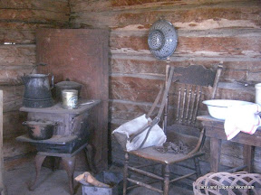
We pulled into the Winnemucca RV park around noon on Sunday. After lunch we moseyed into town to see what was happening..... not much on a Sunday! The one museum that was scheduled to be open on Sunday is in the convention center, but it was closed for a wedding reception. So, we went grocery shopping and drove around town a bit. There's evidence here of the town's age. It's been occupied continuously since 1830, and many of the store fronts and frame houses are from those early years. Murals on the walls downtown also capture the historic mood.
As a shipping and ranching center Winnemucca was at the center of a lot of activity over the years, not to mention it's importance in supporting the early settlers, and it's role now as headquarters for the Winnemucca Indian (Paiute) Colony.

There have been a few lively events over the years.
One of the most notorious was on Sept. 19, 1900. Butch Cassidy's gang pulled one of their last successful robberies, galloping out of town in a hail of bullets with $2,000 in gold. The story varies with the telling, but there's no evidence that Butch was actually present at the time. This photo, at the right, was discovered by a law enforcement officer in the window of a photographer, and shown to the bank manager. He itentified several of the individuals, so it is certain that many of the other gang members were involved, but he didn't itendify Butch as one of those present in the holdup.
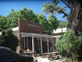
You'll find a saloon across from the convention center commemorating this event.

Our excursions Monday included the
Humboldt County Museum and the
Buckaroo Hall of Fame. Both, sad to say, were somewhat disappointing. The
Humboldt County Museum is nicely done, what there is of it. They jumped over much of the local history and important events. It felt more like some families had donated some nice things and they figured out how to display them, not like they were trying to convey a picture of the history of the area. I'm not saying don't visit if you're here, 'just saying don't count on it to fill in any of the information you might want. The
Humboldt County Museum page at the Travel Nevada website has more info, though it's out of date. The museum is no longer in the old church. The church is still on the property, but the museum is now housed in a new building behind the church.
The
Buckaroo Hall of Fame is located inside the Winnemucca Convention Center, in a series of display windows around the perimeter of the hall. It shares the space with a mineral collection, and a collection of large antlered critters. It's a somewhat odd arrangement in the first place, which wasn't helped a bit by the fact there'd been a wedding reception in the hall the day before and all the display windows were covered with white drapes. We had to lift them all up in order to see the displays, so not knowing what was under each curtain we sort of started in the middle and worked both directions. There was no curator, just the office girl who waved her had and said "it's back there", in response to our query as to where the exhibit was. The Buckaroo collection includes saddles and other memorabilia from those who've been inducted into the hall of fame, paintings, and some other miscellaneous items related to ranching. Unfortunately there was little information tying it all together, or explaining the importance of ranching to Winnemucca. A visit to the
Buckaroo Hall of Fame website is actually a more informative experience. The website does a nice job of explaining the history and terminology, and has an index of inductees.
This area has been home to Basque sheep herders for many years, so it's one of the few places in the country where you can get authentic Basque food. The consensus after reading reviews was that
Martin Hotel was the best place for dinner, so that's where we went. It was an excellent meal, as one would expect. If you've never eaten in a Basque restaurant, it's a different experience. First the soup, then the salad, then the side dishes (four or five, including some very tender, nicely seasoned tongue) then the entree. If you haven't carefully budgeted you're out of room by now! We did save a tiny bit of space for dessert.... their bread pudding is the best we've ever eaten! Very spicy and tender. The restaurant itself was established 1898, and some of the original architecture and decor are still visible. Embossed tin ceiling and wall panels, and knotty pine wall paneling, give the dining room a cozy feeling. Some of the other diners were locals, others in town for the junior rodeo, all decked out in their finest, which means big hats, big buckles, and in one case, spurs!
Next stop, somewhere in south eastern Oregon........
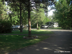 Steve has been wanting to stay in Clyde Holiday State Park for a long time. We made an attempt a couple of years ago the park was too crowded, so we tried again and had success!
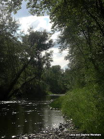 This park is a great home base if you want to explore the John Day area. The river, as well as the town, are named for John Day, an old time trapper best known, along with Ramsay Crooks, for being robbed and stripped naked by Indians on the Columbia River near the mouth of the river than now bears his name.
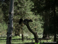

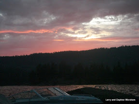


 This was the last stop. It was late, we'd traveled about 150 miles on rough gravel roads, and temperatures were still in the 90's so we headed for home, where an air conditioned RV, an cold beer and a view of the river awaited!