Friday, July 26, 2013

Missoula, Montana

July 22-23  Lolo Creek Square Dance Center and RV Park
Designed as a center for square dancing activities, this park also welcomes "non-dancers"...like us!  The sites are varied, some fairly close together, some like ours, are like stopping in a park. We are out on the edge, where we have a lovely little mowed meadow that is actually part of the wiffle golf course (?) 'Never heard of it before, but they seem to like it here.  There are also families of wild turkeys that wander the grounds. Add a few wildflowers scattered here and there for color, and a creek running along the back side of the campground and you have a near perfect place to stop for a few nights.

Only a few miles back to the east, toward Missoula proper,
Quilt in Traveler's Rest museum
 Traveler's Rest State Park, on the Bitterroot River. It sounds like an RV park doesn't it? It's actually named for the fact that Lewis and Clark's exploration party stopped here in 1805. The visitor's center has a good many artifacts from the time and what a marvelous job they have done with their displays. Many of the items are displayed in a village-like setting that's been constructed inside the building. There's also a full size teepee, a lot of hands-on materials for the kids, and well written signboards explaining the importance of pieces in the collection.The volunteer docents are very helpful, as well as knowledgeable. There's also a walking path with additional information posted along the way. It's definitely a worthwhile stop.

We visited Traveler's Rest in the morning and then later in the day we toured Fort Missoula. Wow! Where to start with the history of this fort? We only knew it was involved in the Indian wars in this area. Established as a permanent post in 1877, it never had walls. It was an "open fort", requiring troops to actively patrol the area.
In 1888 the 25th Infantry arrived at Fort Missoula. This was a regiment made up of Black Soldiers. In 1896 they were organized as the  25th Infantry Bicycle Corps, to test the potential of bicycles as military transportation.

The fort was used as a training center during WW I, and then it was nearly abandoned before it was designated the Northwest Regional Headquarters for the Civilian Conservation Corps in 1933.

We were surprised to learn that in 1941 it also served as a detention center for Italian Merchant Marines captured in WWII, as well as Japanese who were kept here along with American military personnel who were accused of crimes.   

Many of the original buildings are gone now, so the vast acreage is used to good advantage in multiple ways. Surviving buildings are all used to house permanent and rotating museum displays or other related activities. There are forestry displays, a collection of railroad cars and equipment, and a few pioneer cabins have been brought in. There's also one building remaining that was used during the Japanese internment camp era.

The fort was remodeled between 1908 and 1914 and many of the buildings remaining are from that era. The officers quarters, enlisted barracks and the hospital are currently occupied by various state and federal programs, such as the Lolo National Forest Service Supervisor's office.

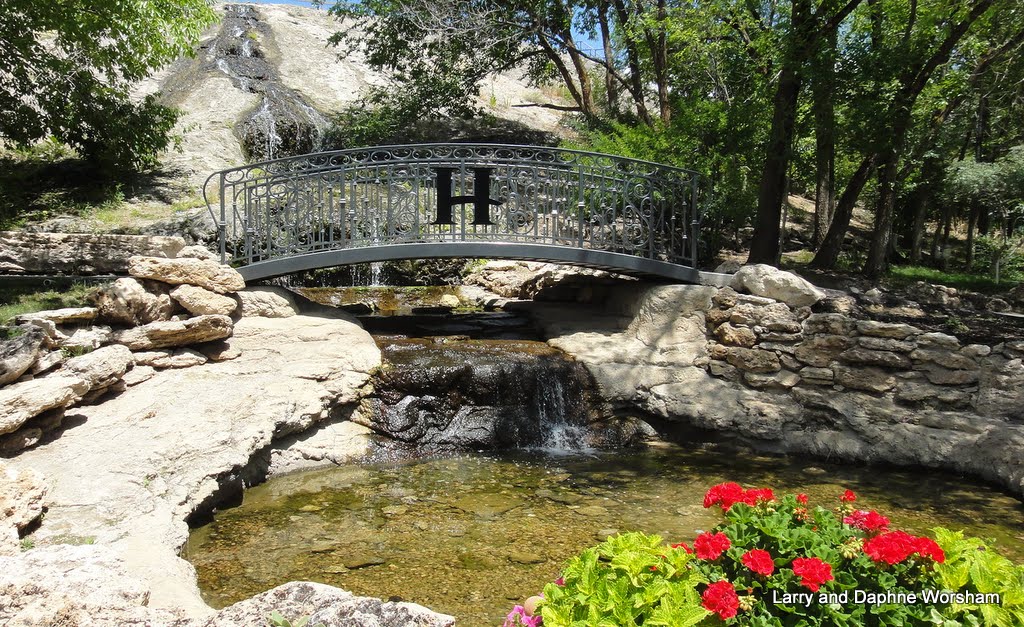
 The one really unexpected touch....the Montana Iris Society has a garden here. The iris were past blooming, but here were other colorful plants making up for their absence.
Iris garden at Fort Missoula

Wow, what a day! Needless to say, our brains were full of historical information by the time we finished at the Fort,  so back to camp we went for a relaxing evening.

A few more views of the fort here.

Thursday, July 25, 2013

The Nez Perce Trail

July 20-21 May Creek Campground, near Wisdom, Montana.

This is the closest campground to the Big Hole National Battlefield, a part of the Nez Perce National Historical Park.  We stayed two nights, so we could devote a full day to visiting the park's Visitor's Center, and the area in general.

Following our visit to Utah our travels have been organized according to the history of the Nez Perce trail. Steve had recently finished reading The Last Indian War: The Nez Perce Story (Elliott West) and was so impressed by struggles of the tribe, the overall importance to history of the Northwest and the country as a whole, that we decided to base part of our trip on the trail they followed as the government pushed them first one way and then another in an attempt to confiscate their land.

The teepee poles are in the exact center of the photo, on the light green area
The visitor's center has new displays, installed only a year ago, that are beautifully fabricated to convey the critical concepts of the events that took place here in a minimal amount of space. Having just read the history of this horrific battle, which left 90 Nez Perce and 31 soldiers and volunteers dead, it was hard to view battlefield. Teepee poles are in place where the village once was, making it easy to picture the situation at the time of the battle. But those of us who have not been in a war cannot imagine what it was like for the Nez Perce, but also for the soldiers. This is history we should not forget.

We're doing the "trail" from the middle out, as a result of scheduling commitments, but the history and the impact are felt none-the-less. The history of the subjugation of the Nez Perce is too involved to do justice in this blog, so I'll include a few links for those who chose to delve further into the subject. I will say, West's book, mentioned above is excellent: very readable, and West does not tell the story from only one side... he reports facts as they were documented. It's difficult to ready history without putting today's value judgements on it, but West does his best not to reflect today's political and social values in his writing, leaving it to the reader to draw their own conclusions. It was a hard time, for all involved. Could there have been better solutions? Probably. Unfortunately, as with all political and military actions, humans are involved and therefore decisions made and actions taken were imperfect.

Having lived in the northwest for 30 years, and being fairly well informed students of American history, we often find ourselves saying "I didn't know that", and are repeatedly reminded of how much of our history has been buried. Never taught in school, never mentioned. Unless you go looking for it and inform yourself, and your children, you'd never know any of this happened. That is why history repeats itself. We can't learn from it if we aren't exposed to it.

We, unlike those whose history we are here to learn, could retreat to the comfort of our campsite - a wooded haven, with a creek running nearby. Shiner and I indulged in a lengthy walk along the creek for each of the two days we stayed at May Creek.

A sad note on the forests in the area of Wisdom: the bug kill here is terrible. Another camper said they didn't see any damage last year, but we estimate about 30% or more now. Don't be surprised to hear of huge wildfires in this part of Montana in the future. On one of our walks one day the sky darkened with a weird peachy gray tone that means fire in the distance. It turned out to be over the Idaho border, so no immediate danger to us, but it was very creepy to be surrounded by so many dead trees and see smoke that color.

I do think this was one of Shiner's favorite campsites so far! She really had a good time visiting with fellow campers too, especially Bill and Jack, who seem to be fairly accomplished fishermen. They seemed to know exactly where to scritch her her ears to make her happy....or maybe it was fish perfume?

Jack with a German Brown
Following the Nez Perce trail further west (in reverse of the way it originated) we'll be going to the Missoula, Montana area next. If you can't travel to the Nez Perce sites the National Parks Service has made a virtual museum available on park website. There are some great photos of the items and each has a detailed description.

After touring the visitor's center we went into the little near-by town of Wisdom. Originally named for the near-by river, before they changed the name of the river to Big Hole River.

Wisdom's population isn't much over 100, but I suspect there are a lot of weekenders represented by all the buildings with antenna and other signs of activity.
Newer and older, shoulder to shoulder
There are a lot of really old wooden structures, lending the feel of a ghost town, but a still-active church, a couple of saloons, a small grocery store keep it alive. An interesting place to visit on the way to the battlefield.

Tuesday, July 23, 2013

Beaver Dick Park, Idaho

"Beaver Dick", a Madison County park is in Idaho near the town of Rexburg. The park is on Henry's Fork of the Snake River, which is a pretty good running river at this point. Deep enough for swimming but not so swift as to be a worry about safety, at least under current conditions.

Now this is what the RVing life is all about, at least in our book.  We located a spot up near the entrance, right by the river, in view of the boat ramp.

Our campsite is to the right, between the tree trunks
Surrounded by a cluster of the biggest serviceberry shrubs I've ever seen, it was perfect for bird-watching. There's apparently no shortage of irrigation water here as the sprinklers run all day and the entire park is carpeted in lush green grass, which Shiner enjoyed very much. She was also happy to finally be somewhere that doesn't have a lengthy list of things dogs can't do "no dogs on the beach, no dogs on the trail, 'must be on a 6ft. leash at all times", etc.
She rescued her favorite log in the river, chased the ball on the grass, made friends with other dogs, and basked in the sun, then nestled down in the grass and wild camomile for a nap (nothing like a dog that smells like pineapple!)

This park is named for Richard "Beaver Dick" Leigh, who was one of the last real mountain men of this valley. He was very well liked, and Jenny Lake in the Tetons is named for his Shoshone wife. She, and all their children, were killed in a smallpox epidemic and are buried nearby.

There's also a historic marker just across the highway that commemorates the North Fork Ferry, the first ferry to run on Henry's Fork, built by the people of the nearby town of Rexburg in 1888. This is a very historic location!

We originally planned on one night here at Beaver Dick, but it seemed like such a great place to just relax that we signed up for a second night. We spent the second day watching a pair of kingbirds catch bugs to feed their babies in the nest, a wooly woodpecker catching bug on one of our shrubs, and an egret fish in the river. The bugs here are plentiful, accounting for the flock of swallows and other birds that fill the are under the highway bridge in the early morning. The park does spray (natural stuff) for mosquitoes though, so we haven't been bothered at all, and there are plenty of butterflies decorating the shrubs around us. Whatever they use must be pretty selective.The park is adjacent to a wildlife management area, and there are trails that lead from the park into the wild areas so there's plenty of opportunity to explore away from the river.  The mosquito treatment also doesn't bother the cottontail rabbits. They came out every evening to graze on the grass, and to torture poor Shiner as we  wouldn't let her chase them.

Beaver Dick Park has four group areas as well as 12 individual sites. There are new vault restrooms near the group picnic area at entrance, and older ones throughout the campground. Everything is very well maintained, and we were impressed with the fact that even though the park is heavily used by local families they treat it respectfully. There is no trash around, no graffiti, no damage to any of the fishing docks or picnic tables.  There are no electric or water services available in the park so pack in plenty of water.  The best part is the price. $5 a night, or $15 for the week (5 days). Photo album here.

Sunday, July 21, 2013

Heading north, to Montana


We followed hwy. 80 out of Park City, then hwy. 89 north to Bear Lake for a quick stop-over. The afternoon light was just perfect to show off the beautiful bright blue water. the color is due to a high calcite content, they say. An afternoon thunderstorm cooled things off, and also diminished the intensity of the color in the lake.

Walking Shiner around the campground I noticed a strange plant, low to the ground, mostly dead and going to seed.
The pods are furry little white things that inspired me to make up a story about bunny rabbit eggs. The plant is actually astragalus purshii, otherwise known as wooly pod locoweed. Not very attractive this time of year, but it is unusual.

This is not a particularly dog-friendly park. No dogs allowed near the water, and there are no trails to speak of. The spaces are generous though, and water and electric are available.

Steve spent some time here planning the next leg of the trip. Poking around on the Internet he discovered Bannack Days, held in Bannack State Park, which happens to be right on our route, and there was one camping site left so he grabbed a reservation.  He went back to the website about an hour later and discovered the park had been closed and the event canceled due to a flash flood that had happened just about the time he was making the reservation! Bummer!... We were really looking forward to the event, and it's really sad for all the folks who were ready to perform as reenactors and who are vendors. Hopefully the town didn't suffer too much damage. See the news article and photos.

Leaving Bear Lake, not knowing what we'd do next since that event was canceled, we traveled west and north around Bear Lake, passing historic cabins like this one in Randolph, UT.

This was one of the early homes of Wilford Woodruff, an early president of the Church of Latter Day Saints. Quite modest compared to many of the other houses he lived in. Here's a bit of history on him.   Historic barns and sheds also dot the landscape, but there's also a lot of residential development in this rural area.

Lander Cutoff viewpoint
We were really surprised at not only the number of residences, but the fact that most of them seem new and are really large homes, not what one would classify as a weekend cabin.

Continuing on, our route took us through the edge of Wyoming, where we paused for a breathtaking view of the historic Lander Cutoff,  through the picturesque antler arch in Afton, then swinging back west into Idaho.
Antler arch in Afton, WY
We had considered stopping at Palisade Lake for the night, but we soon discovered all the nice sites with river views were designated as "double sites", and were only available at full price, twice the regular site price, and were told the golden age pass discount didn't apply to them (though the golden age pass applies to single sites). It's no surprise those sites were all sitting empty.  We were irritated at this gimmick to raise prices without actually saying that's what they're doing so decided to forge on ahead to our alternative location.

We stopped at a pull-out along the highway for lunch and had a great view of the river (far better than any of those campsites had!) This part of the country has such beautiful scenery!

We arrived at Beaver Dick Park, in Madison County, Idaho, in the early afternoon. (No, the name isn't a joke, it's historic!)  In the next post we'll tell you all about it.

Friday, July 19, 2013

The well-dressed western dog - Boom Dog Creations

Kathy in her workshop
Boomer, Shiner's new friend, is a pretty important guy. Whether he knows it or not, he and Roxy, the other canine family member, played a major role in the founding of Boom Dog Creations, a unique business operated by my sister Diana's neighbor, Kathy Pederson.

Kathy makes fantastic dog collars and other accessories from recycled western, tooled leather belts. Kathy's artistic talent and skilled hands convert  quality handcrafted leather and carefully selected metal or jewel accents into amazing collars, bracelets, bootlets, and what she calls trophy dog bowls.


We all trooped next door to her house in the afternoon, where Boomer, on the right in the photo, generously brought out his favorite stuffed toy to share with Shiner. Boomer's sister, Roxy on the left, supervised the two youngsters as they romped around all afternoon.

Roxy, Shiner, and Boomer

Kathy usually sells here wares at the Park City Sunday Silly Market, but she was gracious enough to create one especially for Shiner during our visit. Doesn't Shiner look classy? The perfectly dressed Texas Canine!


Kathy's wares were described in an article in the Salt Lake Tribune just a short time ago. Customers at the Silly Market can benefit from her personal attention in selecting just the right color and size of collar for their canine companions. She has a good eye for the right shade of leather and accents that convey the personality of your pet. She'll size it on the spot if necessary, too. You can't beat that for service! You can see more examples of her wares and contact her through her website, Boom Dog Creations.

Park City, UT and environs

Jordanelle Reservoir
Sunday, July 14, we arrived at Jordanelle State Park in the afternoon. Just south of Park City, the park is a convenient place to stay while visiting sister Diana and her husband Donald.  We stayed here in 2011 and in 2012, so it's becoming a regular routine for us.

The lake is still really low, but at least it isn't any worse than it was last year. I learned from past mistakes (I'm slow, but I do learn) so unlike the previous visit, Shiner didn't get to go romping in the mud, so no fish aroma to deal with.

Monday Don and Diana took us to lunch at The Homestead, a truly unique resort in the town of Midway. They didn't tell us much about the resort beforehand, so we didn't really have any idea of what the place was like. Consequently, I was rather startled upon our arrival to see a small mountain in the middle of the parking lot.

 This little "mountain" had a musical little waterfall running down the side of it, and an attractive wrought iron bridge over the pool at the bottom of the falls. Intrigued, we asked at the resort desk for information about the history of the resort, and the desk clerk gave me a whole packet of information.

The Homestead Resort, currently owned by Great Inns of the Rockies, has been entertaining visitors since 1886. That was the year land-owner and farmer Simon Schneitter built an enclosed pool to capture the steaming water from the geothermal crater on his property. Farmers and miners in the area came to the pool to soak away their aches and pains in the mineral water.
Simon and Fanny Schneitter
That crater dome, the small mountain in the parking lot, is formed of calcite carried by the water, and is now 55 feet high.
Only a few stairs to the top

An entrance tunnel has been hollowed out on one side of the dome to allow access to the water level and now divers and swimmers can enjoy the warm mineral waters year-round.

A looooong starway leads to the top of the crater. We didn't count steps, but we had to stop to catch our breath, and we're fairly used to stairs. It was worth the hike though.

The crater opening is topped with mesh, to protect those swimming below, and then surmounted by another wrought iron bridge, matching the one over the waterfall below.

There's a marvelous view of the surrounding countryside from the top of the crater. It's surprising how high up 55 feet really is!

We had lunch on the patio of Fanny's Grill, named for Simon's wife Fanny who became quite famous for the chicken dinners she prepared for visitors.

The patio has a nice view of the golf course, and there's a little pond running alongside the patio where geese and ducks paddle by looking for a handout.

Though we didn't have time to tour it all, the resort is really quite extensive, with 19 different buildings included in the rooming accommodations (most are historic buildings) in addition to the golf course and several restaurants.

The grounds of the resort are beautiful, and it's a delightful place to wander and admire the flowers and the historic buildings that have been incorporated.

Many of the small landscaping features are constructed of "pot rock", the calcite material (thermogene travertine) deposited by the mineral water. It looks a bit like stone sponge, and makes for very attractive garden walls and benches. You see a lot of it around town as it's an inexpensive landscaping material, and there's a lot of it available.

The town of Midway,where the Homestead Resort is located, was settled by Mormon Swiss pioneers, sent to this area by Brigham Young in the 1860's and 1870's. Many of the homes and businesses are still ornamented with delightful murals in the Swiss style. The community's Swiss Days celebrates their each year on Labor Day weekend. This Swiss heritage has led to the area being dubbed the "Utah Alps."

We fished out the day relaxing in Don and Diana's back yard, admiring their flower boxes and watching Shiner play with the neighbor's golden lab, Boomer. 

Fortunately the impending thunderstorm held off until we were in the process of saying good-bye for evening, so it didn't hinder the afternoon at all.

See more of The Homestead Resort in the photo album.

Deer Creek State Park, Utah

Friday – July 12
Long day today – about 260 miles. We’ve been keeping it to only a couple of hours of driving time each day, but it’s hard to get very far that way. 

We’re stopping two nights at Deer Creek State Park, in Utah. We'll be visiting sister Diana and her husband Don in Park City, but couldn't get into Jordanelle State Park until Sunday, so this is a holding place.  

Our route from Nevada, took us over hwy 50 and then hwy 6 when it split off to the north. This is really desolate country, and seemed even “lonelier” than the stretch of Nevada we’d just traversed. If it weren’t for the fascinating mountain ranges in the distance and the beautiful puffy thunderheads we wouldn’t have had any scenery at all.

Entering Utah we drove through several small, not very prosperous-looking farming communities before we finally reached the more mountainous area where the Deer Creek is located.

We arrived in the early afternoon and were somewhat dismayed to not have any map or brochure of the park offered when we checked in. When we asked if any were available we learned that on June 10 vandals burned the park office building (follow the link to the news article). Everything burned including all the park brochures. We did see the perfectly clean, recently disturbed plot of ground where tractors had cleaned up the remains of the building. So, no map, no info, we just poked our way around.

The campground at the upper level is spacious, and has a nice view of the lake in one direction and magnificent mountains in the other. The lower loop is more along the older style of campgrounds, crowded, and good for tents and small vehicles.

It's not a particularly dog-friendly park, as there are no dogs allowed on any beach, or at the boat ramps. That leaves the campground, only! We couldn't find any trails that would be appropriate for just walking, as they all lead down to the beach. 

It's a pretty good location for birdwatching, as the berries on the many serviceberry bushes around the park are ripe this time of year, and the weedy wild grasses and flowers that are also ripening are popular with many bird species. Several birds flitted through our site, and we enjoyed the activity as well as the entertainment of trying to figure out exactly which bird it was. When they move quickly it's hard to get the binocs on them.

We ran up to Heber City for grocery shopping as it's close by, and got things in order for moving to Jordanelle. A rather mundane stop, but it served our purposes. I hope they catch whoever set that fire!


Thursday, July 18, 2013

Cave Lake and the Charcoal Kilns

Wednesday, July 10, 2013
Cave Lake State Park is just a few miles east of Ely. We stopped here, at Elk Flat campground, in the past (see that post) and had a good experience so decided on a repeat visit. We like Elk Flat campground, as the spaces are widely separated with the juniper trees providing considerable privacy. Ely is close enough to run in for groceries and other necessities which is nice if staying for several days.

Thursday was the day for exploring. We took hwy.50 (hwy.6) north just a few miles to the turnoff for the Ward charcoal kilns historic site. 
Cave Valley Road leads to the kilns, where you turn off at the sign for the Willow Creek Trading Post.

You'll find charcoal kilns like these at many locations throughout the west, as in pioneer times charcoal was an important fuel used in mining and metallurgy industries. 

The process was long and complicated, involving 35 cords of wood cooked through a special process for 13 days for each batch produced. 

The active mining area here required so much charcoal the surrounding hillsides were almost completely stripped of trees by the time the mines petered out.


These particular kilns have weathered the years quite gracefully, perhaps because of their remote location and the generally dry weather. 

Now, with desert shrubs softening their edges and colorful lichens growing on the stone blocks, they are interesting relics of a time long past. The skill in stone masonry required to build the kilns is to be admired.  


Willow Creek runs past the kilns, and though the area is largely sagebrush, the creek itself is lush with grasses, mint and pennyroyal, which sent of a wonderful aroma when Shiner went down to check out the fresh water gurgling under the little footbridge.

If you're looking for an out-of-the-way place to camp, Willow Creek campground, near the kilns, is attractive, with generous sites and thick stands of juniper and pines between them. And it was completely unoccupied! 

Each site has a covered picnic table, and there’s a smallish group site available. There’s also a picnic area halfway between the kilns and the campground with two tables and restrooms. 

Leaving the kilns we backtracked to the Ward Mining District turnoff. As the term "district" indicates there were, and are, several mines here. Some are still in operation and not open for exploration. The actual Ward town site is at the upper end of the road, past the cemetery.

The Ward Cemetery is an interesting place to explore. An information sign board at the entrance tells the history of several of the individuals and families buried there. Several ornate markers still stand, a few plots are set apart with wrought iron fences, but most of the graves are protected with simple wooden fences. Many are unmarked now, the names and dates lost to time and weather. 

There isn’t much left of the town now but a few stone foundations, though more can be seen if you hike out among the sagebrush. As the temperature was dropping rapidly and we were being pelted with icy raindrops we passed up that opportunity in favor of continuing our tour on the road. 


At the end of the road there's the remains of a mining operation and a few metal structures surrounded by colorful piles of tailings.

We returned to our campsite by the alternate route, taking the cutoff east from the charcoal ovens site back to hwy 50 (this would be the southern entrance to the kilns from hwy 50). This road is shorter (3 miles less of gravel) and with less noticeable washboards than the northern route. If towing a trailer in to the campground at the kilns we’d definitely recommend this route. 

Elk Flat is definitely a dog-friendly place to stay. Surrounded by wide-open spaces there are opportunities for hiking in all directions. Shiner and I headed for a nearby ridge for this view of the campground.

Our campsite as seen from a ridge to the NW of the campground
Elk Flat campground is situated high up on a ridge so there are nice vistas from several of the sites. Many of the sites will accommodate our length so it's easy to find a space, and there’s a restroom with showers, as well as an RV dump.

Cave Lake
The Lake View campground, higher up, is nice, but steeper, tighter and designed more for fishing and boating visitors.There's usually more traffic there, which means more dust too. The sites are higher up than the lake, affording a nice view from many of them. 

All things considered, this is a nice state park for those who like to hike (there are several trails) fish, boat, or just relax!

Cave Lake State Park and environs album here.

Tuesday, July 16, 2013

Bob Scott Campground, Nevada

July 9 
We left Fish Springs, through Carson City and turned east on hwy. 50 – Nevada’s Loneliest Highway.

Traveling east, we pass through mining country, and then out into the wide open spaces of the Great Basin. A little east of Fallon a highway points to the the Navy's Centroid Facility. This area contains a simulated air defense network, including approximately 20 operational radar installations. Most of this area is publicly accessible, with the exception of areas immediately surrounding the radar installations. You won't see much more of it than the sign on the highway as the facility is situated quite a ways off the road.

Whizzing by in an automobile the highway does look lonely now, from the asphalt, but examining the map one can see what a busy area this stretch of Nevada has been over the years. The Pony Express Route, The Overland Express Route, and the Lincoln Highway all share this same ground along this stretch of the Great Basin. 

The map is dotted with the names of long gone communities, rail sidings, ranches and mines, in addition to currently active military installations and test sites, like the Centroid Facility. There are remains of stone and wooden structures at several points along the highway, some with historic information plaques. If you use your imagination it’s far from lonely or boring!

We spent time in the well-known town of Austin a few years ago, so didn’t stop this time, choosing instead to move on to the campground. See the post on that previous trip here.

About four miles east of Austin we stopped at Bob Scott Camp Ground. This is a nice, quiet hideaway that's probably designed more for hunters than today's average RV traveler. There are only 9 spaces, and 1 group site, and most are fairly small. We managed to find one we could tuck ourselves into. The restrooms are small, but do have running water, though no showers.

Sheltered by juniper trees, the sites are fairly private. The campground is surrounded by a log fence to keep out cattle and other grazers one would suppose, as you cross a cattle guard when entering. Shiner found crossing the cattle guard a bit of a challenge but eventually tiptoed across it. 

We hiked up the hillside in back of the campground (outside that log fence) and she really enjoyed the opportunity to check out all the rodent holes, follow the hunters' trails and just generally run around like crazy. This is a very dog-friendly site for large critter like her who need some space to run now and then.

A curious phenomenon had occurred in the area recently, leaving the ground resembling Swiss cheese. 

Closer inspection revealed nymph shells, some stuck in the holes in the ground and some on branches, and a few adults that didn’t survive the hatch – cicadas! 

Considering the number of holes there were hundreds and hundreds of them crawling out of the ground at nearly the same time. It must have been quite a sight to see when they were all hatching! 


More info on the cicada hatch of 2013 and a chart of when and where the next hatch can be expected. Most of the western states don't show up in the chart, but maybe yours does! The site includes a video of the nymphs as they emerge from the ground and a wealth of additional information on cicadas. According to the chart we're due for them in Texas in 2015.

Monday, July 15, 2013

Nevada State Train Museum

July 5 

The fire in the hills behind the house in Fish Springs looked pretty calm in the morning, so we loaded up our kids and headed for the Nevada State Railroad Museum in Carson City.


Who doesn't love a an old fashioned steam engine? There's one in every old cowboy movie it seems, and they show up often in all the mystery and spy movies. Many of those famous "actors" are now living here, in the Carson City train museum, and we had a ride on one of them.


Our grandson Jax loves trains, and he enjoyed seeing the real thing he’s been seeing in his picture books. 

We were barely in the door when he latched on to the small wooden train set up in the lobby.


The museum houses lots of restored cars and engines, well presented with historic information about the individual train cars as well as the history of trains within the state of Nevada, and in some cases, the names of the movies they've appeared in. 

Trains played an important role in the development of Nevada's mines, and are still important in the state. The route from Carson City up to Virginia City, the historic silver mining city in the mountains, has been restored and there are several opportunities to ride the train over that route.

There's  also a real steam train to ride around the museum property. There are several choices of cars to ride in, some open and some more closed in so in any weather the passengers can be comfortable

My favorite of all the restored cars was the McKeen Motor Car

Such an unusual example of engineering! 

In searching for engineering solutions to the strength needed to build the car as designed the knowledge of boat and plumbing experts was incorporated, resulting in a machine reminiscent of a diving bell, and worthy of a Jewels Vern novel.

It manages to look very Victorian, yet modern at the same time. Today's Steam-Punk fan would feel right at home in this train car. It is operable and does run fairly often, so there are opportunities to experience this unusual and elegant form of transportation. 


The restoration of the car is impeccable. Volunteers spent many hours and the results are amazing. All the brass has been reproduced, and the light fixtures, while appearing authentic, have been changed from the original gas to electric without altering or harming the design.


The train departs from an original, restored, depot building, and the volunteer conductor and engineers all dress their parts. (You can buy little engineers overalls in the gift shop - guess what Jax went home with!)

The train travels two circuits around the museum property, which gives the passengers time to view many of the historic rail cars waiting to be restored, as well as a railroad turntable and other pieces of railroad equipment. This is a really wonderful experience for kids, of all ages! 
   More train photos here.

We had a nice lunch at nearby Schatts bakery just a few blocks away, picked up a few baked goods, and then headed back to Fish Springs, with Jax making train noises in the back seat all the way. 

We were hoping to see the Bison fire had been contained by the time we arrived back in Fish Springs. Unfortunately the famous Washoe Zephyr had no mercy on the firefighters, and the fire had spread to the northeast, by this time the acreage increasing to an estimated 17,000 acres. 

In the evening we all settled in to the Finch’s elevated deck, a good place to view the smoke and the flames, which become visible in the dark. 

The local fire department prints up commemorative T-shirts for large events and neighbor Aaron and his father gifted several of us with one of them. 

The pattern we’d been observing over the first two days of the fire is pretty consistent. After sunset the winds calm down, the humidity levels come up, and the fire settles down. The winds pick up every day around noon, gusting up to 25 mph at times, and often changing direction for brief periods which make fighting the fire very difficult. 

Each morning we looked hopefully at the hills that had been blazing the night before, thinking the cool, damp morning conditions would give the firefighters a break, and then, the winds would again whip up the flames and the fire was off and running. 

In the photo at right, the small glow to the far right is where the fire started, but by the time this was taken the winds had pushed the flames to the east (photo is looking south from the Finch's deck.)

As the wildfire grew it became the focus of everyone’s attention. We watched planes and helicopters deliver retardant and water to the fire. By evening it looked as though they had a pretty good handle on the fire, again. It seemed so in the morning too. 

Fortunately the winds were cooperative in direction if not intensity and the fire circled around the small community of Fish Springs, to the northeast. The firefighters managed to keep it out of any residential areas in the foothills, though a few mining buildings were lost. 
As we left Fish Springs, on July 9, the fire had moved clear around to the east, over several ridges, into the juniper and sage forest beyond. It was estimated to have consumed about 25,000 acres, and was still burning.

UPDATE: See the Inciweb map and report for the details of the fire.The Finchs' place is just about in the middle of the loop road labeled Pinenut Road. As of July 14, 2013 the fire was 100% contained, and the cost, to date, of fighting this fire is $7,729,660. That doesn't begin to describe the lost forest cover, or the archeological damage, as much of the acreage is Washoe ancestral land.