Saturday, December 23, 2017

MERRY CHRISTMAS Y'ALL!


Holiday Greetings from Texas!

We hope this little note finds you doing well and enjoying the holidays.

We’ve followed our usual schedule this year, spending the hot months on the road. Our summer travels began in May. We began by heading for the Black Hills and Badlands areas of South Dakota, where we enjoyed the cooler weather as well as the scenery and history. Custer Battlefield was a highlight. Then, to Nevada for the annual 4th of July BBQ, and Tailgate Training Camp with friends in Oregon. We enjoyed visiting with sister Diana in Utah, and then spent several pleasant days rambling through state parks in Oregon, Utah and Colorado. Overall we traveled 7,884 miles. That’s a lot of scenery!

An early snowstorm did its best to get us in the holiday spirit, and the boys enjoyed playing in the fluffy white stuff. Steve’s mother is doing well. She joined us for Thanksgiving, and was here to enjoy the rare event. In the photo, Jaxen is proudly showing off his first missing tooth.


We’re keeping plenty busy when we’re at home. In addition to working around the place we’ve been on the road a lot helping out the kids. Kendra has developed some serious health challenges that prevent her from driving, so we’re filling in shuttling kids, and getting her to appointments. The boys are growing like weeds, and we enjoy every minute with them.


So that’s our 2017! We want to wish you a very Merry Christmas and a healthy and happy New Year! And don’t forget to look us up if you’re out this way. We’re always open for visitors!

Monday, August 28, 2017

SUMMER 2017 END OF TRIP SUMMARY

As I sit at home listening to the wind and rain from Hurricane Henry I recall some of the highlights of our trip and want to document some of the statistics resulting from our travels.

We left home May 24 as the temp. was approaching the Mid-90's heading to an area we enjoyed during last years travels. . . . The Badlands, Black Hills, Deadwood, Sturgis, Devils Tower, Little Big Horn and other related battlefields. Higher in elevation, these areas were much cooler and we really enjoyed the refuge from the heat we'd left behind.

We stopped at Lewis and Clark Caverns on the way to our annual Nevada BBQ then went down through Idaho to Nevada. We visited old friends for the 4th of July in Gardnerville, then moved onto Oregon for another reunion and spending about a month at some of our favorite haunts in the Cascades, including North Davis Creek, John Day, and the Wallowa Lake.

We had a great time camping with our Oregon friends at "Tailgate Training Camp" in the Ochocho's. After Wallowa Lake we moved on to Park City, Utah to visit a relative, then on to Flaming Gorge, Utah and across Colorado (Leadville) and towards home through New Mexico.

We returned home to Texas with the temp still in the mid 90's. . . just as if we'd never left, except we missed all those 100+ degree days!

Looking back over the summer, our favorite camping site was huge, grassy space we had in Clyde Holiday State Park in Oregon and least favorite was the steep, dry weedy site in Jordenelle State Park in Utah. The State Park was fine but our particular spot was not. The slope was so severe we could barely get in and out the door.

Our favorite historical visit was Little Big Horn and the best overall vista's were at Flaming Gorge, though Wallowa Lake and Leadville were right up there. We were gone 91 days, but nothing we couldn't cope with as few places offer the humidity we have in Texas.

And now for the statistics: We traveled 7884 miles. We spent $1860 for camping fees and $2015 for fuel for at total of $3876. For the entire trip we averaged $43 per day. I don't keep track of food as we eat about the same as we do at home.

Comparisons to previous years - When we started our summer travels in 2010 (six trips over the last seven years) we had no problem finding camping spaces and only needed reservations on holiday weekends. During this last trip we usually had to make reservations for the high tourist areas months in advance and other area's weeks in advance.

Fuel prices are down, more boomers are on the road, and I think their is less foreign travel, which has increased competition for space and has certainly increased crowding and traffic in high-interest areas.

State Park Campground prices are up. Several State Park systems are now charging day use fees on top of the campground fee's and along with reservation fees some parks are approaching the $40 per night range. New Mexico is the best deal for State Parks. $14.OO a night for water and electric. Of course, for us the Federal Campgrounds are the best deal due to the 50% discount for the senior pass. These are boondocking sites, so no services, but often very scenic.

Recreation management companies now handle the camping services for many state and federal lands, and they seem to be free to add extra charges if they see fit, so read the entrance boards carefully. We stayed at a forest service campground in the Black Hills that charged $2.00 extra per day per dog. No extra services for dogs were provided - as in no off leash area or anything else, but all the usual "no dogs here" restrictions were in place.

Who knows where our travels will take us this next year. We enjoy our home on wheels and after reviewing a lot of other rigs and floorplans on the market we've evaluated our trailer and future travel plans we are going to stick with the travel trailer and truck we have. You know what they say, if it isn't broke, don't fix it!

 We are happy to be home and look forward to spending time with family. We REALLY missed the grandsons and look forward to upcoming visits by friends and family to Texas. There's lots of exploring to do here!

Monday, August 21, 2017

Homeward bound

Sunday, August 20

Storrie Lake State Park - Named for the man who began building the dam here. He had an agricultural project in mind, which never panned out, but it makes a nice fishing and boating lake. It's a nice campground, unusual in that there's a lot of boondocking area right around the shore of the lake. If we'd know that we probably wouldn't have reserved a full service site. No complaints with the site we have though.

All the standard camping sites have nice little adobe style shelters which cover the picnic tables and have a half wall on the back side, so the wind is pretty well contained while you still have light and can view the lake.

There's plenty of room to walk dogs in the meadow or on the road, as well as water to play in, in the lake or above the lake in the Gallinas River, which isn't a very big river, at least currently. We had a nice romp in it yesterday.

It rained softly all night, which finally used up some of the heavy cloud cover and, now, on Monday, we can actually see the sky!

We off now to our next camp, and a quilt shop along the way!

Monday, August 21

We made it into Las Vegas (New Mexico) just as Thread Bear was opening. There's a fairly large parking lot nearby, and since we were so early there was room for Hubby to park the rig in the lot. It was a productive stop! Beautiful fabrics in this shop, and unique.
Many I've never seen before and may not again, so I bough two pieces I just couldn't resist, and a license plate of course!
Another of those" long term" projects is a "postcard" wall hanging, so I bought a Las Cruces fabric postcard for that. We were there in the past, and I hadn't seen one of these. The postcard project is still percolating in my little pea brain and probably will for some time.

The shopping done we headed south through the flattest land we've seen since Nebraska. The shifting clouds were about the only scenery. We stopped in Ft. Sumner (Billy the Kid Territory) to see if we could view the partial (in this area) eclipse, but the clouds were too heavy.  Our stop for the night is Oasis State Park.

We've been here several times before, and it's a good stop for the dogs as I can take them over the sand dunes at the edge of camp into a dry lake bed and let them run.


And run they did. The ran, and hunted, and chased each other, and ran some more. I gave them water twice in the 30 minutes or so we were on the lake bed, but it took them another 30 minutes back in camp to stop panting.

We have a nice pull through site (#23) right near the beginning of the trail that goes over the dunes, and several shade trees, so we're set for the evening. Our evening entertainment is the ever-changing sunset. Pinks and blazing gold all around. We may have missed the eclipse, but this makes up for it!


Previous posts on our two previous visits to this park can be found here , and they include details about several of the local museums and other points of interest, or you can click on "New Mexico" in the Topics section in the lower right hand column of the page and find more past posts.

A few more photos here

Tomorrow we're off to San Angelo, Texas!!!


Sunday, August 20, 2017

Trinidad, on the Santa Fe Trail - Where Cultures Meet

Friday, August 19
It was 34 degrees when we woke up this morning - better than yesterday's 29 but still a might chilly for August. We packed up quickly (moving keeps you warm!) and were on the road by 9:00, our destination is Trinidad State Park.

What a beautiful drive from Molly Brown campground. We soon left the pine forest behind and found ourselves in lush range land, with ranches and rolling pastures dotted with cattle. That terrain evolved into sage and juniper, high desert, then the trees grew bigger and we were in forest again.
All of it beautiful, with interesting mountains in the distance. As we drew closer to Trinidad the rock grew redder, a nice contrast to the cloudy sky.

We were setting up in Trinidad State Park by around 3 P.M. and it was in the mid 80's. Siesta inspiring for all concerned!

After dinner an evening stroll around the immediate portions of the campground was very enjoyable, as we are still high enough that the evenings cool off quickly.

This is a very nice park, with several access points on the water for fishing and boating. We're staying in Carpios Ridge Campground, which has nicely graveled sites, most fairly level, some with a view of the lake, but there's no swimming for human or canine unless you can find one of the little muddy fingers of the lake.

In most places the shore is too steep to make swimming practical.  Boating, water skiing, fishing, hiking, etc. are all accommodated, so, sorry pups, maybe at the next stop! They've done a fairly nice job of spacing sites around the loops, but of all the campgrounds we've stayed in on this trip, other than Prineville this is probably the least private site we've had. There are a few trails around the edges so at least we have interesting walking spaces.

There are interpretive kiosks all around the park.
One, near the amphitheater, features a horno, a primitive oven used by Native Americans as well as the Hispanic settlers in the early days.
Other information kiosks tell of various aspects Spanish/Mexican colonial era, the pioneers, and the Native Americans in the area.


Saturday

Today is work day, and a bit of touring. Laundry first, before the two campground machines  fill up! and then a little time in town.

Trinidad isn't a huge town, the current population is a little over 9,000, but you can tell by the historic downtown area that it was once a very prosperous and bustling city. They are working at bringing back the historic section, with art galleries, restaurants and other interesting shops, but there are many vacant spaces and buildings in desperate need of restoration.
The Bloom Mansion

Originally a coal mining and shipping center, Trinidad had a bustling economy until the mining slowed down. The Wikipedia article on Trinidad has some very interesting information on the town and is defiantly worth the read, especially the section titled "Recent".

We had noticed signs for the Santa Fe Trail museum when we passed through town on our way to the campground, so decided that would make a good destination for the day. It's a good thing there was plenty of on-street parking, as the dark clouds decided to open up just as we arrived in town. Pounding rain, the kind that happens when the air is warm and the clouds are so full they just can't hold any more. Yes, we have an umbrella, and yes, it was safely tucked away in the trailer.

We dashed to the museum, shaking off the water like wet dogs, and of course, the rain quit shortly thereafter. The Santa Fe Trail museum takes up an entire block and is a combination of homes, gardens and traditional museum displays.

The two restored homes in the complex can be toured with a guide, for a small fee, but the remainder of the complex is accessible for no charge. It's a pleasant place to wander the gardens (when it's not raining) and in fact the entire neighborhood is interesting, with historic buildings all around.

Among the museum displays we ran into a new term that, surprisingly, we had not encountered before........."Hispano" Though the word is Spanish in origin, it's meaning when used in English was established for census purposes in the 1930's.  Hispano refers to individuals of Spanish Colonial ancestry who have lived here for generations and maintained that culture. They did not cross a border to move to the area, the border was drawn around them. In Texas the term Tejano has a similar meaning for individuals of Mexican ancestry and cultural identity.

Fort Wooten is very close to the museum and immediately caught our eye as it's military design contrasts with the many Victorian era homes in the area.

It was originally design as a military memorial and home for community veterans groups, but never saw use for that purpose. It's now home to the social service agency. The gate to the courtyard is locked, but it's good to know the building is in use as that will help prevent vandalism and deterioration.

In the afternoon I explored one of the trails that leads down to the edge of the water. I didn't make it all the way, as when I turned around and looked at the trail I reminded myself that what goes down must go back up again! Watch reminded me too.
I have to go back up?
Why did we come down?

The trail is rough and fairly steep, but also provides an opportunity for some close up inspection of the geology here.

There's a fairly noticeable of (low grade) coal running along the side of the trail, and the red and buff colored sandstone layers sparkle like glitter in the sun, the result of a high mica content.

There's a lot to explore in Trinidad, more museums and shops, and there are some amazing sculptures along the main street.

We've enjoyed the relatively cool weather this altitude offers, so we'll be back!

Sunday
Time to pack up and head for New Mexico.

If the sunrise this morning is an omen, it's going to be a good day!

More photos here


Friday, August 18, 2017

Top of the Rockies Scenic By-way and Leadville, Colorado

Wednesday, August 16

What a beautiful day for driving. We woke up to the sunniest morning we'd had in several days (of course, now that all the photos have been take under clouds!)

We departed Rifle Gap State Park and wandered through the back scenic country. Beautiful ranches and smaller holdings all scattered across green pastures lined the roads. What a contrast to the sagebrush and rock formations we had driven through for the last two days.


Red Cliff Bridge
We continued on, eventually ending up on the Top of the Rockies Scenic By-way. We climbed in elevation until we hit the 9,000 foot zone, enjoying many glimpses of the road we'd just been on as it looped back and forth up the mountain.

Railroad tracks, remnants of mining activity in days past, including a mine and home for the employees. and few cabins scattered across the valley floor and on the slopes give scale to show how steep the mountains are in this area.

The gorgeous snow capped mountains in the distance provide a visual contrast and reminded us that it's going to be chilly up here on top of the Rockies!


It proved so when we stopped onTennessee Pass to take a stretch. The wind was biting, and this is August! We could only imagine what it must be like in winter. We soon discovered there were several military memorials to explore, and it seems they are here because the climate in this area was essential to their training.

One is the memorial to the 10th Mountain Division. After seeing Finnish troops overcome Russian forces in 1939 the head of the National Ski Patrol began pressuring the War Department to form a similar unit. There's an excellent summary of the history of the little known 10th Mountain Division, on the National WWII Museum website.

Another, the Norwegian Monument, provides the history of the formation of the battalion known as the "Viking Battalion" and a summary of their accomplishments and importance during WWII. The 99th infantry Battalion (Separate) was activated at Camp Ripley, Minnesota on August 15, 1942 as per written instructions by the War Department.

This unique elite unit was to consist only of Norwegians and Americans with direct Norwegian descent. Soldiers picked out for this elite unit had to have a working knowledge of the Norwegian language and preferably already knowing how to ski. The link at the beginning of this paragraph takes you to the official website and has the full history.

For the next two days well be staying in Molly Brown campground, near Leadville. Named for the famous "Unsinkable Molly Brown", it's a nod to the mining history in the area.

The other campgrounds in the area are also named for local historic characters. Baby Doe and Silver Dollar are right next to us. The Wikipedia article on Leadville does an excellent job of covering the history of the area, as well as many of the famous personalities, so I won't try to repeat all that here.

Our campsite is spacious, and surrounded by pine trees. It's only a short hike to Turquoise lake, so after getting set up the pups had an outing, but no swim as the air and the water this time of day are chilly.


Thursday

I was 29 degrees this morning. . . wow, are we ever going to have a hard time adjusting to Texas temperatures!

Today is tour Leadville day. No particular destination or shopping list in mind, except of course, a quilt shop. There's only one in town, Mountain Top Quilts, and it is a hybrid antique and quilt shop - quite fun to rummage around in!

There are books, handcraft related as well as western history and a few kids books, yardage (short cuts and folds) kits, yarn, completed quilts - some new and some vintage, vintage clothing, glassware, and.... well, you get the idea. Lots of fun to browse.

Leadville has done a fine job of retaining and promoting their mining history while also accommodating more modern tourist interests such as the winter sports, craft brewing, and antique collecting. Main street sports several original buildings with the old fashioned plaster and brick facades and some very interesting murals, and  many of the side streets are a wealth of beautifully restored little Victorian frame houses.

The setting is beautiful, with the snow capped mountains behind the church spires and ornate building roofs, and we actually had a bit of sun to show of the beautiful clouds. Those clouds seem to come and go quickly here, and with a "high" in the 50's it cools off quickly when the sun disappears.

After the quilt shop we stopped at the National Mining Hall of Fame and Museum. Oh my goodness, what an amazing collection of fantastic mineral samples, mining equipment, dioramas explaining gold mining history, life size scenes depicting coal and hard rock mining, famous people in the industry - wow! This is a stop worth making for those at all interested in the history of mining and children will get a lot out of it too, as there are hands on activities, videos, and the dioramas and scenes clearly explain the processes and history. The facility houses four stories of exhibits and photographs, as well as a research library. We only made it through two floors before our brains were full, and our tummies empty.

Soaking up all that history and information made us hungry, so we asked for recommendations and decided on the Golden Burro. Good food and reasonable for where we are. Steve had the best tamale he's had in a long time, and my burger was good too. The place has been in business for 75 years, so they must have something going for them.

Back at camp the dogs were anxious for a romp, so into the woods we went. We had a nice leisurely walk down to Turquoise Lake for a short but enthusiastic swim session - it's never long enough to suit the dogs, though.


And we take one last look at the lake before we head back to camp to begin the packing up.
We depart in the morning for Trinidad State Park.


Thursday, August 17, 2017

Rifle Gap State Park, Colorado

Monday, August 14
From our campsite at Greens Lake, Utah, it was a beautiful three and a half hour  (182 miles)  drive to Rifle Gap State Park, in Colorado.  The drive to the park, and the park itself, provided another opportunity to view the beautiful geology of this area of the state.

Rifle Gap Dam
The park includes Rifle Gap Reservoir, an earth dam structure that impounds both East and West Rifle Gap Creeks. They really like that name around here and have used it wherever they can!

The park campground consists of five small, separate campgrounds, some with only a few spaces. There are also day use areas and a swim beach.

The RV sites are mostly paved with immaculate graveled pads, fire rings and tables with shade covers. The tent sites aren't paved, but tucked artfully in among the sagebrush. They also have the tables with shelter roofs and gravel pads.

Our site was at the highest point of the highest loop, so we had a nice view all around, including a view of The Gap. Behind us was a log fence, and BLM property behind the fence.

At first glance the park didn't seem very "dog friendly" and the first time we asked about dogs swimming we got a negative answer, but each person we talked to gave us a bit more information and we soon got the feel of the "system".  We could take the dogs out into the BLM property for walks (but beware of the cactus!) and they can swim in the lake, just not in the human swim areas, which is pretty standard.

To say the park is well maintained would be an understatement, and they have to work hard at keeping it so tidy. We saw park employees hard at work scooping up copious amounts of mud that invaded roadside and campsites alike in a recent down pour.

The lake provides boating, fishing and swimming opportunities, as well as hosting wildlife. There's an accessible nature trail near the office, as well as several day use fishing areas.

Tuesday

Time to stock up on vittles, so we headed in to the town of Rifle. Rifle is an old ranching town, founded in 1882 and functioned as the center of cattle ranching in the area for many years. The town is named for the nearby creek, which got it's name, so the story goes, from a surveyor who left his rifle near the creek while working. The oil industry has provided a lot of jobs in past years, but that has dropped off recently, and some of the ranching still continues.


Rifle is working hard at pleasing the traveler.  Beautifully cared for old buildings line the streets, along with some interesting shops and many really well done murals. Unfortunately, parking and traffic being what they were, I couldn't get many photographs that did them justice. The residents take obvious pride in their history and their community. The town's population now is around 9,000, so most any service you need is available.

More interesting facts about the town  on the Chamber of Commerce web site.

After stashing the groceries and a quick lunch we headed up the road to Rifle Falls State Park. The campground area there is small, but still has nice size sites, and the area is beautiful, much more dense forest than where we are camped. The sites at the falls are not paved, but are fairly level, and they have electricity but no water hookups. Water is available however.

The falls are beautiful, and it's an easy walk from the parking lot to a good viewing location. From the base of the falls you can follow a short trail to explore small but interesting limestone caves and other unique rock formations.

And you never know what else you'll see - a doe nearly ran over some of us while we were walking up the path. On our way back to the truck a chipmunk ran out on a nearby rock and tempted the dogs. I think we were in the path back to her nest as she seemed pretty anxious to get past us.

Back to our own camp to pack up. We are heading out Wednesday morning. A last note, we found cell service at Rifle Gap rather dismal. Though the park isn't far from town, it's in a basin, surrounded by rather tall mountains. Make plans accordingly!

More photos in the album.

Wednesday, August 16, 2017

Flaming Gorge Recreation Area, Utah

Friday, August 11
We had black storm clouds chasing us as we arrived at Green's Lake Camp Ground, where we had reservations for our three days at the gorge.


We arrived just about lunch time, but no time to eat!  We flew through our fastest set up ever and piled into the trailer just as the icy raindrops started falling. It's funny, the dogs love swimming but just hit them with a cold raindrop and you'd think their tails were on fire!

By the time we finished lunch the storm had moved on so we took a short drive to the nearby Red Canyon Visitor Center. Wow, what views of the lake and the canyon from the rim of the gorge!


Even with the clouds dimming the light, the rock formations are impressive. The visitor's center is small, but does a nice job of touching on human history as well as the geology and natural history of the area. We talked with the volunteers and gathered up tour info for the next day.

Our site was wonderful - really deep and wide so there was lots of space to spread out, or at least, not have the other campers too close. There are a couple of trails close to the entrance to the campground for walks with the dogs, or for enjoying the flora and fauna.

The campground is one of many in the Red Canyon area of the reservoir, and we also had our own little lake, and a trail immediately out from our site (#4) goes directly to it. It's only a short walking distance around the edge of Green's Lake to Red Canyon Lodge, which offers cabin rentals, horseback rides, a restaurant, and many other amenities.

Unfortunately the weather was too chilly and the rocky beach too steep for the pups to be able to swim. They had to make do with playing ball among the many pine cones and chunks of sandstone that surround us.

The forest here is largely Ponderosa pine, Douglas Fir and Mountain Cedar, with some stands of poplar thrown in for variety. There are chipmunks and marmots aplenty to annoy and tease the dogs with all their chirping and squeaking. It's a little like dog TV as far as entertainment value goes.


When the majority of campers moved out each morning the magpies moved in, checking to see what morsels had been left behind and plucking the berries from the shrubs.

Saturday
Bright and early we headed out for the Sheep Creek Scenic Geology Loop, which wanders through a variety of really scenic formations, along a creek and through ranch land and then veers north to the town of Manila.

We had picked up a small brochure in the visitor center that provided geologic details for each of the well labeled stops in the 10-mile tour through Sheep Creek Canyon.

We began the tour with a short trip down a spur road for a brief stop at the  Ute Mountain Fire Lookout Tower.

The tower is one of many build by the CCC in the 1930's, and has been restored to look as it would if it were in daily use.

It is fully functional, but is no longer used for the original purpose, serving as a point of living history for visitors, and offering exceptional views of the surrounding territory.

The volunteer stationed at the tower was well versed in the details of its history as well as the restoration and we really enjoyed talking with him - he even took our photo!

Leaving the lookout tower we continued on, following the little guide book and the informative signs along the way. There are frequent pull-outs for photography or for just admiring the amazing geology.


The formations in this area are of such varied ages, some so old that they contain some of the oldest rock and fossils in North America. The colors and textures of the stone are fascinating, and change with the light and cloud cover. The views are so vast it's hard to convey it all in photos, no matter how wide-angle the lens. A few of the most striking views are included in the album.

Looking toward the Wyoming shore of the lake
At the north edge of Manila we caught the western-most edge of the lake, and dipped our toe just across the Utah/Wyoming state line. The character of the landscape is very different in this area.

Sunday
A beautiful sunny  morning beckoned, so we harnessed up the dogs and started out down one of the trails at the edge of camp. We hadn't gone far when we came upon a huge Ponderosa that appeared to have exploded.

We poked around the still fresh-looking branches and determined it had probably been hit by lightening during the storm on Friday. 'Sure glad we weren't parked next to it!

When we returned to the visitor center in the afternoon we saw a tree with a sign stating it had been struck by lightening, so we compared the features and determined our conclusion was correct.

After lunch we headed out, hoping for a dam tour, but the dam elevator was broken. Besides that, the afternoon storm - complete with lightening, had moved in, so tours were cancelled.

We made do with a driving tour around the dam and through the little burg of Dutch John, and took a few more photos. One striking feature is the Cart Creek Bridge. It stands out like a work of art against the red cliffs.

Cart Creek Bridge, near the Flaming Gorge Dam
Back to camp through the rain. There's a lot of history and beautiful scenery here that we didn't have time to touch on, but it's time to begin packing up as we head out Monday for Colorado.

About Flaming Gorge Recreation Area  
The Flaming Gorge Recreation Area is within the Ashley National Forest,  under the management of the U.S. Forest Service. A great deal of information about the area can be found on the Forest Service's web site. Flaming Gorge Reservoir is the result of the Flaming Gorge dam, in Utah, containing the waters of the Green River, which flows south from Wyoming. A large part of the reservoir is in Wyoming, but the widest part, near the dam itself, is in Utah. The Green River eventually flows into Lake Powell, which is another really beautiful area. We haven't visited there in many years but still remember the vivid red sandstone cliffs against the blue sky and water.

There's additional information attached to many of the photos in the album. If the information panel doesn't display just click the circle with the "i" in it at the top right to display the panel. This album is fairly large, so if you're loading the album view please give it time.

Thursday, August 10, 2017

Park City, UT - Jordanelle State Park

We've stayed at Jordanelle State Park three times in the past (the 2013 post includes links to the other two visits), as it's a convenient base to visit family in Park City. The lake looks quite different this year than it did during our last visit in 2013 - there's water in it now! Well, it wasn't totally dry before, but really low, and it's really up to reasonable levels now.

You can tell by all the sailboats and paddle boards (out there in the distance) that everyone is really enjoying it too. They tie up in the evenings close to shore, but during the day they are all way out on the water.

It's a busy park and reservations are definately recommended. . . but don't choose site 98 (Hailstone Campground, Wasatch Loop), as we did, unless you are up for imitating a mountain goat.

The park is basically situated on sloping ground and we decided this is probably the most un-level site in the park!

The good thing about the site location is that it's right across the road from the "day use" area, where dogs are allowed off-leash, and in the water. Most of the shoreline is off limits for the canine set.

We've had beautiful weather here. It was a bit smokey when we arrived, but after a brief shower the first evening the air cleared.

The lake is surrounded by hills and the view is very pretty. The huge thunderheads that build in the afternoon really add to the view. They sometimes evolve into thunderstorms but there's not been enough rain to cause a problem.

One of our first chores upon arrival was to get the truck checked out for an error message that cropped up pulling the grade into park city (Karl Malone Dodge dealership in Heber City was great!)

We had a really nice 3-day visit with sister Diana. Here we're getting ready to tuck into plates full of Steve's world famous BBQ'd meat loaf.


And.... surprise! I even found time to visit a quilt shop! The woman who owns Davidene's Quilt Shop is very fond of moose as an overall theme, and she's designed several quilt patterns featuring the lovable but lumpy creatures.


The canine portion of our group got to swim in the lake twice, so I'm sure they count it as a successful stay too.


Now, we're heading to Flaming Gorge!

Sunday, August 6, 2017

We Say Farewell to Oregon

August 4 - Farewell Bend State Recreation area

I guess you could say we're following the Oregon Trail in reverse, as this is where the pioneers said "farewell" to the Snake River. The entrance to the park is marked by two antique covered wagons, which make great backdrops for photos.

Farewell Bend campsite
We arrived around lunch time and set up quickly. The temperature was already climbing and we wanted to start cooling off the inside of the trailer.

The trees in the park aren't looking so healthy, in fact, several are marked for removal, so shade is at a premium.

We were here only one week later in 2011 and remembered things as being much greener. Harsh weather over the winter, and current drought, have taken their toll on the trees and other landscaping in the area, but with ready access to water from the river I've no doubt it will bounce back soon.

Another "small world" experience. . . our camp host is from Fredricksburg, TX, just up the road from where we live. He and his wife own a restaurant there. They're in the process of selling it to their chef, while they look for a new place to settle, or a new challenge. So far it seems they like camp hosting.

Our last visit was in 2011. In that post I commented on all the night hawks. We didn't notice any night hawks this time, but we didn't notice many bugs either, so they've probably moved to another area.

In addition to the Oregon Trail history here, there's fishing, birds and other wildlife to watch. A road from the campground leads down to the river, but the campground is on higher ground which actually affords a better view of the landscape and the river itself.

August 5
Thick smoke covered the sky this morning. The news said 3 mile visibility in nearby Boise, and it's certainly no better here. We broke camp by 9 AM and headed for civilization looking for a part for a repair. After several dead ends and chasing our tails all over Boise (well, it felt that way) we finally ended up at Nelson's RVs repair shop,  where they were nice enough to look up the part in a local auto parts store. If we ever need service in the Boise area we will definately go to Nelson's!

In spite of the detours we made it to Three Island Crossing State Park by 1 PM.
Our site  is really wide and wide open at the back with a long-distance view of the river. The smoke drove us indoors for most of the day, so we just enjoyed the views through the windows.

After a quick lunch we toured the nearby Oregon Trail History and Education Center. 

The displays in the center are informative and very kid-friendly. The center makes for a nice family activity on hot afternoons.


For a short time Three Island Crossing was the most important and difficult river crossing in Idaho. Later, other routes were developed and preferred as less dangerous. 


The ferry system, which provided the town here with the name Glenns Ferry, operated for many years and an example of the ferry used can be seen near the education center, down by the river bank. 

We chatted with the woman at the reception counter and discovered her son and daughter in law live in San Marcos. We run into Texans everywhere we go!

Outside, the smoke is getting worse. It seems much of northern Idaho is on fire.

August 6 - Sunday

Heyburn RV Riverside Park is also right on the Snake River.

Steve thought something seemed vaguely familiar about this place.

When I was walking the dogs I came. upon a nice little covered bridge with benches, and an antique farm implement next to it. At about the same time we both came to the conclusion we'd been here before!

I guess we've been in too many campgrounds and RV parks to remember them all. And in our own defense, a lot has happened since we were last here, in 2012.

In that blog post we also described smoke in the air, so that hasn't changed, but the landscaping has.


The trees are much larger, the grass greener, and the riverwalk now has an arboretum along one area and has been heavily planted with wildflowers.

The sites are still spacious, and we're on the end closest to the dog walk area, with a nice lawn for the pups to lay on, so life is good. . . even if it is a bit dim from the smoke!


Now we're heading on to Park City, Utah. . . . . .     Time for a nap!


There are a few more photos in the album.


Friday, August 4, 2017

LaGrande and Wallowa State Park

June 29-30  La Grande, Oregon

A prosperous looking little town, La Grande has a long history. The first permanent settler was in 1861. There's been a lot of history here since then. The influence of cattle ranching is seen in the really wide streets - nice if you're towing or driving a big RV!

Grande Hot Springs RV park is home base - a new name for the park we stayed in last time. They've added a few new features since we were here last, including an additional laundry facility.
Ladd Marsh Wildlife Area is right across the road, and there's a canal running across the back side of the RV park, so it's a good location for bird watchers.

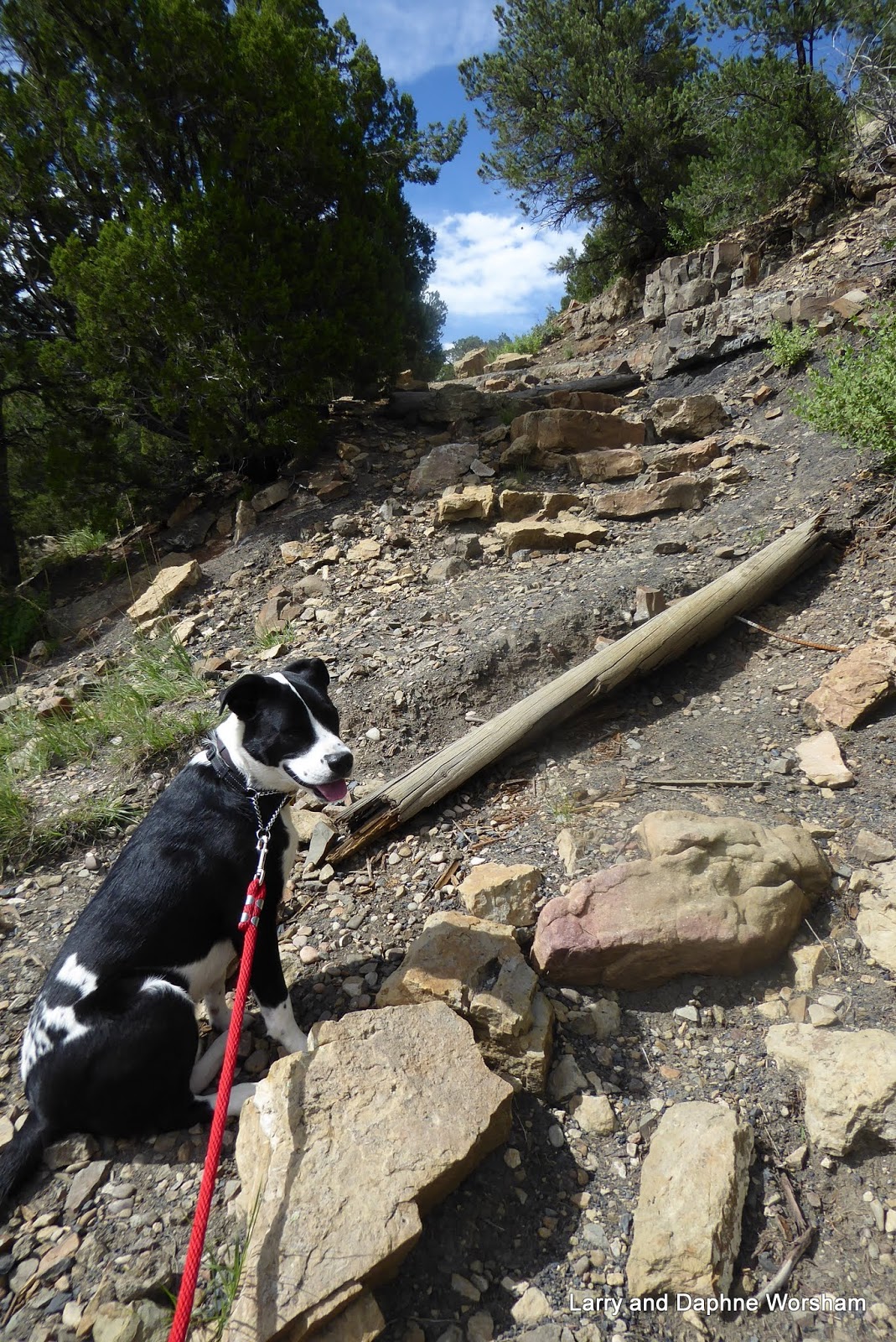
This is another of those quick stops, laundry, shopping, any needed repairs, and then on to four days at Wallowa State Park.

I could only identify one quilt shop in town, so paid them a brief visit when we ran a couple of errands. The shop in is the older downtown part of LaGrand, and while we weren't really in the market for shopping or browsing at the moment, there are a lot of attractive little specialty shops in the area. The La Grande Quilt Shop has a nice range of fabrics, but my space is limited so I only picked up a few interesting fat quarters.


We visited LaGrande in 2011 for trailer a trailer repair, as the Arctic Fox factory is here. We had no major repairs needed this time, but did develop a problem.

One afternoon we noticed we had no water on the hot water side of all the faucets. A bit of research and a lot of crawling around in tight spaces revealed the problem. It was Sunday, of course, so no parts were available, but as it turns out, we don't really need to replaced the valve. It's unnecessary unless you are planning to use antifreeze in winterizing the water system, which we never do. Problem solved!

Not much has changed in the area since our last visit except the name changes. Our comments on the interesting features of the hotel (now called Hot Springs Lake B&B) and the RV park (now called Grande Hot Springs RV Park) at that came are in this post.


July 31- August 3    Wallowa Lake State Park

They call the Wallowa Mountains the Little Alps, and you can see why.

First views of the mountain range from the highway are breathtaking, and in spite of the hot weather there are still little patches of snow here and there on the mountain peaks.


Steve has had Wallowa Lake State Park on his bucket list for a long time, and we finally made it! . . and it was a close call! When making reservations months ago he found it was already booked up, but put his name on the wait list. A short time before we left Texas he received an email message saying they'd had a cancellation, so he snapped it up.

Considering we had no choice in the matter, we got lucky and really have a great site. It's on an end, so our sitting area is much more spacious than most, and we are only a few steps from the entrance to the nature trail, which is handy for the dogs.

This park is huge ( 209 sites) , and very densely populated ..... the complete opposite of Clyde Holiday.

They've done a great job of working in around huge fir trees though, so there's a lot of shade.

We've never seen such a busy campground! All day and into the evening people there are wandering around, adults talking in groups, kids riding bikes (we've seen some pretty amazing bike helmets), young parents chasing their toddlers, people walking dogs (it seems everyone has at least one dog) and two enterprising young men made several firewood deliveries, pushing the little firewood carts while riding their skateboards. Now THAT was entertaining!

The park has a small but adequate off-leash dog area down by the marina, and it works well for the evening ball games. We also went swimming at one of the day use boat ramp areas. Otherwise, life is fairly restricted for the canine set.

Views of this beautiful lake can be had from the highway and the shore, but the campground isn't really situated in a way to afford that kind of scenery. This is where a boat would be handy, but we've given up hauling our canoes. We enjoyed several short excursions around the park to explore the little trails and views of the lake, and to play ball with the pups of course!


The little town of Joseph is just north of the state park, and the closest place for groceries and other services. Joseph is a beautiful town with a long history. It was established as far back as 1883. Originally a ranching and logging community, the town has now evolved into an art colony and tourism center. Summer visitors come for the beautiful views, fall visitors for the hunting, and winter for the snow sports. If you want to shop the galleries gift shops and eateries, you can do that year round too. And of course, there's a quilt shop!


Cattle Country Quilts didn't disappoint. They have some wonderful fabrics that really fit with the themes of the area. I couldn't resist a winter themed piece, and a license plate of course!

We stopped in to the local museum and chatted with their docents who are well versed in the history and family names. They can fill you in on all the artifacts displayed there, as well as Nez Perce tribe history, and anything else you want to know about the area.

Main street is an art walk every day, featuring several bronzes from local artists, cast in the city's foundry. We had lunch in an outdoor restaurant and really enjoyed the views.
The photo album includes larger versions of each sculpture
We also stopped at Old Chief Joseph's cemetery on the way back to camp. There's so much to do and explore here it's hard to fit it all in.

Wednesday we took the Wallowa Mountain Loop to the Hells Canyon Overlook

Photos of these huge mountains and steep valleys covered with trees just wouldn't convey the real message, so I didn't even try. What we did notice as unusual was the extremely tall snags standing far above the obviously younger, and very dense, fir trees.

Checking later I found this is the result of the Canal Fire, where a lightning-caused fire burned 23,000 acres in 1989. The younger trees (28 years since the fire) are so dense that they really need to be thinned, and there are discussions about how to go about that now.

We really enjoyed the drive to Hells Canyon Overlook. It's another one of those amazing, overwhelming scenic views. It's so large it's difficult to convey, a little like the Grand Canyon, and the smoke from forest fires was beginning to creep in.


We really enjoyed the drive, stopping along the way to admire several of the creeks that crisscross the road, visiting the fish weir, and stopping for lunch at a small fishing pond. The dogs seem to enjoy the scenery from the truck as well as getting out to explore each time we stop.

On our last day we drove north to the town of Wallowa to visit the Nez Perce Homeland Interpretive Center. The project office is in an unpretentious little building directly across from the post office, and we almost missed it. The displays aren't extensive, but there are some beautiful artifacts, excellent maps and explanatory displays, and the office is staffed by an enthusiastic and very knowledgeable young woman. The office will provide you with a brochure that includes a map to the nearby Homelands project, where you can walk a trail with interpretive markers along the Wallowa River, visit the dance arbor and longhouse, and enjoy some very special views of the Nez Perce homelands.

We've followed the Nez Perce trail in bits and pieces, starting at the end and now, we've worked our way to the beginning, so we've completed the route. If you are interested in Native American history this is a worthwhile side trip.

On the way back to camp we stopped in to take a look at Wallowa Lake Lodge, which is located right before the entrance to the campground. The lodge was built in 1923, and was really thriving when our daughter's choir performed there (many years ago!) but apparently was about to go under when a small group of investors gathered together to rescue it in 2015. It would have been so sad to see the lodge close. It's a wonderful example of the classic lodge style, beautifully maintained, and exemplifies the gracious feel of the older park lodges throughout the west.
Reception area and main lounge
I said at the beginning the views of the mountains here are amazing, and they really are. Unfortunately, fires in the area began pushing smoke in, and by our third day the mountains were barely visible. I'm glad I didn't wait to take photos. This was taken the morning of the third day, and the smoke got progressively worse. 

Smoke over Wallowa Lake

We really enjoyed our time here, but now we're packing up and heading for a few days in Utah!

Photo Album here