Showing posts with label Colorado. Show all posts

Sunday, August 20, 2017

Trinidad, on the Santa Fe Trail - Where Cultures Meet

Friday, August 19
It was 34 degrees when we woke up this morning - better than yesterday's 29 but still a might chilly for August. We packed up quickly (moving keeps you warm!) and were on the road by 9:00, our destination is Trinidad State Park.

What a beautiful drive from Molly Brown campground. We soon left the pine forest behind and found ourselves in lush range land, with ranches and rolling pastures dotted with cattle. That terrain evolved into sage and juniper, high desert, then the trees grew bigger and we were in forest again.
All of it beautiful, with interesting mountains in the distance. As we drew closer to Trinidad the rock grew redder, a nice contrast to the cloudy sky.

We were setting up in Trinidad State Park by around 3 P.M. and it was in the mid 80's. Siesta inspiring for all concerned!

After dinner an evening stroll around the immediate portions of the campground was very enjoyable, as we are still high enough that the evenings cool off quickly.

This is a very nice park, with several access points on the water for fishing and boating. We're staying in Carpios Ridge Campground, which has nicely graveled sites, most fairly level, some with a view of the lake, but there's no swimming for human or canine unless you can find one of the little muddy fingers of the lake.

In most places the shore is too steep to make swimming practical.  Boating, water skiing, fishing, hiking, etc. are all accommodated, so, sorry pups, maybe at the next stop! They've done a fairly nice job of spacing sites around the loops, but of all the campgrounds we've stayed in on this trip, other than Prineville this is probably the least private site we've had. There are a few trails around the edges so at least we have interesting walking spaces.

There are interpretive kiosks all around the park.
One, near the amphitheater, features a horno, a primitive oven used by Native Americans as well as the Hispanic settlers in the early days.
Other information kiosks tell of various aspects Spanish/Mexican colonial era, the pioneers, and the Native Americans in the area.


Saturday

Today is work day, and a bit of touring. Laundry first, before the two campground machines  fill up! and then a little time in town.

Trinidad isn't a huge town, the current population is a little over 9,000, but you can tell by the historic downtown area that it was once a very prosperous and bustling city. They are working at bringing back the historic section, with art galleries, restaurants and other interesting shops, but there are many vacant spaces and buildings in desperate need of restoration.
The Bloom Mansion

Originally a coal mining and shipping center, Trinidad had a bustling economy until the mining slowed down. The Wikipedia article on Trinidad has some very interesting information on the town and is defiantly worth the read, especially the section titled "Recent".

We had noticed signs for the Santa Fe Trail museum when we passed through town on our way to the campground, so decided that would make a good destination for the day. It's a good thing there was plenty of on-street parking, as the dark clouds decided to open up just as we arrived in town. Pounding rain, the kind that happens when the air is warm and the clouds are so full they just can't hold any more. Yes, we have an umbrella, and yes, it was safely tucked away in the trailer.

We dashed to the museum, shaking off the water like wet dogs, and of course, the rain quit shortly thereafter. The Santa Fe Trail museum takes up an entire block and is a combination of homes, gardens and traditional museum displays.

The two restored homes in the complex can be toured with a guide, for a small fee, but the remainder of the complex is accessible for no charge. It's a pleasant place to wander the gardens (when it's not raining) and in fact the entire neighborhood is interesting, with historic buildings all around.

Among the museum displays we ran into a new term that, surprisingly, we had not encountered before........."Hispano" Though the word is Spanish in origin, it's meaning when used in English was established for census purposes in the 1930's.  Hispano refers to individuals of Spanish Colonial ancestry who have lived here for generations and maintained that culture. They did not cross a border to move to the area, the border was drawn around them. In Texas the term Tejano has a similar meaning for individuals of Mexican ancestry and cultural identity.

Fort Wooten is very close to the museum and immediately caught our eye as it's military design contrasts with the many Victorian era homes in the area.

It was originally design as a military memorial and home for community veterans groups, but never saw use for that purpose. It's now home to the social service agency. The gate to the courtyard is locked, but it's good to know the building is in use as that will help prevent vandalism and deterioration.

In the afternoon I explored one of the trails that leads down to the edge of the water. I didn't make it all the way, as when I turned around and looked at the trail I reminded myself that what goes down must go back up again! Watch reminded me too.
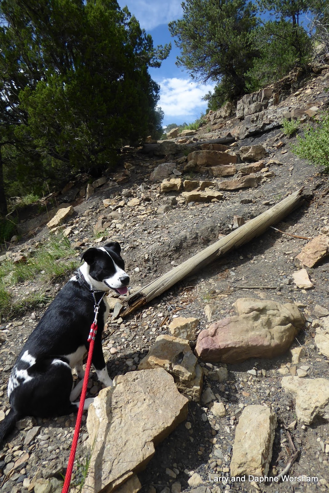
I have to go back up?
Why did we come down?

The trail is rough and fairly steep, but also provides an opportunity for some close up inspection of the geology here.

There's a fairly noticeable of (low grade) coal running along the side of the trail, and the red and buff colored sandstone layers sparkle like glitter in the sun, the result of a high mica content.

There's a lot to explore in Trinidad, more museums and shops, and there are some amazing sculptures along the main street.

We've enjoyed the relatively cool weather this altitude offers, so we'll be back!

Sunday
Time to pack up and head for New Mexico.

If the sunrise this morning is an omen, it's going to be a good day!

More photos here


Friday, August 18, 2017

Top of the Rockies Scenic By-way and Leadville, Colorado

Wednesday, August 16

What a beautiful day for driving. We woke up to the sunniest morning we'd had in several days (of course, now that all the photos have been take under clouds!)

We departed Rifle Gap State Park and wandered through the back scenic country. Beautiful ranches and smaller holdings all scattered across green pastures lined the roads. What a contrast to the sagebrush and rock formations we had driven through for the last two days.


Red Cliff Bridge
We continued on, eventually ending up on the Top of the Rockies Scenic By-way. We climbed in elevation until we hit the 9,000 foot zone, enjoying many glimpses of the road we'd just been on as it looped back and forth up the mountain.

Railroad tracks, remnants of mining activity in days past, including a mine and home for the employees. and few cabins scattered across the valley floor and on the slopes give scale to show how steep the mountains are in this area.

The gorgeous snow capped mountains in the distance provide a visual contrast and reminded us that it's going to be chilly up here on top of the Rockies!


It proved so when we stopped onTennessee Pass to take a stretch. The wind was biting, and this is August! We could only imagine what it must be like in winter. We soon discovered there were several military memorials to explore, and it seems they are here because the climate in this area was essential to their training.

One is the memorial to the 10th Mountain Division. After seeing Finnish troops overcome Russian forces in 1939 the head of the National Ski Patrol began pressuring the War Department to form a similar unit. There's an excellent summary of the history of the little known 10th Mountain Division, on the National WWII Museum website.

Another, the Norwegian Monument, provides the history of the formation of the battalion known as the "Viking Battalion" and a summary of their accomplishments and importance during WWII. The 99th infantry Battalion (Separate) was activated at Camp Ripley, Minnesota on August 15, 1942 as per written instructions by the War Department.

This unique elite unit was to consist only of Norwegians and Americans with direct Norwegian descent. Soldiers picked out for this elite unit had to have a working knowledge of the Norwegian language and preferably already knowing how to ski. The link at the beginning of this paragraph takes you to the official website and has the full history.

For the next two days well be staying in Molly Brown campground, near Leadville. Named for the famous "Unsinkable Molly Brown", it's a nod to the mining history in the area.

The other campgrounds in the area are also named for local historic characters. Baby Doe and Silver Dollar are right next to us. The Wikipedia article on Leadville does an excellent job of covering the history of the area, as well as many of the famous personalities, so I won't try to repeat all that here.

Our campsite is spacious, and surrounded by pine trees. It's only a short hike to Turquoise lake, so after getting set up the pups had an outing, but no swim as the air and the water this time of day are chilly.


Thursday

I was 29 degrees this morning. . . wow, are we ever going to have a hard time adjusting to Texas temperatures!

Today is tour Leadville day. No particular destination or shopping list in mind, except of course, a quilt shop. There's only one in town, Mountain Top Quilts, and it is a hybrid antique and quilt shop - quite fun to rummage around in!

There are books, handcraft related as well as western history and a few kids books, yardage (short cuts and folds) kits, yarn, completed quilts - some new and some vintage, vintage clothing, glassware, and.... well, you get the idea. Lots of fun to browse.

Leadville has done a fine job of retaining and promoting their mining history while also accommodating more modern tourist interests such as the winter sports, craft brewing, and antique collecting. Main street sports several original buildings with the old fashioned plaster and brick facades and some very interesting murals, and  many of the side streets are a wealth of beautifully restored little Victorian frame houses.

The setting is beautiful, with the snow capped mountains behind the church spires and ornate building roofs, and we actually had a bit of sun to show of the beautiful clouds. Those clouds seem to come and go quickly here, and with a "high" in the 50's it cools off quickly when the sun disappears.

After the quilt shop we stopped at the National Mining Hall of Fame and Museum. Oh my goodness, what an amazing collection of fantastic mineral samples, mining equipment, dioramas explaining gold mining history, life size scenes depicting coal and hard rock mining, famous people in the industry - wow! This is a stop worth making for those at all interested in the history of mining and children will get a lot out of it too, as there are hands on activities, videos, and the dioramas and scenes clearly explain the processes and history. The facility houses four stories of exhibits and photographs, as well as a research library. We only made it through two floors before our brains were full, and our tummies empty.

Soaking up all that history and information made us hungry, so we asked for recommendations and decided on the Golden Burro. Good food and reasonable for where we are. Steve had the best tamale he's had in a long time, and my burger was good too. The place has been in business for 75 years, so they must have something going for them.

Back at camp the dogs were anxious for a romp, so into the woods we went. We had a nice leisurely walk down to Turquoise Lake for a short but enthusiastic swim session - it's never long enough to suit the dogs, though.


And we take one last look at the lake before we head back to camp to begin the packing up.
We depart in the morning for Trinidad State Park.


Thursday, August 17, 2017

Rifle Gap State Park, Colorado

Monday, August 14
From our campsite at Greens Lake, Utah, it was a beautiful three and a half hour  (182 miles)  drive to Rifle Gap State Park, in Colorado.  The drive to the park, and the park itself, provided another opportunity to view the beautiful geology of this area of the state.

Rifle Gap Dam
The park includes Rifle Gap Reservoir, an earth dam structure that impounds both East and West Rifle Gap Creeks. They really like that name around here and have used it wherever they can!

The park campground consists of five small, separate campgrounds, some with only a few spaces. There are also day use areas and a swim beach.

The RV sites are mostly paved with immaculate graveled pads, fire rings and tables with shade covers. The tent sites aren't paved, but tucked artfully in among the sagebrush. They also have the tables with shelter roofs and gravel pads.

Our site was at the highest point of the highest loop, so we had a nice view all around, including a view of The Gap. Behind us was a log fence, and BLM property behind the fence.

At first glance the park didn't seem very "dog friendly" and the first time we asked about dogs swimming we got a negative answer, but each person we talked to gave us a bit more information and we soon got the feel of the "system".  We could take the dogs out into the BLM property for walks (but beware of the cactus!) and they can swim in the lake, just not in the human swim areas, which is pretty standard.

To say the park is well maintained would be an understatement, and they have to work hard at keeping it so tidy. We saw park employees hard at work scooping up copious amounts of mud that invaded roadside and campsites alike in a recent down pour.

The lake provides boating, fishing and swimming opportunities, as well as hosting wildlife. There's an accessible nature trail near the office, as well as several day use fishing areas.

Tuesday

Time to stock up on vittles, so we headed in to the town of Rifle. Rifle is an old ranching town, founded in 1882 and functioned as the center of cattle ranching in the area for many years. The town is named for the nearby creek, which got it's name, so the story goes, from a surveyor who left his rifle near the creek while working. The oil industry has provided a lot of jobs in past years, but that has dropped off recently, and some of the ranching still continues.


Rifle is working hard at pleasing the traveler.  Beautifully cared for old buildings line the streets, along with some interesting shops and many really well done murals. Unfortunately, parking and traffic being what they were, I couldn't get many photographs that did them justice. The residents take obvious pride in their history and their community. The town's population now is around 9,000, so most any service you need is available.

More interesting facts about the town  on the Chamber of Commerce web site.

After stashing the groceries and a quick lunch we headed up the road to Rifle Falls State Park. The campground area there is small, but still has nice size sites, and the area is beautiful, much more dense forest than where we are camped. The sites at the falls are not paved, but are fairly level, and they have electricity but no water hookups. Water is available however.

The falls are beautiful, and it's an easy walk from the parking lot to a good viewing location. From the base of the falls you can follow a short trail to explore small but interesting limestone caves and other unique rock formations.

And you never know what else you'll see - a doe nearly ran over some of us while we were walking up the path. On our way back to the truck a chipmunk ran out on a nearby rock and tempted the dogs. I think we were in the path back to her nest as she seemed pretty anxious to get past us.

Back to our own camp to pack up. We are heading out Wednesday morning. A last note, we found cell service at Rifle Gap rather dismal. Though the park isn't far from town, it's in a basin, surrounded by rather tall mountains. Make plans accordingly!

More photos in the album.