Showing posts with label geology. Show all posts

Friday, May 3, 2024

Palo Duro State Park

Monday, April 29

"Nothing to make a shadow", that was the first thing to pop into my mind as we left the rolling green of northern Texas Hill Country and entered the plains area of the Texas panhandle. Flat....as far as the eye can see, the sky becomes so large it dwarfs even the modern day wind generators slowly rotating above the dwarfed farm houses and outbuildings. 

Sometimes it's a lone windmill, other times the entire farm seems to have been given over to "wind farming".  The book title I mention above was written by a woman recalling her very early days as a settler on the plains of South Dakota. I wonder what she would think of the Texas plains. Not much in the way of shadows here, even now.  

I can't begin to imagine the surprise of those who arrive from the eastern states so many years ago, traveling across the miles and miles of flat-flat-flat land known as the Great Plains, only to come upon this, an 800 foot deep canyon laced with layers of red and white with glistening rivers and creeks flowing through a small forest of trees and shrubs.

We're staying in Palo Duro Canyon State Park. The Spanish name "Palo Duro", which translates to "hard wood" refers to the Rocky Mountain junipers that grow here. The canyon also contains mesquite (also a very hard wood), cottonwood, willow, western soapberry and hackberry. A variety of shrubs and other greenery fill the canyon floor, especially this time of year when many things are in full bloom.


The early development of Palo Duro Canyon as a park relied largely on the work of the Civilian Conservation Corp. First came the road, a fascinating and very steep involving many switchbacks. Then came the El Coronado Lodge. The building serves as the visitor center and gift shop today, but a photo tells of the rustic luxury of the Mission era when it was first completed.

The many retaining walls and stone bridges found throughout the park are also the work of the CCC. 


Palo Duro Canyon was formed over millions of years. of water erosion by the Prairie Dog Town Fork of the Red River with a bit of help from the famous the West Texas wind. The cliffs, gullies, layers of color and ever changing shadows are a joy to watch as the lighting changes during the day. Some of the formations have been given fanciful names, like the Lighthouse, taken as the symbol of the canyon. We also learned about the Sad Monkey, which can be viewed from the area behind the Old West Stables. 

Many years ago there was a small railroad that ran in that area, providing visitors with ongoing narrative about the canyon and it's history during the ride. The name "Sad Monkey was inspired by a rock formation, and the sprit is kept alive in the name of a mercantile just outside the park. The historical Sad Monkey Railroad is no longer running, a victim of regulations and insurance costs, it has been restored and sits on display in Neblett Park in the nearby town of Canyon. In 2019 a state historic marker was placed near the train display in the park. The tracks have been removed and bits of them are available on Ebay as souvenirs. 

The nearby town of Canyon (20 miles away) is worth visiting, if not for the train, then for a visit to the Panhandle-Plains Historical Museum. We thoroughly enjoyed visiting the beautiful collection of artifacts, art, and cultural presentations. This is truly a beautiful museum, with the most artistic, informative and professional presentations of historic artifacts, art objects, and the range of cultures in the area over time. I couldn't help taking a few photos, though it's difficult to truly present the experience without being there. 


The Native Americans knew about Palo Duro canyon long before the settlers arrived of course, they had been living in the canyon and hunting the abundant wildlife for generations. That fact and the desire for the settlers of the westward movement led to the Red River War. (more here Red River War) It was not just one simple battle, but part of a process over several years that led to the complete destruction of the Native American culture in the plains area. The Panhandle-Plains Museum does an excellent job of illustrating the complexities of the cultural changes of those times. 


The park is a network of trails and offers surprising things to discover along the way. We heard the turkeys long before we saw them, and it took some serious hunting to find the dugout style cabin. Wildflowers and shrubs we've never seen before decorate the slopes, and there are several small creeks crossing the trails. Horses, bicycles, dogs and humans are all welcome here. 

Our site is #90 in the Mesquite Camp area. It's a great site, with  couple of drawbacks. The first is, there is a giant dumpster placed exactly where a vehicle needs access to in order to make the swing when backing a trailer into the space. The second is that the shelter and picnic table assigned to this site are actually closer to the adjacent site than to this one. This is probably the result of changes in site design over the years, and we have a table of our own as well as the shade of the awning so all is well. We have lots of space and a great view to the canyon out the back window. 

The dogs are loving all the room for sniffing, and the many trails for our frequent walks. Though all the spaces seem to be occupied by evening this doesn't seem to be an especially busy time of year for the park.   


The book mentioned is  Nothing to Make a Shadow. Faye Cashatt Lewis. 1940

 More photos in the album, along with some explanatory notes. 


Saturday, January 27, 2024

Heading to Arizona

 SAY HI! BEFORE YOU DIE 

We are heading to Glendale AZ for a reunion with a bunch of guys I (Steve) worked with at Orange County Sheriffs Dept. over 50 yrs. ago. This trip will include stops at state parks in Arizona and a trip to Palm Desert to visit Daph's relatives.  We are traveling in the trailer with the dogs.

We haven't been out in the trailer since February of last year, when we met with the same crowd in Arizona, so we had some work to do. The trailer is a 2003 model and is showing some wear.  The refer died and I replaced it with a 12 volt unit.  Of course this required a upgrade of our solar system and batteries.  This hopefully will allow some limited boondocking as the sun will allow.


We left Central TX on 1/23  We normally stay at the South Llano State Park when we're headed west, but it is closed for hunting several days in January. This time we stayed stayed at North Llano RV Park in Junction, TX. The park is on the river which makes a nice place to walk the dogs and during the summer it is probably pretty scenery, but the weather for us was a cold dreary, both the drive and all day after we set up camp. We were stuck in a space in the back as we had a discount pass.  With the discount the cost was $27.50.  The normal price ranges from $50 to $70 a night. The prices have gotten out of hand!  Be warned that I will probably complain a lot about the prices of camp grounds and the need to make reservations months in advance.  This is the result of Covid and late blooming boomers coming onto the RV scene.

On the 24th we spent the night at Saddle Back Mountain RV park in Balmorhea, TX.  It is an RV adjacent to a truck stop.  Only $20 a night. Again, the state park in the area is closed during this time. The spaces here are large, and there are plantings of native cactus and small trees between each. We've stayed here before and it suits the purpose, in addition to having a lot of space for walking dogs.

The landscape here is wide open and makes for a good view of sunsets and in this case, the almost full Wolf Moon.  

Just as we were getting ready to leave in the morning we discovered a nature trail on the outer row of RV spaces. We'll check that out next time. The sign says there are maps of the trail in the "office" but we've never seen the office open! They've always had a self-check in procedure. 


1/25 - Today we're are finally out of Texas!  It takes 2 1/2 days to leave the state (We only average 250 miles a day)  We're now settled in at Rockhound State Park in New Mexico for 3 nights.  This is one of our favorite places, both for the scenery and the campground itself. Really spacious sites, lots of vegetation around each site, all carefully maintained, and a beautiful display of sunsets over the town of Deming every evening. 


This park actually has two separate units, the second being Spring Canyon. This area is more rugged and has no services, but offers interesting and challenging trails and some excellent photo opportunities. 


In the morning we took a short drive up into the canyon and did a bit of exploring, but the chilly wind discouraged further adventuring.... that would be more fun on a warmer day!

We did make a quick stop beside the road after leaving the Spring Canyon section, but before returning to the main park. 

Steve noticed a roadside memorial, so I hopped out of the truck and walked over to inspect it. 

The photo below is all we could see from the road.  When I walked to the center of the arrangement there was an amazing collection of objects, all carefully positioned and some protected by low edging, like a flowerbed might have. Some of the items were religious, some cute toy type things, the neat paths were lined with stones, and at the very end a small plaque with a photo of a young woman and a name. 

I did a little research and found a rather sketchy story, the makings of a book if one were so inclined. Lots of mystery but no real answers as to what happened, why the memorial is located here close to the park, and why there were no comments anywhere online about the husband. What little I discovered is attached to her photo in the album for this post... you'll have to go there to find out what few facts I uncovered!

The town of Deming is only about 13 miles away, so close enough to hop over for a good Mexican dinner and a little sightseeing. We planned to visit the  Deming Luna Mimbres Museum, but it seems they have closed for the time being and no details were available on the reason or when they'd open again. So we did a little shopping and then moved on to an early dinner. 

At the suggestion of the campground host we tried Irma's Restaurant, a homey little place in downtown Deming. The street itself is interesting with murals and other art objects depicting the culture and history of the area. The food at Irma's was plentiful and really good! 

We were back at camp early enough for a walk with the dogs before they had their dinner, then enjoyed the ever changing sunset. This one hit a cherry-red stage just before the sun sank over the horizon, but the photo just doesn't do it justice. 


Tomorrow we pack up and head for Roper State Park in Arizona.


Monday, March 20, 2023

Rockhound State Park

 Rockhound State Park, near Demming New Mexico, has been a favorite stopping point for us since our first visit. 

Approaching the park from the southwest Demming (Stirup Rd SE) it appears as a few scattered bright spots gathered against the base of the Little Florida mountains. Those bright spots are reflections off the RVs in this small and very special campground Once settled in a campsite, you have a grand view of the valley below, sheltered by the Little Florida Mountain peaks that surround you. The location offers not only amazing view of the valley during the day, but some of the beautiful sunsets New Mexico is known for. 

This park is a small oasis of cacti, yucca, wildflowers and multiple bird species, not to mention the rodents and reptiles one doesn't often see, but are documented here. 

The park is unusual in that visitors are actually encouraged to gather a few mineral samples while visiting. In the past there was a limit of several pounds, which was abused by commercial dealers, so now the limit is much smaller. 

A small visitor center at the entrance to the park has great visuals and descriptions of local wildflowers and wildlife, as well as the geologic history of the area. We were lucky in the timiing of our visit, the Mexian Gold Poppies were just beginning to bloom and really brightened up the slopes of the mountains. 


State geologic groups have donated some amazing mineral samples on display in the visitor center, and there are samples for sale too, for those who don't want to roam the hillsides looking for something to take home as a souvenir. Rock shops in Demming offer additional opportunties to "collect" samples from the area.

A botanical trail meanders around the north side of the campground and makes it easy to enjoy the several types of prickly pear, barrel and cholla cactus. Any time after early March will probably offer wildflowers, and the birds are always singing. My Merlin app identified 6 different birds in a 90 second recording. 

A smaller day-use-only park, Spring Canyon, is also available to explore - admission to that is included with your entrance to Rock Hound park. We haven't explored that park yet, so it's on the list for our next visit. 

For those interested in more of the geology of the area, The New Mexico Department of Geology and Mineral Resources has posted a Geologic Tour for several areas, the tour for Rockhound State Park is here. In short, the area is basically volcanic in origin, that translates to a lot of granite as well as the minerals that make up granite. The cactus love the decomposed granite soil, and are some of the healthiest I have seen. Over time water trickling through the layers of mineral deposits has created geodes, lots of geodes! The visitor center has some lovely ones on display as well as excellent information on how they are formed. If you know what to look for while you are hiking the trails you may find one to take home!

The evening views are worth waiting for.


Sunday, August 20, 2017

Trinidad, on the Santa Fe Trail - Where Cultures Meet

Friday, August 19
It was 34 degrees when we woke up this morning - better than yesterday's 29 but still a might chilly for August. We packed up quickly (moving keeps you warm!) and were on the road by 9:00, our destination is Trinidad State Park.

What a beautiful drive from Molly Brown campground. We soon left the pine forest behind and found ourselves in lush range land, with ranches and rolling pastures dotted with cattle. That terrain evolved into sage and juniper, high desert, then the trees grew bigger and we were in forest again.
All of it beautiful, with interesting mountains in the distance. As we drew closer to Trinidad the rock grew redder, a nice contrast to the cloudy sky.

We were setting up in Trinidad State Park by around 3 P.M. and it was in the mid 80's. Siesta inspiring for all concerned!

After dinner an evening stroll around the immediate portions of the campground was very enjoyable, as we are still high enough that the evenings cool off quickly.

This is a very nice park, with several access points on the water for fishing and boating. We're staying in Carpios Ridge Campground, which has nicely graveled sites, most fairly level, some with a view of the lake, but there's no swimming for human or canine unless you can find one of the little muddy fingers of the lake.

In most places the shore is too steep to make swimming practical.  Boating, water skiing, fishing, hiking, etc. are all accommodated, so, sorry pups, maybe at the next stop! They've done a fairly nice job of spacing sites around the loops, but of all the campgrounds we've stayed in on this trip, other than Prineville this is probably the least private site we've had. There are a few trails around the edges so at least we have interesting walking spaces.

There are interpretive kiosks all around the park.
One, near the amphitheater, features a horno, a primitive oven used by Native Americans as well as the Hispanic settlers in the early days.
Other information kiosks tell of various aspects Spanish/Mexican colonial era, the pioneers, and the Native Americans in the area.


Saturday

Today is work day, and a bit of touring. Laundry first, before the two campground machines  fill up! and then a little time in town.

Trinidad isn't a huge town, the current population is a little over 9,000, but you can tell by the historic downtown area that it was once a very prosperous and bustling city. They are working at bringing back the historic section, with art galleries, restaurants and other interesting shops, but there are many vacant spaces and buildings in desperate need of restoration.
The Bloom Mansion

Originally a coal mining and shipping center, Trinidad had a bustling economy until the mining slowed down. The Wikipedia article on Trinidad has some very interesting information on the town and is defiantly worth the read, especially the section titled "Recent".

We had noticed signs for the Santa Fe Trail museum when we passed through town on our way to the campground, so decided that would make a good destination for the day. It's a good thing there was plenty of on-street parking, as the dark clouds decided to open up just as we arrived in town. Pounding rain, the kind that happens when the air is warm and the clouds are so full they just can't hold any more. Yes, we have an umbrella, and yes, it was safely tucked away in the trailer.

We dashed to the museum, shaking off the water like wet dogs, and of course, the rain quit shortly thereafter. The Santa Fe Trail museum takes up an entire block and is a combination of homes, gardens and traditional museum displays.

The two restored homes in the complex can be toured with a guide, for a small fee, but the remainder of the complex is accessible for no charge. It's a pleasant place to wander the gardens (when it's not raining) and in fact the entire neighborhood is interesting, with historic buildings all around.

Among the museum displays we ran into a new term that, surprisingly, we had not encountered before........."Hispano" Though the word is Spanish in origin, it's meaning when used in English was established for census purposes in the 1930's.  Hispano refers to individuals of Spanish Colonial ancestry who have lived here for generations and maintained that culture. They did not cross a border to move to the area, the border was drawn around them. In Texas the term Tejano has a similar meaning for individuals of Mexican ancestry and cultural identity.

Fort Wooten is very close to the museum and immediately caught our eye as it's military design contrasts with the many Victorian era homes in the area.

It was originally design as a military memorial and home for community veterans groups, but never saw use for that purpose. It's now home to the social service agency. The gate to the courtyard is locked, but it's good to know the building is in use as that will help prevent vandalism and deterioration.

In the afternoon I explored one of the trails that leads down to the edge of the water. I didn't make it all the way, as when I turned around and looked at the trail I reminded myself that what goes down must go back up again! Watch reminded me too.
I have to go back up?
Why did we come down?

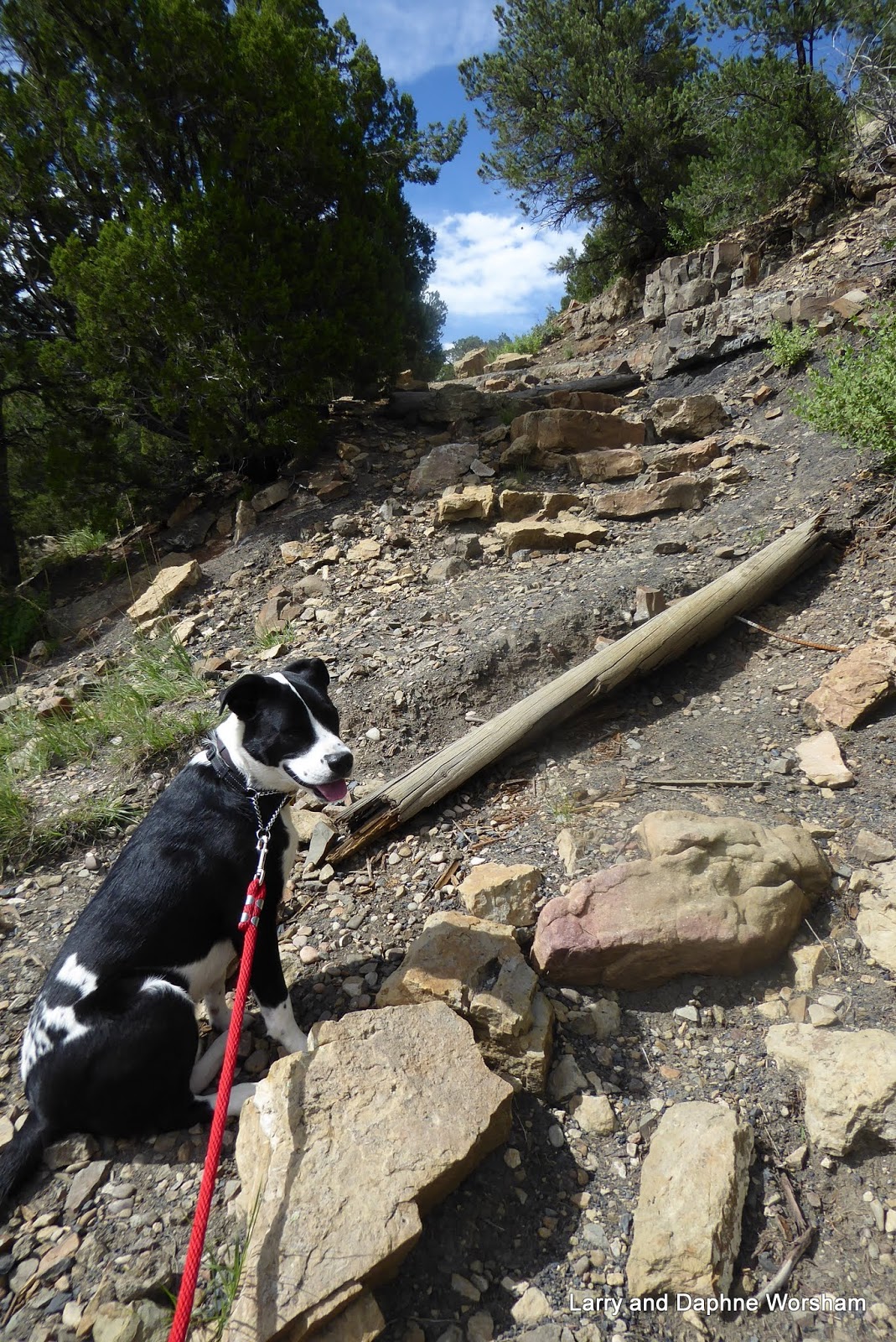
The trail is rough and fairly steep, but also provides an opportunity for some close up inspection of the geology here.

There's a fairly noticeable of (low grade) coal running along the side of the trail, and the red and buff colored sandstone layers sparkle like glitter in the sun, the result of a high mica content.

There's a lot to explore in Trinidad, more museums and shops, and there are some amazing sculptures along the main street.

We've enjoyed the relatively cool weather this altitude offers, so we'll be back!

Sunday
Time to pack up and head for New Mexico.

If the sunrise this morning is an omen, it's going to be a good day!

More photos here


Wednesday, August 16, 2017

Flaming Gorge Recreation Area, Utah

Friday, August 11
We had black storm clouds chasing us as we arrived at Green's Lake Camp Ground, where we had reservations for our three days at the gorge.


We arrived just about lunch time, but no time to eat!  We flew through our fastest set up ever and piled into the trailer just as the icy raindrops started falling. It's funny, the dogs love swimming but just hit them with a cold raindrop and you'd think their tails were on fire!

By the time we finished lunch the storm had moved on so we took a short drive to the nearby Red Canyon Visitor Center. Wow, what views of the lake and the canyon from the rim of the gorge!


Even with the clouds dimming the light, the rock formations are impressive. The visitor's center is small, but does a nice job of touching on human history as well as the geology and natural history of the area. We talked with the volunteers and gathered up tour info for the next day.

Our site was wonderful - really deep and wide so there was lots of space to spread out, or at least, not have the other campers too close. There are a couple of trails close to the entrance to the campground for walks with the dogs, or for enjoying the flora and fauna.

The campground is one of many in the Red Canyon area of the reservoir, and we also had our own little lake, and a trail immediately out from our site (#4) goes directly to it. It's only a short walking distance around the edge of Green's Lake to Red Canyon Lodge, which offers cabin rentals, horseback rides, a restaurant, and many other amenities.

Unfortunately the weather was too chilly and the rocky beach too steep for the pups to be able to swim. They had to make do with playing ball among the many pine cones and chunks of sandstone that surround us.

The forest here is largely Ponderosa pine, Douglas Fir and Mountain Cedar, with some stands of poplar thrown in for variety. There are chipmunks and marmots aplenty to annoy and tease the dogs with all their chirping and squeaking. It's a little like dog TV as far as entertainment value goes.


When the majority of campers moved out each morning the magpies moved in, checking to see what morsels had been left behind and plucking the berries from the shrubs.

Saturday
Bright and early we headed out for the Sheep Creek Scenic Geology Loop, which wanders through a variety of really scenic formations, along a creek and through ranch land and then veers north to the town of Manila.

We had picked up a small brochure in the visitor center that provided geologic details for each of the well labeled stops in the 10-mile tour through Sheep Creek Canyon.

We began the tour with a short trip down a spur road for a brief stop at the  Ute Mountain Fire Lookout Tower.

The tower is one of many build by the CCC in the 1930's, and has been restored to look as it would if it were in daily use.

It is fully functional, but is no longer used for the original purpose, serving as a point of living history for visitors, and offering exceptional views of the surrounding territory.

The volunteer stationed at the tower was well versed in the details of its history as well as the restoration and we really enjoyed talking with him - he even took our photo!

Leaving the lookout tower we continued on, following the little guide book and the informative signs along the way. There are frequent pull-outs for photography or for just admiring the amazing geology.


The formations in this area are of such varied ages, some so old that they contain some of the oldest rock and fossils in North America. The colors and textures of the stone are fascinating, and change with the light and cloud cover. The views are so vast it's hard to convey it all in photos, no matter how wide-angle the lens. A few of the most striking views are included in the album.

Looking toward the Wyoming shore of the lake
At the north edge of Manila we caught the western-most edge of the lake, and dipped our toe just across the Utah/Wyoming state line. The character of the landscape is very different in this area.

Sunday
A beautiful sunny  morning beckoned, so we harnessed up the dogs and started out down one of the trails at the edge of camp. We hadn't gone far when we came upon a huge Ponderosa that appeared to have exploded.

We poked around the still fresh-looking branches and determined it had probably been hit by lightening during the storm on Friday. 'Sure glad we weren't parked next to it!

When we returned to the visitor center in the afternoon we saw a tree with a sign stating it had been struck by lightening, so we compared the features and determined our conclusion was correct.

After lunch we headed out, hoping for a dam tour, but the dam elevator was broken. Besides that, the afternoon storm - complete with lightening, had moved in, so tours were cancelled.

We made do with a driving tour around the dam and through the little burg of Dutch John, and took a few more photos. One striking feature is the Cart Creek Bridge. It stands out like a work of art against the red cliffs.

Cart Creek Bridge, near the Flaming Gorge Dam
Back to camp through the rain. There's a lot of history and beautiful scenery here that we didn't have time to touch on, but it's time to begin packing up as we head out Monday for Colorado.

About Flaming Gorge Recreation Area  
The Flaming Gorge Recreation Area is within the Ashley National Forest,  under the management of the U.S. Forest Service. A great deal of information about the area can be found on the Forest Service's web site. Flaming Gorge Reservoir is the result of the Flaming Gorge dam, in Utah, containing the waters of the Green River, which flows south from Wyoming. A large part of the reservoir is in Wyoming, but the widest part, near the dam itself, is in Utah. The Green River eventually flows into Lake Powell, which is another really beautiful area. We haven't visited there in many years but still remember the vivid red sandstone cliffs against the blue sky and water.

There's additional information attached to many of the photos in the album. If the information panel doesn't display just click the circle with the "i" in it at the top right to display the panel. This album is fairly large, so if you're loading the album view please give it time.

Tuesday, June 20, 2017

Lewis and Clark Caverns State Park, MT

Saturday, June 17- 19
Lewis and Clark Caverns State Park, Whitehall, MT

What a beautiful part of the country! We really enjoyed the looooong 27 mile drive from our last campsite. . . rough day, beautiful scenery!

The snowy peaks in the distance emphasize how late spring arrives here, but our campsite is in a valley, so the snow disappears behind the closer mountains and we're surrounded by green slopes and trees with a few limestone outcrops and beautiful puffy clouds, and wind. . . lots of wind.

The campground is fairly spacious - laid out in five wagon wheels, so to speak. The area includes a tepee and three log cabins for rent for those who travel without an RV.

Many of the park amenities were developed by the CCC back in the 1930's, in fact, this was the first state park the CCC worked in. Montana later developed a state program of their own modeled after the national CCC.

Though they didn't discover them, the caves are named for the Lewis and Clark expedition that traveled down the Jefferson River, which runs right by this area.

The caves, or caverns, here are limestone structures, thousands, probably millions of years old. We decided on the short tour and met our tour guide at the upper visitor's center. Our group took a short but fairly steep walk uphill to the entrance to the cave, then traveled long dark tunnel, which serves as an airlock to protect the cave. Entering a second door we had our first look at the cavern structures. Beautiful!

We had a great tour guide, with a real gift for delivering the information and stories regarding the caverns, and we really enjoyed the history of the lineage of the cave's ownership, and the stories about the early explorers.

These formations really are beautiful examples of the limestone stalactite/stalagmite type of cavern, and the lighting was better than several of the caves we've visited, allowing for much better photography. It's a little on the pink side, as that's the spectrum their lights put out, but at least you can see what the structures look like.


It seems the Montana state parks system is something like 48th down on the list of national funding for their state park system, so they have a partnership with Americorp. Our guide was one of the Americorp  program volunteers. There are several in the park, and they help make up for the lack of regular rangers, which the state can't afford at this time.

In addition to the beautiful formations the caves are also famous for bats. They are the small brown type, and they don't come as far down in the cave as our tour took us, so we didn't see them. We are thankful for their presence anyway - they eat 1-2,000 bugs a night. Lovely to be by a river and have almost zero mosquitoes!

Monday, June 19
In the morning we took a jaunt up to Whitehall. It's really the closest town for services. There's a grocery store, gas station, etc. They've livened the place up a bit with a few murals but most of them are now badly faded. We found the pups a place to play ball on the way back to the campground, so their day was complete.
Downtown Whitehall, MT
We have to give the wind some credit for the bug free weather I think. By evening the wind had calmed down and we enjoyed sitting outside, basking in the sun and admiring the snowfall of cottonwood seeds. By evening the bugs began to come out of hiding.

Tomorrow we head south, working our way toward Nevada.

Lewis and Clark Caverns album here. Lots of cave photos in the album!

Thursday, September 1, 2016

Exploring South Dakota - The Badlands

Those old everyday chores have to be done some time, so we headed back to Rapid City to take care of them. We'd enjoyed the Elk's club there as a one night stop, so moved in again, and had another friendly pub-style dinner while chatting with other members and travelers.

The next day, errands and chores completed, we took drove south into Badlands National Park. There's a nice loop tour, which suited the situation pretty well. As it was very cloudy, and slightly rainy, we weren't in the mood to do a lot of sightseeing on foot. So we spent some time checking out the visitors center.

This is the BEST visitor center we've seen on this trip. Not only are the displays really well done (kids will love the way they depict the dinosaur era animals that lived here) but they also have a fossil lab open to visitors where you can watch technicians clean specimens, and pack them for shipping. There are several specimens on display, and we discovered while talking with the ranger who was stationed in the room at the time that she was a graduate of the University of Oregon. We had a nice chat with her before moving on to drive through the remainder of the Badlands .

The formations in the park are amazing. Dramatic spires topped with dollops of whipped cream, mesas with unbelievable erosion, and stripes of colorful soils. Even with little sun the shadows created by the many layers are fascinating. It's rugged country and one can only imagine the challenge of navigating it on horseback or in a wagon.

As the afternoon wore on the clouds thinned a bit and by the time we reached the park boundary we actually had a little sun. Good timing.  It's an impressive area in spite of the clouds, and bears further exploration.

The Badlands under stormy skies

Beautiful downtown Wall
We planned to spend the evening at Sleepy Hollow Campground in Wall, which is only about 8 miles from the park boundary. As it turned out the location was perfect. We did a quick tour through the Wall Drug area of the town, and a couple of other shops, sampled a local brew while chatting with a couple who are full-timers and had just recently been in Eugene, OR. We returned to camp just in time to fix a quick dinner and walk the dogs before a fairly blustery thunderstorm hit. (No, we didn't get a free glass of water, but yes, we did get donuts!)

Hoping he'll tell me where his mine is!

It's that time of year. Days are noticeably shorter, evenings cooler, and overall it's beginning to feel like winter. Time to head south!

Aug. 28 Saturday - Sunday
Guess I spoke too soon! The sun is out, so we decided to make a swing through The Badlands again, so we could catch it in a different light. The sun does make the colors a little brighter, and the shadows sharper. It was good to take a second look.

For two days we're camped at Francis Case Lake, Snake Creek Recreation Area, on the Missouri River, and the weather has turned to summer again!

We had a great view of the lake
It's a beautiful area, and the lake is huge, as is our campsite. We've got plenty of room for the dogs to play, privacy as we're in an end site, and there are areas on the beach where they can play in the water. What a find!

We drove both camping loops to look over the layout and sites, and they are all large, though some have better views than others. The little cabins are mostly right along the shoreline so have excellent views of the lake.

It took some doing, as things are pretty overgrown this time of year, but we found a couple of trails around the edges of the campground. Signage is a little on the short side, but you can find a map of the area on line. There are four different maps at the bottom of the page I linked to above.

Now for the remainder of touring in South Dakota, on to the little towns where some of my family settled and lived for many years.
We had beautiful sunsets most nights at the lake

The album is here.


Monday, August 29, 2016

Custer State Park part III - The Black Hills underground

There is so much to see aboveground in the Black Hills, and Custer State Park in particular, that it's easy to miss the other half of the scenery here. Fortunately there are two sites that make it easy to experience.

Neither of the caves that are open for tours are in the state park, but both are within easy driving distance. Neither of these caves features the "classic" stalactites and stalagmites that one often sees in photos of caves, but each has their own unique "claim to fame".

Wind Cave National Park is just south of Custer State Park. Discovered by settlers in 1881, it became our 7th national park in 1903.

We've heard from other campers that road to the cave is a favorite place for Elk to hang out in the early morning and late evening hours. We didn't see any elk, but they aren't always predictable and we were probably out a little later than their preferred grazing hours.

Wind Cave, so named for the blast of wind that sometimes moves out of the very small opening, which was originally the only opening, is regarded as sacred by several Native American tribes, and is considered by some to be the origin place for the human race. Many Native American tribes' origin stories involve people coming up from underground, through a small opening. It makes one wonder when the same story occurs in so many cultures. This tiny opening was the only access point when the cave was discovered, and remained so during much of the early work in mapping the cave's chambers and passageways.

There are over 100 miles of mapped passageways, and researchers know from barometric studies that they have only explored and mapped a small percentage of what exists. Estimates of the mapped area indicate that it's about 5% of the total area the cave covers. This means, in short, that the entire area is honeycombed with caves. It's amazing that the whole surface doesn't collapse!
Boxwork

About 60 million years ago the geologic force that uplifted the Rocky Mountains also uplifted the Black Hills, producing large fractures and cracks in the limestone layers that had formed over the area. Over millions of years water slowly seeped through those cracks, dissolving the limestone, to produce the cave's passages. Later erosion removed the softer stone, leaving the harder calcite deposits that had been left behind in cracks in the soft limestone. These thin, honeycomb like formations are called "boxwork".  It seems this is actually a fairly rare formation, and about 90% of the known boxwork in caves is located here.

Passageways in this cave are very narrow, and though the Park Service has placed limited lighting in areas that assist visitors in seeing the depth of side tunnels and some of the formations it's difficult to really get a perspective on just how deep some of the side rooms and channels are.

The narrow passageways make the tour a bit of a challenge. When you look up, you may hit your head on the wall behind you, if you turn around to take a photo, your elbow may brush the wall - all things to be avoided by the way, to avoid contaminating the atmosphere and damaging the formations.  Not for the claustrophobic, to be sure, but an interesting tour none the less.

The Wind Cave geology driving tour brochure does a great job of explaining the geology of formations seen throughout the park.


Jewel Cave National Monument - the third longest cave system in the world, to the west of our camping area, was our second experience with the underground wonders of the Black Hills. By the time we reached this park we'd already climbed so many stairs, and hiked over so many steep hills, that we opted for the short tour.

Calcite crystals in the wall
The cave "room" in which we gathered to hear the ranger's presentation was lined with calcite crystals and limestone flows. It was spacious and well lit, so photos were a little easier to take, and there seemed to be, in this one area, a greater variety of forms. The tour included an informative presentation by the ranger and lots of time for questions and discussions.  It came up during the discussion that there is a distinct possibility that this cave is connected, somewhere, to Wind Cave.

So much of each cave remains unmapped it's hard to know. It does look as if they are both impacted by the same aquifer, so research continues.  It was a short tour, but not a disappointment. If we're here again we'll definately come back for a longer tour.

The entrance is at the end of the path, on the right
After leaving the cave proper we drove a mile up the road to Hell's Canyon, where the original cave entrance is located. After parking near the historic ranger cabin we followed the trail from the parking area up to the cabin, over the hill, down steep stairs, and along the edge of a cliff to the entrance which is protected by an iron door. This entrance is still used by some of the most strenuous tours.

While walking to the entrance there was an opportunity to view several places where the crystals and formations are visible along the path.

This entrance was used  from the time the monument was established in 1908 until 1972. The current entrance is through the visitors' center, which is the most informative of any we have visited in the Black Hills area. The center has displays and information on the cave, of course, but also other natural history of the area.

More photos of the caves.