Friday, June 30, 2017

Yeah! We made it to Nevada

Whewww! It's hot here! Should be no surprise, but when you've been up in the forested mountains it does come as a shock.
At the entrance to the interpretive center

We had originally planned to space out the distance over two different stops, on our way to Minden, but with the heat we decided to condense it to just one. 'Might as well spend the day in an air-conditioned truck! We did make time to stop along the way at the California Trail Interpretive Center, near Elko.

The temperature prevented us from exploring the trails around the center, but we did enjoy the inside. Life size dioramas and other historic displays, short videos, very knowledgeable docents, and a variety of beautiful artwork make this a stop worth devoting some time too.

Back side of the statue

Much of the information is presented in a hands-on format so it's great for kids too.  If you're really pressed for time a pull-off with several information kiosks is located just before the center, off to the side of the highway. 


The artwork, dioramas and murals depict the local tribal life as well as the pioneers. 


Our last night on the road, for awhile anyway, is the New Frontier RV Park, in Winnemucca, NV.  This was a rather unusual RV park in that at least half of the area was filled with brand new, very nice workforce housing units. It appeared some of the occupants are miners or other similar jobs, but many appeared to be otherwise employed. There's huge growth in the area in all kinds of services, so apparently the standard housing hasn't kept up with demand. The park is quite new, and very nice, with large spaces. 'Mostly graveled sites, with a little grass here and there, and a small fenced dog run, so the pups weren't thrilled. It had been a long day in the truck, but we made-do. We had dinner at the nearby Wingers and called it a day. 

Saturday, June 24 - We made it!  We pulled in to the Finch Estate in the early afternoon, and promptly settled in. Now it's time to start getting ready for the big Happy Birthday American party!!

Nevada welcomed us with one of her famous beautiful sunsets!


Working our way through Idaho - Nevada or Bust!

June 20, Tuesday
We really enjoyed Lewis and Clark Caverns State Park, and several of the small towns around the area deserve a second look, so they're on the list for another trip.

We're southbound and down, heading for the annual Happy Birthday America BBQ and reunion in Garderville/Minden, Nevada. A few quick stops along the way and then we'll settle in there for awhile.

Today we're heading south along the Snake River,  through what is obviously fly fishing country. Beautiful, huge lodges, fly fishing clubs, and vacation homes. Fishing supply companies and boat rentals are pretty much the industry around here.


Home for the night is Flat Rock Campground. This is a beautiful little Forest Service campground, but not what you'd call a destination in it's own right.

The area is fairly dense with threes, so shady and cool, and the grounds are lush with grasses and wildflowers, at least this time of year, but there are no trails anywhere, so a cruise around the campground loop was the highlight of the day for the pups.

The campground is also right on the highway. The location is convenient, I will say, but the sites along the highway get a lot of road noise, our site was on the back side so the noise was buffered a bit by all the trees.
Shiner enjoyed the morning sun

This is a good location for travelers who want to spend the day fishing or visiting other attractions in the area.

Spaces are large and very well designed. Each site has an immaculate seating area and tent space. Most also have grills or fire rings and Dutch oven cooking tables.

June 21-22, Massacre Rocks State Park
Massacre Rocks State Park is a beautiful area on the Snake River, situated along the historic Oregon/California trail.

According to diaries of emigrants, settlers in five wagons clashed with Shoshone just east of the rocks on August 9–10, 1862. Ten emigrants died in the fight, which involved four wagon trains. (See Wikipedia for more history) So, it was't exactly a massacre, but over time several people did die here. There are alternate names for the local, all equally dismal, reflecting the ongoing conflicts between settlers and travelers and the local tribes. The area is rich in pioneer history, and in some areas the pioneer's wagon ruts are still visible.

We've dropped in elevation and left most of the forest behind. This area is a lovely contrast of volcanic rimrock, canyons, and the beautiful Snake River. The River is running high this year due to all the snow melt. It's so high and the current is so fast that the park isn't renting out their canoes and kayaks yet. They'll open that service up when they feel the river has reached a safe level.

Other than the boating aspect this is a fishing river. Steep banks, and the fast current, make any swimming or wading problematic, so it's sightseeing for us! Lots of Oregon Trail history in this area. The huge volcanic boulders and crevices providing good ambush cover as well as shelter for travelers.

View from our site
Our site here is a pull-through with quite a bit of elevation so we have a nice view of the river. Some sites have even better views, but some have none, so when making a reservation check the map carefully and use a satellite map too, like Google's satellite view. The whole campground is up above the river, so where the park map makes it appear that a site is right next to the river it is actually up on a cliff.  From this vantage point we can watch the pelicans and other birds that soar over the river.

There are multiple trails crisscrossing through the giant sage bushes and rock formations, so getting to the bank for fishing isn't too difficult, but the banks are crowded with reeds in most places, so fishing from a boat is probably preferable.
The dogs enjoyed checking out the trails, and they found the scent of the cottontails and lizards quite enticing! If you're into Frisbee golf, they have a huge course  here, and the visitor center even sells Frisbees.

The area is rich for wildlife viewing too. We saw a wide variety of birds, and deer right outside our door. The shrubs were all heavy with currents and other fruit and seeds so it's not surprising there were so many critters around.

A short hop over to the other side of the highway there's a nice little park with a shelter protecting Register Rock. Many inscriptions here from the early 1800's.

The inscriptions are hard to read without the right lighting, and the chain link fencing round it rather limits one's photography choices, but we did manage to locate a few legible names and dates. Other boulders in the park have more recent inscriptions - from the 1970's on up to the 2000's. Perhaps some day they'll decide these are "historic" too and fence them off!

Tomorrow we should hit Nevada!

A few more photos here.


Tuesday, June 20, 2017

Lewis and Clark Caverns State Park, MT

Saturday, June 17- 19
Lewis and Clark Caverns State Park, Whitehall, MT

What a beautiful part of the country! We really enjoyed the looooong 27 mile drive from our last campsite. . . rough day, beautiful scenery!

The snowy peaks in the distance emphasize how late spring arrives here, but our campsite is in a valley, so the snow disappears behind the closer mountains and we're surrounded by green slopes and trees with a few limestone outcrops and beautiful puffy clouds, and wind. . . lots of wind.

The campground is fairly spacious - laid out in five wagon wheels, so to speak. The area includes a tepee and three log cabins for rent for those who travel without an RV.

Many of the park amenities were developed by the CCC back in the 1930's, in fact, this was the first state park the CCC worked in. Montana later developed a state program of their own modeled after the national CCC.

Though they didn't discover them, the caves are named for the Lewis and Clark expedition that traveled down the Jefferson River, which runs right by this area.

The caves, or caverns, here are limestone structures, thousands, probably millions of years old. We decided on the short tour and met our tour guide at the upper visitor's center. Our group took a short but fairly steep walk uphill to the entrance to the cave, then traveled long dark tunnel, which serves as an airlock to protect the cave. Entering a second door we had our first look at the cavern structures. Beautiful!

We had a great tour guide, with a real gift for delivering the information and stories regarding the caverns, and we really enjoyed the history of the lineage of the cave's ownership, and the stories about the early explorers.

These formations really are beautiful examples of the limestone stalactite/stalagmite type of cavern, and the lighting was better than several of the caves we've visited, allowing for much better photography. It's a little on the pink side, as that's the spectrum their lights put out, but at least you can see what the structures look like.


It seems the Montana state parks system is something like 48th down on the list of national funding for their state park system, so they have a partnership with Americorp. Our guide was one of the Americorp  program volunteers. There are several in the park, and they help make up for the lack of regular rangers, which the state can't afford at this time.

In addition to the beautiful formations the caves are also famous for bats. They are the small brown type, and they don't come as far down in the cave as our tour took us, so we didn't see them. We are thankful for their presence anyway - they eat 1-2,000 bugs a night. Lovely to be by a river and have almost zero mosquitoes!

Monday, June 19
In the morning we took a jaunt up to Whitehall. It's really the closest town for services. There's a grocery store, gas station, etc. They've livened the place up a bit with a few murals but most of them are now badly faded. We found the pups a place to play ball on the way back to the campground, so their day was complete.
Downtown Whitehall, MT
We have to give the wind some credit for the bug free weather I think. By evening the wind had calmed down and we enjoyed sitting outside, basking in the sun and admiring the snowfall of cottonwood seeds. By evening the bugs began to come out of hiding.

Tomorrow we head south, working our way toward Nevada.

Lewis and Clark Caverns album here. Lots of cave photos in the album!

Monday, June 19, 2017

Missouri Headwaters

Friday, June 16
We had a fairly long drive planned, so packed up what we could on Thursday, had a quick breakfast, and hit the trail. Stiff winds again - only from the side this time! Wow - bad for the mileage, and tiring for the driver.

This is beautiful country though. The grass is so rich, all the cattle and horses are fat. The farms and ranches are all well kept and prosperous looking. There are signs of harsh winters everywhere. . . the sally-port entrances to stores, jeeps in the driveways (no Smart cars), and snow still on the mountains that surround the valleys.

We're camped tonight at the Missouri Headwaters State Park, Three Forks, Montana.

A rustic little park, it's brimming with songbirds and other wildlife. We're tucked back in a little cove, carved out between willow bushes, wild roses, cattails, and other miscellaneous shrubs.

It was sprinkling while we set up, and while I took the dogs for a walk, but so far no real rain. The songbirds have been bashful, and I can hear more varieties than I have been able to see. I suspect there are warblers and blue birds - we've caught glimpses, but they are shy so we never get a good look. A sign in the campground warned of moose too, but sadly, we never saw any.

site of the confluence
Saturday, June 17
The day started out sunny, with the birds all trying to out do one another with their early morning song. By 6:30 it was clouding up again, but we had a bit of sun while we did a quick tour of the park trails. There are several walking trails, and the park is a long narrow one, so a short drive will also give a good overview.

We stopped first at the confluence of the Missouri, Jefferson and Madison rivers. This was the inspiration for the park in the first place. There's a lot of water moving by, but no crashing, foaming crush as there are in other similar confluences. Here, the waters just merge politely and move on.

The Missouri River has been the life-blood of so much of our country for generations, and so much history has happened along it's banks, it's certainly worthy of a park setting. We're back in Lewis and Clark Territory here, with quotations and namesake places all around us.

Our next stop was the pictograph trail. The two painted figures the trail leads to are quite faint due to time and weathering, in fact they are almost impossible to make out in the photos I took, but it still made a pleasant walk.

The signage is pretty good in this park, and the information kiosk and picnic facilities in the park are unique and very nicely done. There's a small newspaper style brochure available that's full of information too, so be sure to pick one up.

Front and side of the Sacagawea Hotel, Three Forks, MT

  1. After leaving the park we stopped for fuel in Three Forks, what a nice town! They really play up the western and the Lewis and Clark history, and the Sacajawea Hotel is beautiful. We'll have to come back some time to fully explore it.


They really have done a nice job with their downtown, which looks very prosperous compared to many we've been through.  We're on our way to Lewis and Clark Caverns State Park, our last stop in Montana for this trip.


Mural in Three Forks, MT

Friday, June 16, 2017

Custer's Last Stand


June 13-15
This is another of those locals on our bucket list. After touring several other Indian Wars battle sites on our way to the area we were pretty well acquainted with the history of the time.

A visit to the Little Bighorn Battlefield National Monument is a solemn experience in many respects.

Custer National Cemetary
Immediately adjacent to the parking area is the Custer National Cemetery, so we look a little time to walk the rows and read a few of the headstones. Originally established in 1879 to protect the graves of soldiers who died in the Little Bighorn battle it was later enlarged and includes burials from veterans and spouses, as well as children, from almost every military action up until the closing in 1978, Only plots already reserved are still available. A small booklet is available for a self guided walking tour. It has some fascinating details about the history of the cemetery as well as many of the individuals interred there.

Only a short distance from the cemetery is the Little Bighorn visitors center. An informative film, nice displays, and a fantastic presentation by a ranger (from Texas!) who has been studying this historic event since he was 18. 'Guess he knows a little about it!

After the ranger's presentation we took a bus tour with the Absaalooka tribal tours (Absaalooka is the true name of the tribe that came to be known as the Crow). Narrated by a member of the tribe, we learned more about the event as well as a little of their culture, and the inter-tribal politics that had an impact on the battle. Specific facts about the battle were discussed as we viewed the actual locations. The guide explained how the terrain impacted the actions of the soldiers and the Indians.
A portion of the Little Bighorn Battlefield

For those unaware of the timeline of events - here's the brief history. (A much more detailed version is available here.) We all know pioneers headed west for free or cheap land. When they came into contact with the Indians (it's ok to call them Indians, they use that term too) there were often conflicts. Sometimes they got along, sometimes not. Usually at issue was the conflict over land to farm (pioneers) and land to hunt (Indians).

A treaty was signed giving most of the Dakota Territory to the Indians, including some land not assigned to a specific tribe, but open for all to hunt. The Black Hills were included in the treaty area. Forts were established along the main travel routes so the military could protect the settlers as well as keeping the settlers from bothering the Indians.

Shortly after the Civil War, when many men were returning home, with no jobs, a financial recession hit the nation hard. At about the same time gold was discovered in the Black Hills. There was no stopping the pioneers from flooding into the areas that were supposed to be off limits to them. President Grant tried various ways of managing the situation, but several Chiefs (Crazy Horse and Sitting Bull, primarily) wouldn't go along with his plan and insisted on staying off reservation, in the open area. This was when the military was sent in to "round then all up and get them to the reservation".

Tribal politics were having their own effect on the situation. The Sioux (Lakota) and Cheyenne were trying to push the Crow out of the area. The Crow, thinking that if they could get rid of the Sioux they'd be in good shape, were happy to scout for the Army. It didn't turn out so well for anyone. The Indians knew this was their last stand, and whether Custer knew it was his "last stand" as he went into battle or not, it was a major turning point for the Native American cultures in the area.

Monument on the mass grave on Last Stand Hill
After careful scouting, planning and discussions, Custer divided his troops into three groups, hoping to surround the tepees set up in the valley near the river. Gathered for hunting and a seasonal celebration, the village setting was full of families.  Though the attack was a surprise, the Indians resoundingly defeated the Army. The battle, over two hot June days in 1876, resulted in the deaths of over 260 soldiers and attached personnel. It's hard to say how many Indians were killed, including women and children, but the number is probably under 50.

A mass grave holds many of the remains, and there are markers throughout the park, indicating where it is known that someone fell - white for soldiers, red for Native Americans. A few have names, but most do not.

There is also a peace memorial, dedicated to the Native Americans who were involved in, and perished in, this battle. The memorial has panels around the curved walls with names and etched portraits. It's beautiful, and definately worth the short walk up the hill from the visitor center. There's more information about the Indian Memorial and what happened to those who died in the battle here.

After two days of touring the sites and digesting all the historic information we decided on a lunch out, at the trading post near the entrance to the park. Good souvenir shopping, and the best "Indian Taco" I've ever had. HUGE fry bread heaped with goodies.

7th Ranch RV Park was home for the duration of our visit to the Little Bighorn. There aren't a lot of housing choices in the area, but we were very pleased with our choice. 7th Ranch is named for the 7th Cavalry, Custer's command.

7th Ranch is situated inside a working ranch of several hundred acres. They have a few head of cattle, and some great scenery! Guests are free to take dogs off-leash anywhere outside the immediate fenced campground area, so there's plenty of room to roam and good grass and sagebrush to check out.

The spaces are comfortably large, and some have shade trees. There are also a few tent spaces, and a playground for the little ones. The laundry facilities are pretty small, but seem to be adequate for the needs of visitors. It seems most guests stay only one night so the area really empties out during the day. The owners and camp hosts are all friendly and helpful, and we really enjoyed our stay!
The evening view from our site - a Charlie Russell sky

On the map, the closest town is Garryowen - which turns out to be a one acre, privately owned town (the ownership is too long to discuss, and irrelevant). The name is  unusual so I just had to look it up. 'Turns out, the tune Garryowen is, and has been for many years, the official tune of the 7th Cavalry.  Here's the full history,  along with the music. It seems like a good name for this tiny town near this infamous location so closely connected to the 7th Cavalry.

This little "town" houses a private museum of Native American artifacts. They also have an extensive gift shop with a range of goods from typical souvenirs to high end art work and traditional Indian jewelry as well as art works of rawhide, feathers and beads.

The album is here, and there's more information on each of the individual photos.

Thursday, June 15, 2017

North to Montana, and the Indian Wars

Sunday, June 11,

'Time to say goodbye to Devils Tower and wander our way further north.

We hadn't been on the road very long when we dropped down over a little rise to see this view...

 brrrrrrrrrrrrrr, us Texans aren't really ready for that!
Home for the night,  Deer Park, just outside Buffalo, WY.

The park turned out to be perfect for our one night stop. A nice little laundry room, a level site right on their central green area, and a trail along with a huge mowed meadow that worked for our evening ball toss with the dogs.

They really offer a variety of activities and housing choices. They have a few cabins, and there's a small playground for little ones, along with horseshoe pits.

We toured the town of Buffalo in the afternoon and what a nice little town it is.
They've really played up their western heritage. Everything is very clean and it's clear they are proud of their history. A few things really caught our attention.

One such item was this statue of Nate Champion in front of the museum.

This cowboy had the kind of grit it took to ranch in the old west, but big money and big ranching got the best of him in the end.

This article in American Cowboy describing his ordeal is worth a read . . .  The Story of Nate Champion. The situation described in the article was apparently pretty common at the time as we found the Nate Champion story referenced in several museums as an example of the situation that existed for small cattle ranchers at the time.

As usual, we're going to miss a big local event - the annual Longmire Days celebration. Anyone who's read Craig Johnson's series about Sheriff Longmire, or watched the series (now on Netflix) will get the picture. The little town in the stories is modeled after Buffalo. Their annual celebration brings the cast of the show and fans together for a week of activities. It sounds like fun! . . but we'll be in Nevada by then! If anyone's interested, here's the Chamber of Commerce's page with the key info.

In the morning we loaded up the wagon and headed for the freeway heading north toward Sheridan to find the on-ramp was being patrolled by a wild turkey! What a rare sight! We've gotten used to all the rolling green grassland dotted with cattle and antelope, but this is the first turkey sentry we've seen, and right in town!

Monday, June 12
On our way north to Sheridan, WY, we stopped first at a monument recalling the Fetterman Fight.

To put this in perspective historically, a full ten years before the infamous Battle at Little Big Horn the settlers and U.S. Army were engaging in armed battle with local tribes across the northern plains.

The Fetterman Fight was one such battle. In December of 1866, Sioux, Cheyenne and Arapaho warriors engaged a force commanded by Capt. William J. Fetterman. The soldiers had been sent out to rescue a wagon train.

Using a decoy plan, something the Indians weren't noted for doing before, they lured the soldiers into an ambush. All 81 men in Fetterman's command were killed within 30 minutes. Only The Battle of the Little Big horn stands as a worse defeat for the U.S. Army, and victory for the Plains Indians.  The monument noting the details of the battle overlooks beautiful rolling grass covered hills. It's hard to envision the shooting, yelling smoke and chaos that must have taken place.

Unfortunately The Fetterman Fight was not the only incident of its kind. A treaty had been signed that allotted certain lands to the Indians and left a corridor open for settlers to travel, as well as for hunting. The idea at the time was that the military would be responsible for keeping the settlers out of the agreed upon Indian lands, then GOLD was discovered in the Black Hills of South Dakota, a large piece of the land deeded to the tribes, and that turned the agreement upside down.

In 1866 Fort Phil Kearny was established at the forks of Big and Little Piney Creeks. One of three forts along the trail, the mission of the post was three-fold - protect travelers along the Bozeman trail, prevent inter-tribal warfare among the Native Americans, and to draw the Indian forces away from the development of the railroad line that was under construction in southern Wyoming.

Site of Fort Phil Kearney
By 1868 the Union Pacific Railroad had reached a point to the west where travelers could bypass the trail forts and all the risk, and in the Treaty of 1868 the U.S. government agreed to close the forts. Fort Phil Kearny was burned shortly thereafter. It was in terrible shape by then anyway, having been built from green logs and green lumber. After drying for only a year the wood had shrunk so badly the walls all had huge cracks, and many structures were deemed unsafe for occupancy.

Shiner and a wagon box
The current buildings and structures on the site of the original fort are reconstructions, and do help to give visitors a feel for the place. Frequent sighting devices around the perimeter of the site make it easy to identify specific landmarks and the sites of specific events.

A short gravel road from the site of the fort leads visitors to the Wagon Box fight. Here, soldiers took refuge in a corral made of wagon boxes - Shiner lends scale - not a very large shelter as you can see, and though this was high ground, they had no shelter other than the boxes.

The Connor Battlefield State Historic Site, only a short distance north, is another memorial to the events of those days.

This was the site of the Battle of Tongue River, between the Army and the Arapaho.
This was the single most important military engagement of the Powder River Expedition of 1865 because this particular battle caused the Arapaho to ally with the Sioux and the Cheyenne. The alliance thereby creating the large force that overcame the Army in the Fetterman Fight, a year later.

The Conner Battlefield site is located along the tongue river, and has been developed into a very nice park and campground. One of those hidden jewels we really enjoy.
Conner Battlefield monument


The Tongue River curves around the park, which is beautifully maintained. Lots of trees, a few graveled pull-through sites and some tent sites and picnic spaces. $11 a night for a pull-through right on the river. No hook-ups. The park does have restrooms and water is available.

This area is dripping in history - one could do a tour here focusing on military history, another on the Native American aspect, and another focusing on the pioneer perspective.

To view them all at once is of course more realistic, but hard to process as there is so much information to digest. . . so many brave and hardworking individuals. No good guys and bad guys, just everyone trying to do what they thought was best at the time.


Monday, June 12, 2017

Devils Tower and Small Town America, Wyoming

We couldn't have been luckier with our campsite at Devils Tower National Monument. This photo below was the view right outside our door. How perfect is that!  We had green, grassy fields all around, and with the bits of red cliff here at there it made for fantastic scenery.


Yes, it's officially Devils Tower, plural, because when the official documents making this land form a National Monument were drawn up someone left out the apostrophe. The intended name was Devil's Tower.

Geologically speaking, it's formed by an magma intrusion, with the surrounding layers of soil eroded away. A nearby range of hills was created by the same type of flow, only it was wider and eroded into the more usual hill shapes.

Mythologically speaking, the mountain has had a mystical meaning for not only Native Americans, but others who come here to experience the beauty and peace of the surrounding forest. This sculpture by Japanese artist Junkyu Muto, titled Circle of Sacred Smoke, is an example of that inspiration.

The Native Americans had several names - Bear Tree is one. The texture of the basalt columns does strongly resemble the bark of the many cottonwoods that grow around it, so that may have been the inspiration.  There are many versions of a story that involves a bear chasing seven little Indian girls up the rock/tree. They went so high they became stars - the constellation Pleiades. The constellation is centered over the tower in the winter.

Whichever way you look at it, Devils Tower is an impressive formation, and it is beautiful here. Cottonwood and pine trees mix in the forest, and the meadows are full of rich grass and wildflowers. . . and a lot of very happy cows!

We enjoyed casual walks around the park and up to the base of the tower, and on our last day we ventured out on a side trip up to Hulette, a little town of about 400 just north of the park. We were pleasantly surprised to discover they were about to hold their Hulette Rodeo parade, so we spent a little time driving around the town and checking out the classic cars at the car show and waited for the parade to begin. People have come for miles around to show their cars, sell hand made items at the stalls set up along Main Street, and to participate in the parade.

The town has a lot of interesting shops, and really is worth a side trip.

The rodeo queen and her court were included of course, along with the high school band, the Lions Club, local churches, the Little League (they threw water balloons at the crowd and rode stick ponies) and of course, the full stable of fire engines.
It was small town America at it's best!

,Everyone clearly had a great time, and after the parade I know they all scooted down to the fire house for a chicken dinner, or over to the car show for a free hotdog (or both!)  The outing gave the dogs a chance to play ball and do a little off-leash exploration, as they don't have those privileges in the campground.

More photos of the park and the parade in the album.

We had beautiful weather all three days, though it was a bit on the hot side on Friday. We sat outside in the late afternoon enjoying the shade and the wind in the cottonwoods to the accompaniment of a symphony of generators and a new-age drum or two. The birds didn't have a chance I'm afraid. Generator hours are 8 to 8, so at least they had to cut them off early!

The Devils Tower campground does not accept reservations, so it's a good idea to arrive early in the day. The sites are curved pull-throughs and fairly spacious, so suitability is a matter of shade/sun exposure, how sharp the curve is, and any leveling issues. We had a perfect view of the tower from our site. There are restrooms in the campground, but no water or electric service.

Thursday, June 8, 2017

Deadwood and Sturgis, South Dakota

June 6, Tuesday

Roubaix Lake
We'll be staying at a Forest Service campground, Roubaix Lake  (Row-bay) for the next few days.

We just missed the weekend crowd and practically have the place to ourselves. There's fishing here, and beautiful scenery. . . and weather. Sun, puffy clouds, rain and hail, pretty much in that order. They need the rain here though, so no one's complaining.

Our first stop is Deadwood. Though the name of the town conjures up images of gunfights and the like, it was actually named for a bunch of dead trees in the gulch near the settlement. The reputation as a gunslingers hangout was earned though. It seems every notorious bad guy (and a few women) hung their hat here for at least one night.

Butch Cassidy and Sundance, for example. They robbed a bank in nearby Belle Fourche (Bell-foosh), which didn't have a jail, so the authorities brought them to Deadwood to be held until they could move them to the proper authorities. They escaped during the night, and weren't heard of here again.

Gunslingers looking for a job in law enforcement were drawn to communities like this and Wild Bill Hickok was no exception.

Quick, and accurate, on the draw, he had been fired by his previous employers for (accidentally) shooting and killing his deputy. He showed up here looking for a job and ended up primarily playing cards - something he was pretty good at. Unfortunately he hadn't been here long when he decided to join a game at a table with only one chair available, and it faced away from the door. That was his undoing, and he was shot in the back of the head. Another legend made. He's been immortalized here, with statues, hotels, sandwiches and who knows what else carrying his name.
Site of Wild Bill's murder

Deadwood was born when Custer and his men discovered gold in the surrounding hills. The population swelled to over 5,000, then the mines petered out and people began to drift away. Deadwood's population currently is about 12,700 .

Funds have been raised in a variety of ways and the town has done a great job of restoration on the original buildings. New structures mostly blend in pretty well, but, the town at this point is largely casinos, hotels, B & Bs with a few museums and a bit of theater thrown in for flavor. The historic downtown area is pretty tight as far as traffic goes, and it's not very relaxing to try to navigate strange streets and take in the sites too, so we opted for a one hour tour ($10/head). 'Worth the money - good stories about some of the historic figures, brief tour of the cemetery, and plenty of chances to take photos. You can always go back to an area for more in depth touring if you are so inclined.

In the cemetery our attention was directed to the burial places of Wild Bill Hickock and Clamity Jane, but the tour guide didn't mention another one that caught my eye nearby. . . James Leighton Gilmore - the first legal execution in the state. He was born in Steubenville, OK, moved west to find his fortune, and the rest of his story is here.

On the way home we took a quick, fly-by tour of the closest town, Lead ( as in, lead, don't follow).

The town was named for the veins (leads) of gold that miners were working in the surrounding hills. Once the second largest town in the state with a population of over 8,000, the town now has a population of a little over 3,000. It's much calmer and less touristy than Deadwood, but still rich in history.

June 7, Wednesday
Sturgis was the next stop on our list.

Motorcycles motorcycles motorcycles. . . . that's the theme, of everything!
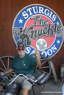
Bars, babes and bikes. There's a real town hidden somewhere underneath all the promotional stuff, but summer is the time for this town to make it's income on the tourists, and they are all here because of the reputation, so they have to live up to it. There are some fun themes, and no end of T-shirt shops, the streets are wide, so with the current, not too busy, time of year navigation wasn't a problem. We did a bit of shopping then headed for Fabric Junction so I could shop for a current project. I picked up some yardage for the project, a fabric license plate, and some souvenir fabric.

A little research indicated a nearby museum at historic Fort Mead. We thought it sounded interesting so we popped into a local sandwich shop and picked up a quick lunch. I'd read that there were picnic facilities at Fort Mead, so we headed for the fort, sandwiches in hand.

Other than the stiff breeze that kept blowing our chips off the table it was a perfect plan. We ate lunch, wandered around the beautiful grounds to give the dogs a bit of a break, and then worked our way toward the museum. A very friendly and helpful docent greeted us, showed us a brief film depicting the fort's history, and then we spent quite a little time wandering the labyrinth of rooms with displays.

A few highlights of what we learned:

The 7th Cavalry, re-formed after the disastrous Battle of the Little Big Horn in 1876, constituted the first permanent garrison of the post. Its commander, Colonel Samuel D Sturgis, was on of the founders of the nearby town that bears his name.

It was at Fort Meade that the Cavalry horse named Comanche, the only living thing found on the Little Big Horn Battlefield, was officially retired with military honors.

Comanche lived a long life at the fort, leading parades - with no rider - and serving other ceremonial functions until he passed away. It was here, too, that the Star Spangled Banner first became the official music for the military retreat ceremony, long before in became the National Anthem. A display in the fort museum gives the fort commander's wife credit for urging the adoption of the song as the national anthem.

When we left camp in the morning it was beautiful and sunny, by the time we were eating lunch in Sturgis the sky was darkening, and by the time we got back to camp it was clear we'd just missed a thunderstorm.

It turns out that this is the rainy season in this part of the world. We totally missed this particular storm just by being a few miles away.

It was thundering when we pulled into camp, so the dogs decided they'd rather hop into the trailer than sit outside.

Roubaix Lake campsites are $24 per night, though they do accept the federal passes for discount, and there's also a $2 pet fee per pet, per night. 


Deadwood and Sturgis album

Saturday, June 3, 2017

Badlands National Park, part 2

Saturday, June 3
After all the dark clouds and wind yesterday we woke up to a beautiful clear, sunny day. Perfect for touring! After breakfast and all the usual chores we loaded the pups in the truck and headed west on Badlands Loop Rd. With the good light the sculptured layers really were showy.

Big Foot Pass


One of our first stops was the beautiful pink and white stripped area known as Big Foot Pass. Not the Big Foot of forest fame, this was a Sioux leader who took his band through this pass to participate in the battle of Wounded Knee.


This is rough terrain to travel in moccasins, or any other footwear for that matter. They knew the trails through this area well though, as it was their hunting ground - antelope, big horn sheep, and bison were here in abundance in those days.

I'm not sure what the Sioux did with the Prairie dogs  back then, but if they were a food source the tribe ate well. We have never seen such huge areas marked with the little piles of dirt that mark each borrow. Several of the very large meadows we passed were totally overrun with the little devils. They are cute, but at this point, the novelty has worn off!

The loop drive has several large pullouts for parking and a few have short trails so you can get out closer to the hills. The crowds have been minimal, so there's no trouble finding a parking space. The road is narrow, so these viewpoints are the only safe ways to get photos.

The yellow mounds area is really striking as it's about the only area in the park where the soils show the yellow colors. Various shades of reds, orange and grays are most common.

We rounded a corner after one view point and came across a small group of mountain sheep. They are so accustomed to traffic that they don't bat an eye, as long as the traffic is moving slowly.


At the Pinnacles overlook the paved road ends and a good gravel road named Sage Creek Rim Road picks up. We followed that through more views overlooking the Badlands Wilderness area, past a large herd of bison off in the distance, and then south into an area outside the national park - a good place for Watch and Shiner to have a romp.They seem to enjoy the variety in scenery almost as much as we do, and it was good for all of us to get out and stretch.


Back to camp for lunch and then spend a little time in the visitor's center. We were there last year but a review never hurts. Unfortunately their fossil lab was closed. Last year we watched several techs at work cleaning specimens and had a nice chat with the ranger in charge of that project.

Back in camp we enjoyed walking the dogs and talking with other campers. Our neighbors are visiting from Holland. We meet such interesting people as we travel!

Tomorrow morning we pack up and head for Rapid City.

Badlands album