Saturday, August 28, 2010

The Old Lime Kiln

This was my last full day in Texas. I'm hopping on a plane tomorrow to go back to Oregon. Steve has been hanging out in Humbug campground, east of Portland, with little or no Internet access, so his updates will come when he can get connected.

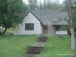
I went to a BBQ this afternoon with Scott and Kendra - a potluck gathering of some of the folks Scott works with. It was held on the ranch of one of his coworkers, up a little higher in the hill country than we are. It was a beautiful setting - a classic stone ranch house, huge spreading oak trees, complete with a little bubbling creek. The food and the conversation were great too!

It was a really nice one hour drive out to the site, and I always enjoy seeing the small towns along the country roads. There's so much to learn about the state, and it's so big! Texas is very proud of its history, and they make it really easy to identify and learn about a lot of the small details that make history come alive. For instance, there are thousands of historic markers around the state. There are 111 markers here in Hays county alone. We pass one of them every time we go to town.

Lime Kiln Road takes its name from, surprise. . . an old lime kiln! so it's a frequent reminder of the history of this area. The authors of a local history, "Clear Springs and Limestone Ledges", estimate the kiln was built somewhere around 1870-1887, but the date of 1887 is stated on the plaque at the site.

The Handbook of Texas On-line has quite a lengthy discussion of the history and importance of these kilns. Here's an excerpt:
"Lime had many uses for farmers, ranchers, and townsmen on the frontier. It was used for making concrete, mortar, and plaster for all sorts of stone construction, as well as for softening water and reducing the acidity of butter, cream, milk, and "sour" soil. Cooks used it to make hominy, tacos, and tortillas. Other uses included tanning leather, blowing fish out of water, destroying diseased animal bodies, killing termites and weevils, drying cuts on livestock, whitewashing, sanitizing outhouses, and making sheep-dip."  'Not too difficult to see why the kilns went out of business. I don't know about you but I haven' had to sanitize an outhouse or dip a sheep in quite awhile, and much larger and more efficient processes are now used to prepare lime for agricultural and other uses.

The kiln on Lime Kiln road still stands, however. It's just a few yards past Travis Elementary, just over the creek. There's a nice wide spot in the road for cars to pull over. That makes a good landmark too, as when the trees are fully leafed out you can't really see the kiln until you walk up to it. It's on the west side of the road, across from the "wide spot". There is a state historical marker there that gives pertinent details of the kiln's history.

Texas Mallow
The kiln is in a chain link enclosure, which was filled with lovely bright Texas Mallow when I visited. It's been really hot, but the huge trees shading the area have protected the flowers so they have lasted later than most.

As I said, we have a lot to learn, and all these markers will help. This nice index makes it easy to locate the markers in Hays County, or you can go to this clickable map and select any county in the state. With 111 markers, we obviously have a lot of history to learn in just our county alone!

Friday, August 27, 2010

Bats!

I finally got to see the bats! Some people would say I AM bats, but that's beside the point.

Kendra and Scott took me to see the "Congress Avenue bats" this evening. We had a nice dinner at a pub close to the bat viewing area and then walked over as evening settled in. On the way we passed the city's bat sculpture - they really appreciate them here!

I've always been fascinated by bats and Austin has them by the thousands. Actually some estimates say this time of year, when the pups are flying with their mothers, they have up to 1.5 million of them. And they are credited with eating from 10,000 to 30,000 pounds of insects per night....that's a lot of bugs!

Austin has been home to bats for many years, but after the Congress Avenue bridge over Lady Bird Lake was renovated in 1980 they found the new design provided a hang out. Narrow but deep openings in between the uprights in the photo below  turned out to be perfect accommodations.

The Statesman, Austin's newspaper, has built a nice little park right under the bridge, beside the river, where people gather and wait until dark when the furry little guys to take flight. The park has a small kiosk and several signs with bat-related information. There are also tour boats, and private craft, in the river to get that particular perspective. They shine red spotlights up under the bridge to illuminate the bats, and once the colony gets moving its like shaking pepper in front of a fan. I've never seen so many of anything flying all at once like that...amazing! And considering they are all eating mosquitoes, it's a lovely site!

A local society has been formed to help promote the bats and provide education. They have a nice site with a lot of information: History of Freetail Bats in Austin

Thursday, August 26, 2010

Old Post Road, San Marcos, TX

As we are "newcomers" to San Marcos, we're still learning the history of the area.
We frequently travel Post Road into town. It's currently lined with small homes and apartments - student housing for the nearby college. With a little research I discovered this is a very historic route that figured largely in the growth of this part of the state.

In 1840, while Mirabeau Lamar was president of The Republic, a law was passed that called for the construction of a series of forts extending from the Nueces to the Red River. At the same time an expedition was organized to open a road from Austin to the springs at the head of the San Marcos River for the construction of what was to become Post San Marcos. Though this post, or fort, existed only briefly it was the beginning of the highway from Austin to San Marcos.

Austin had been the seat of government for a year, and there was no road connecting it to San Antonio, the major town in southwest Texas. Travelers had to follow the El Camino Real, which is farther east, through Bastrop. This new road directly from Austin to the springs at San Marcos shortened the distance by about ten miles, which is a big deal if you are traveling by horse or wagon, and it was one of only a very few roads known to have been built during the time of the Republic.

In 1841 the Texas army was disbanded and troops were withdrawn from Post San Marcos and discharged. There is no record of the post being used after this date. The road, however, continued to be referred to as "Post Road". Used extensively by farmers and other travelers in the area it became a major artery of travel.

In 1914, looking toward growth in population and increasing business opportunities, a contracting opportunity was announced for the expansion of this road from a narrow farm road serving a relatively limited area to a "fine gravel road", 16 feet wide, and connecting several sections of farm roads from Austin to San Antonio. The work was expected to cost $229,000, with the funds coming from the counties and the US Department of Agriculture. The project was completed March 1916. The road was referred to by residents at this time as Federal Post Road, and Austin-San Antonio Post Road.

Post Road became a primary artery for north/south traffic through the area. Most of the land at the time was put to agricultural use, and the shorter route to bring goods to markets in the city was important.

In 1917, one year after the completion of the Austin-San Antonio Post Road project, the Texas legislature created the Texas Highway Department which outlined its "dream scheme" for roads to tie together the state’s wide-spread communities. Highway engineers mapped twenty-five primary highway routes, including one, originally named Highway 2, that later became what is now known as Interstate 35. The Highway 2 plan, and the current I-35, largely followed the old Post Road route. Existing bits of the old route that were bypassed are now called Post Road and Old Stagecoach. These are the sections we drive on a routine basis.

Bismark Filling Station
With the passing of years and the increase in numbers of automobiles it's logical filling stations would spring up.

This stone structure remains in pretty good condition, in spite of the encroaching vines.The name on the front is still faintly legible too. So far I haven't found any references to it in local history.

Though it's now the Texas State University Golf Pro Shop, this building below also looks as if it may have been a gas station at one time. Note the stone pillars in front (at the left) and what looks like a solid square room at the right (rear) of the building. The openings have been filled in with wood siding.

I love the decorative stone work on this building, and would love to know more about this style of masonry. There are a few more shots of the building here if you are interested.

I'm still trying to track down history on these two buildings, so if anyone has any leads please let me know!

Tuesday, August 24, 2010

Doodlebugs!

We've been hitting record temperatures here. . . 107 yesterday, so staying in where it's cool and blogging seems like a sensible thing to do, so here's your nature lesson for the day!

Before we left the ranch here we had worked long an hard at battling fire ants, and I even posted on this blog about them.

After arriving here a few days ago I began noticing these little cone or funnel shaped dents all over the place, especially in the soft soil and I was afraid this was something similar.
Judging by the numbers, I wasn't looking forward to having to do something about them. 'Turns out they are my best buddies in the war against ants!!

Antlions are the larva stage of lacewings, which are sort of miniature dragonflies. The funnel shape is a sort of trap. When the doodlebug/ant lion senses a small insect in the funnel, it pitches dust up and the falling dust drags the hapless insect down to the antlion's jaws. Here's a short video snowing the 'lion in action (proof somebody else is fascinated by these strange things!) These little guys probably won't consume a large enough number of fire ants to endanger the species, but any reduction in numbers is welcome!

Here's one Texan's version of how the common name came about.  I found this comment from someone up in Austin on a bulletin board discussing garden insects. "Take a broom straw and when the cone is being made, insert the straw, twisting it slightly into the bottom of the cone. If you 'doodle around' long enough, the bug will latch onto the straw and you can ease him to the surface and get a look at him." I tried it with no success, but then it was 107 degrees outside at the time, so maybe the antlion was smarter than I am and decided to stay in where it was cool.

This morning the dogs and I were out poking around in the yard when I noticed activity in some of the holes, so I tried "doodling" with a straw again - still no luck. Then I grabbed a teaspoon and dug quickly in one that looked active. Bingo! This isn't a great pic, but you get the idea. They're creepy looking little things, even if they are less than 1/2 inch long.

Now that this mystery is solved I can go back to battling the weeds!

Sunday, August 22, 2010

The Triffids are back!

Giant Ragweed
Well, they aren't really Triffids, as the ones in the movie "The Day of the Triffids" are entirely fictional, but the giant ragweed's scientific name is Ambrosia trifida, so I figure that's close enough. 

Normally these devils are only two or three few feet tall, but in wet years, like this one, they get a little "above themselves" and try to take over the place. This is only a small patch, just behind that six foot ladder I put there for scale. You see, when people in Texas talk about how big things are here it isn't bragging, it's just fact!

When we left in early June this area was full of wildflowers about 3 feet tall. This is what a lot of water and heat will do when you aren't around to tame the monsters. These plants are just about to start making seed, so one of the items on my to-do list is getting them chopped down before they do so. The old DR mower will be able to take these down in no time, the only concern is, how many bug bites am I going to get in the process??

Saturday, August 21, 2010

My "Wingman (wife)" has flown!!

After putting the DW on the plane last week I hung around Champoeg St. Park for a few days getting used to the peace and quite! LOL!!! This State Park is in a great area. Not only do you have some great history, fresh U-Pick fruit, there is a Camping World close by.

I have since moved on to Armitage Park in Eugene, OR, near our old home grounds. I needed to have some maintenance done on the dog, ie; grooming and a pet visit to check a small growth on her eye. Armitage is a nice urban area park located near the confluence of the Willamette and McKenzie Rivers. It is just a couple of miles out of town and has full amenities. They take reservations and it does get full on the weekends. There is some noise from the freeway near-by, but it is not disturbing. We will stay here again during football season.

I'm self sufficient but I truly miss the better half. I had to do laundry yesterday in a laundromat. I resolved the boredom issue of getting the stuff done by heading across the parking lot to a video poker establishment for a brew and two dollars worth of poker. I also put new starting batteries on the truck. They started getting tired after 7.5 years.

I will be here tending to "honey do's" till the middle of next weeks. I plan on heading out to.....???? before I make my pick up at the Portland airport.

Thursday, August 19, 2010

The Cat's Out of the Bag!

Now that Kendra knows, I can write about my quick trip back to Texas for her birthday! It's nice to be back here even if only for a few days. I'll check on all the systems, do a bit of yard maintenance, and then fly back to Oregon where Steve and Molly are so we can continue our travels.

It's a good thing it was hot the last few days I was in Oregon, as it prepared me a little for the time here, where it's even hotter and much more humid. 'Over 100 all this week, with the humidity varying between 73% (in the early morning, when it's about 75 degrees) and 20% late in the afternoon. As the temp rises the humidity decreases, so when it was 103 we were sitting at 19% humidity, for each degree the temp dropped during the night, the humidity went up a percent or more. I actually watched the effect on our little weather station sensor last night.

We've been gone from the ranch since June 6, so it's interesting to see what the effects have been. Kendra has taken care of the mowing so we look pretty civilized, but there are other points of interest.... like, the coyotes have moved in, bugs have moved in to the bird feed stored in the shed, and there are some really horrid stickers trying to take over the place.

The coyotes visited when we were gone before, so they aren't a new problem. How do we know they're here? They leave scat (droppings) all over the driveway! On the white gravel it's pretty hard to miss! They apparently are dining on the mesquite bean pods. According to the articles I located mesquite can make up 80% of their diet when available. Sort of surprising for animals I've always thought of as carnivores. I spent a half hour yesterday picking up after them. Then this morning there was "evidence" that 4 or 5 visited again last night. Wish I could catch the little devils in the act but they probably come while I'm sound asleep.

Gentle Annie
The "stickers" that are taking over are "spiny burr grass" (Cenchrus longispinus) also known in Australia as "Gentle Annie". . . just love that Aussie humor!

The nasty burrs it produces are anything BUT gentle, as a single one in the side of your foot will send you limping and yelping until it's removed. Steve worked hard last year at getting rid of the seeds, but a few plants came back this year and it only takes a few seeds to start the cycle all over again. Roundup, the weed torch, and every other method at hand will be employed - wish me luck!

As for the bugs in the bird seed - they aren't weevils so I don' know what they are. I put a little of the seed out in the feeders and the birds didn't seem to mind the extra protein, so if it doesn't all get used up before I'm ready to leave it will go in the feeders and compost. I don't really want the garden shed full of bugs! Next time any leftover seed will just be put out for the squirrels or stored in a freezer. 'One of those "lessons learned" about leaving for long periods.

The next few days will be busy, doing outside chores early, before it gets hot, and helping Kendra get ready for her "un-birthday pary" a'la Alice in Wonderland!

Friday, August 13, 2010

 Yes! we have Internet! Thanks to the antenna. Though we've noticed we get dropped every evening around 8 PM and service is very "iffy" before 10 AM in the morning.

Tuesday after a long (4 miles) drive from Lava Lake we settled in to the southern campground, the the same spot we've stayed in several times before. After hearing from fellow campers at Lava Lake about how busy this place is we were surprised, but timing is everything. We are learning, though it's not foolproof, that Tuesday or Wednesday at the latest are the best days to move to a new site if it's a popular area. It has been probably 15 years since we've stayed here, so it's interesting to come back after so long. Changes are minor, and mostly due to the growth of new trees that have come up after the massive bug kill that went through this forest in the '90's.

Hosmer Lake is unique, and it's hard to explain and convey the full picture, so this is where the map link is helpful. If the map comes up in street map mode mode, click on "satellite" at top right. Use the arrow button at the top left of the map to move the map so you can see the bottom portion of the lake and the volcanic cone that's just to the southeast edge. That's Red Crater. It's covered with trees so doesn't appear red in the photos.  The very thin stream connecting the south and north ponds is actually as wide as the light green you see, but only the dark water is navigable. The light green is all reeds. The north pond appears pale turquoise because it is very shallow and the bottom of the pond is light sand, so it's like looking into a swimming pool. There is a list along the left site that identifies each of the blue place markers on the map. Click any item in the list at it will expand the note connected to that place marker. A bit of trivia - Hosmer Lake was originally named Mud Lake because a large population of introduced carp stirred up the fine pumice and detritus bottom causing muddy water. In 1965, the name was changed to honor Paul Hosmer, a long-time resident of Bend and well-known amateur naturalist.

Wednesday, after waiting for the weather to warm up adequately, and checking our equipment, we loaded up the dog and headed out in the canoe. We haven't had the canoe in the water for so long we can't remember the last time. Molly must have been in it once, as the little canine life jacket was adjusted perfectly for her. As we paddled away from the dock she nestled down in the bottom of the boat and after catcing a few flies settled down and took a nap. So much for any worries about her being nervous.

We worked our way around the edges of the southern pool, then over to the east where the outlet is. On the way we saw several families of ducks and other water fowl, and two otters. Unfortunately the otters were too quick for the camera and we weren't able to capture them. The day was a mixed bag as far as weather goes. Huge puffy clouds, sometimes threateningly dark, came up and then drifted off. We thoroughly enjoyed the leisurely float, and we'll be back out tomorrow to visit the northern section of the lake.

Thursday - 37 degrees at 6 AM this morning when I got up, and the lake was covered in fog.
In the afternoon we worked our way up to the top of the lake, where Quinn Creek come in. Judging by my paddle, the water is only about 3 feed deep in this area, and so clear you can see every little weed and rock. The channel connecting the two parts of the lake is full of reeds and pond lilies, and fish! Atlantic salmon and trout, all sizes, in water so clear you swear you could just reach in and pick them up. We haven't seen very many fishermen, though. Whether it's the season, or the overabundance of canoes and kayaks crowding them out, there aren't as many people fishing as years past. And, as one we talked to said, "These fish are hard to catch. They're picky, and have seen everything offered to them over the years" The abundance of insects also means they aren't particularly hungry.

Afternoon entertainment consists of watching the wildlife. The chipmunks, golden mantle squirrels and jays couldn't get enough of the bird seed we put out. Their antics kept us entertained for quite awhile, and I'm afraid we took way to many photos of the little devils. Good thing we aren't paying for film!


People are starting to line up for the weekend, and asking when we'll be leaving! By about 3 in the afternoon most of the campsites had been occupied, and as dusk fell there was a layer of campfire smoke settling in over the lake.

If you'd like to see more photos of the lake follow this link to the album.

Monday, August 9, 2010

Lava Lake Resort, Oregon

We had a rough drive from Pringle Falls to Lava Lake - 28 miles! I can get used to that! And, not only do we have phone and Internet access here, we have full bars! (The Cell Phone type........... not drinking establishments)

We haven't stayed here for over 20 years, so there have been changes. The resort is still owned by the same family, and has the same amenities - nice little store with basic groceries and gift items, laundry, boats and fishing tackle for rent, but the trees have grown so much the overall look has changed considerably. When we visited back in the early '90's the spaces were much more open. Now, young pine trees have grown up and it's quite dense and shady. 
 
It's clear the local wildlife feel safe here. The first emissary to greet us at the campsite was a chipmunk, looking at me hopefully as we backed up the rig. Then came the camp robbers (gray jays) darting in and out of the fire ring to see if anything good had been left by the previous residents. We barely had the jacks down when I looked across the campground, two spaces down, to see three deer gazing in a most relaxed way at the campers dogs.
 

The deer later visited us, and then wandered across the street. There, they were given a handout (clearly what they were looking for). The campers were feeding them pretzels - not a good idea. Pretzels are about a nutritionally empty as you can get, and hand feeding deer, while "cute" can be very dangerous if they are spooked. One of the doe in the group limped badly, and a scar on her front shoulder suggested she might have been wounded perhaps by an arrow at some point. This afternoon the Steller jays helped Steve work through a bag of peanuts. They were cautious of Molly at first, but when she didn't chase them they crept in closer. 

Nestled high in the Cascade mountain range, Lava Lake is a relatively small, shallow lake popular with anglers and those who just want to enjoy sensational views of the peaks known as the South Sister,  Broken Top and Mount Bachelor. There are several fishing and canoeing venues within a few minutes drive of Lava Lake too, so it makes a great "home base" for exploring the whole area.

Lava Lake takes its name from the lava flows that created a dam along its eastern shoreline, holding in waters from subsurface springs. One of the closest lakes to Bend and Sunriver, Lava Lake is very popular and camping and RV sites are hard to come by. Reservations are highly recommended for the resort. We called a few days ahead and were lucky to get the only space available - probably a cancellation. Many guests make their reservations for the next year as they leave for home. There is a minimal service campground also, managed by Hoodoo.
 
This area contains 5 large volcanic cones- North Sister, Middle Sister, South Sister, Broken Top, and Mount Bachelor. Mount Bachelor, which is between 11,000 and 15,000 years old is the youngest of these volcanoes in the Cascades. All this volcanic activity in such a concentrated area makes for interesting topology. The contrast of thunderheads, volcanic peaks, and reflecting lake water is hard to beat. In a short drive you'll see lava flows, colorful peaks, and dense forests.
This area offers a wealth of lakes to explore. To the southwest and west, the upper Deschutes River valley contains several lakes dammed by lava flows. The four northern ones (Sparks, Elk, Hosmer, and, except for brief periods, Lava) have no surface outlets; water drains out through the permeable post-glacial lava flows and emerges as springs along the down-valley margins of the flows.
 
We took a short drive this afternoon to scope out our next stop. We've wanted to canoe in Sparks Lake for years and hadn't been able to due to late snow, low water (the lake is 8 foot deep at maximum) or closed roads. We won't be staying there this year, or canoeing it, either. They've taken out some of the campsites and increased day-use access and it was packed! Somehow, canoeing shoulder-to-shoulder with so many others lacks some of the charm we're used to.
Hosmer, on the other hand, was not too crowded and looked better taken care of overall. It's another campground with little to no services, but we've topped off the batteries, done up all the laundry and taken care of other housekeeping chores, so we're good to boondock again for a few days. We'll move up to Hosmer tomorrow. Based on what we saw with our cell phone today we may not have service, or Internet connections, while we're there. Which means no bars either!


Follow this link to locate Lava Lake on the map.
More photos of the Lava Lake area.

Saturday, August 7, 2010

Pringle Falls camp ground

We've had a really nice time, spending so many days here by the river. The Deschutes is a premier fly fishing river, which is another way of saying there are mosquitoes here.... but they weren't bad as we usually had a nice breeze to blow them away.

We wake up every morning to the osprey babies shouting for "more fish", and the bitterbrush bushes shaking like crazy with young golden mantle squirrels romping through the branches, harvesting the seeds. I've never seen so many little squirrels, and they climb the flimsy branches like a jungle-gym. The bitterbrush seeds are fairly large, so worth the effort I guess.

I'm a real sucker when it comes to chipmunks (these are really golden mantle squirrels, but I tend to lump all the stripped rodents together.) We had some surplus carrots and other veggies so I put them out on a rock for the little guys. This one decided to go directly to the source. I was in the kitchen mixing up some bread dough when I heard a strange scratching noise and looked up to see this hanging on the screen door.

Steve and Bill spent most of this morning assisting people driving through the campground who were looking for the "falls", because you see, there aren't any. Pringle Falls is really just a section of not very exciting rapids on this part of the Deschutes. Who knows how the rapids came to be called a "falls", but it's a bit disappointing to those who come here looking for a classic Oregon waterfall. Other than being a bit dusty (inevitable in this volcanic area, as the soil is all "pummy dust") this has been a nice quite stop. The spaces are large and nicely laid out among the trees, and access to the river for fishing is easy.

For those not familiar with the volcanic environment, pummy dust is the pumice ash from volcanoes. Most of the soil on this side of the cascades has a high percentage of that type of material. It's very fine and drains quickly, which is nice if it rains, but makes for a dusty environment when dry. This part of the forest is designated as a "study area", so they aim for minimal human impact. One of the results is a very narrow road in and out of the campground. It's not high traffic so we made it both ways without meeting anyone, which is a good thing as there are few wide spots and even fewer places where it would be easy to back up with a tow vehicle. Other details about the campground include no water available, only a vault type restroom, and the fee is $10 a night.

One of the things about being out like this is you never know what you'll see next. We were sitting around yesterday afternoon gazing over the bushes at the river when around the corner of the campground road came a draft horse pulling a wagon. A couple of local ranchers had decided to go out for a spin. The wagon had a young mule tied behind and when we asked about him we were told he was' just along for the exercise", and they hated to leave him behind because he put up a real fuss when his friend, the horse, leaves without him.


We'll be taking off tomorrow for Lava Lake. No idea what kind of access to Internet we'll have there, so updates may be slow.

Friday, August 6, 2010

Pringle Falls osprey

 Watching the osprey nest has been quite an experience. We cheered them on all day yesterday, but in spite of Big Brother flapping his wings a few times, by nightfall both young ones were still nest-bound. This morning the adults were still bringing in fish, then after breakfast they seemed to be ignoring the children. Then, suddenly, with no adults around, Big Brother left the nest and flew to a snag just a few yards away. He perched there for a few minutes, tottering back and forth and looking down at the ground as if to say "How did that happen? And what do I do now?"

Then he flew back to the nest. A few minutes later he flew over the river and back, then looped around in huge circles above the nest. It was an amazing thing to watch!

Having no idea how an osprey "thinks" one can only guess at the sensation of suddenly taking flight. Apparently the adults were actually watching the nest all day, because as son as he came back from this first real flight one of them arrived with a fish for him. Talk about positive reinforcement! Now will come the fishing lessons I suppose.

This morning both young birds were back in the nest, with the smaller one still hunkered down and not seeming the least bit interested in flying. With the bigger one back, and looking quite large now that the wings are really in use, the nest is looking quite crowded. We'll be here a few more days, so perhaps we'll be lucky enough to see "Little Sister" try her (it's?) wings too. That's one of the advantages of staying in one camp for an extended period of time. You see things you never would have seen with only a one or two night stop.
Lots more photos in the album here.

We came up with so many questions as we watched the nest that I located a bit of information on the osprey.
Osprey eggs do not hatch all at once, but instead the first chick hatches out up to five days before the last one. This helps explain why one of the young is so much stronger than the other [and we have no idea of the gender of any of them, but we had to call them something!] The older chick dominates its younger siblings, and can monopolize the food brought by the parents. If food is abundant, little aggression is seen amongst the chicks, but if food is limited, the younger chicks often starve. I don't think there's a food shortage here, seeing how many fish they brought in yesterday, so no telling how the third young one ended up out of the nest.

If you are interested there's more info here at Osprey World

Thursday, August 5, 2010

Pringle Falls, Oregon

We arrived at Pringle Falls campground, on the Deschutes river, yesterday. We're camping with friends, sort of a continuation of Training Camp.

We spent most of the day sitting by the river watching an osprey nest. There are clearly two young ones in the nest. In the photo below you can see the larger one peeking over the edge. The largest one is much braver than the other and stands up on the sides of the nest (I've been calling him Big Brother), while the other one seems content to set at the center toward the bottom of the nest (this is Little Sister). There was once a third sibling, but it was pushed or fell out of the nest and the remains are lying at the bottom of the tree.

The parents, and several other "relatives" have been hovering and soaring around the nest all day trying to entice the young ones to try their wings. There's been quite a bit of screeching as the young ones beg for food and the adults answer back. They've flown in with several fish, feeding them several times a day. It's no wonder the adults are ready to have these teenagers out on their own!

We've gotten some great shots and will share an album when we get them all uploaded and sorted.

Tuesday, August 3, 2010

Tailgate Training Camp, 2010

We've been holding training camp with fellow Duck fans for several years now. The last several have all been here at Ochoco Forest Camp, near Prineville, Oregon. It's a nice private area, and we have a great time cooking for each other, hiking along Ochoco creak, throwing a few horseshoes and of course, talking football.  Walton lake, a few miles up the road, was closed this year so there was less traffic than usual, and practically no one in the main campground just outside our group site.

The forestry office here has never been open in all the years we've come here, one of many cutbacks I suppose.

New this year is the "cabin for rent", which is one of the original ranger residences, built in 1939 by the CCC. It's nicely furnished (we peeked in the windows) and has a patio complete with BBQ.


 Nearby is a lookout shack that was brought down from Black Mountain.

It's not available for rent, but is set up the way it would be when in use by a fire  watcher, and the door is unlocked, so there are notes left in a guest book from visitors across the country.


Our evenings were spent visiting around the campfire and watching the doe that came in to graze just at the edge of camp.  Good times!