We arrived at Green River State Park just about lunch time and were quite surprised to find it completely empty, except for a handful of rafters milling around the put-in area. The campground is really nice, and so green it seems merely an extension of the golf course that is attached. There are no hook-ups, but water is available and as long as there are sunny days our solar panel keeps cranking out the the electrons so we're in good shape. The restrooms here are really nice too, which I'm sure the tent campers appreciate.
Evening brought a classic thunderstorm. The air went from totally still to blustery and wet, with some amazing lightening. The storm produced quite a bit of water, as we saw the next day when we were out touring. When they warn about flash floods in this country, pay attention!
 |
| Thompson Springs Motel |
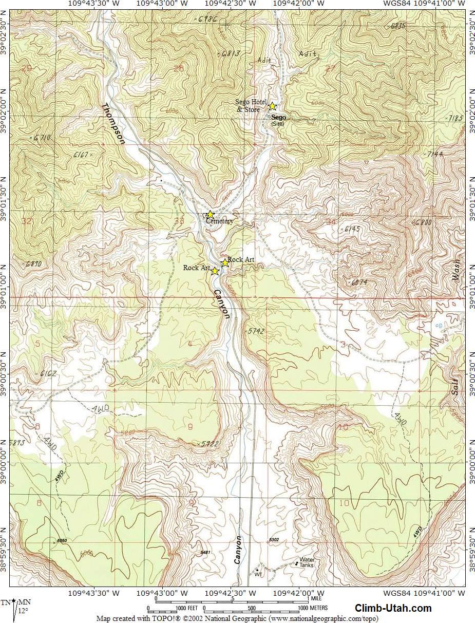
To get to the rock art, go north past the old Thompson Springs school. It's about 3 miles to the rock art site. There's a restroom there, and a picnic table with no shade.
This site is fantastic! Plenty of interpretive signs if you aren't knowledgeable about the subject, and easy to navigate trails for good viewing angles. Everything is near the road so hiking isn't a requirement.
 |
| Panel at the old corral |
 |
| Panel at the picnic areaa |
Unfortunately there's been a good deal of vandalism here. I'm glad we were able to see these areas before there's even more destruction.
If you aren't into rock art, how about a couple of ghost towns?
 |
| Oven at the old homestead |
This was a cozy little enclave in early days, known as the Stortini farm, and they used the oven to bake bread, storing food and other items in the stone dugout according to reminiscences of their granddaughter.
The Thompson Canyon road doesn't go much past the farm, so turn around and go back to the fork you passed on the way up, it will take you to the town of Sego. You'll pass the cemetery soon after the fork. We found mention of the Stortini family in the graveyard. There may have been more than one grave belonging to the family as many aren't marked. Someone has tended the graves recently, forming crosses of stone and leaving artificial flowers. Actually, only a few graves are identified, and several look like the classing "cowboy grave", just mounds of dirt and rocks.
 |
| All that's left of Sego |
When the railroad line to the mine was abandoned in 1950, the owners of the mine owners constructed a truck ramp in Thompson to load coal directly into the railroad cars. The ramp and much of the grade still exists, as well as a couple of the trestles, but they trestles are in a dangerous condition and cannot be crossed.
There's more about the ghost town of Sego in Wikipedia, and Kathy Weiser's article here. Link to a topo map of the area here.

'Best burger and brew we've had in a long time! If you're in Green River, stop in!
Check the album for more photos.
No comments:
Post a Comment